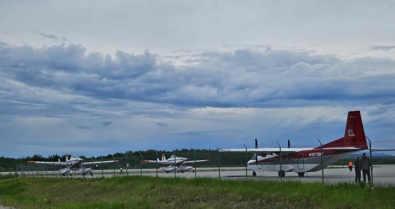
Scattered rain showers and thunderstorms continued to move across Southwest Alaska on Saturday and are forecast to continue through Sunday. There are 30 active fires in the region, several of those received varying amounts of precipitation. Thunderstorms have produced heavy rain and a significant amount of lightning, particularly in the eastern and northern portions of the region. Lightning is responsible for one new start Saturday evening east of Von Frank Mountain. Additional fires may be discovered. Lightning strikes can leave susceptible vegetation smoldering until sunshine and wind can bring them to life. These delayed fires are called lightning holdovers. Detection flights are planned, but with the increase of fires statewide, priority must be given to critical response areas. Saturday, there were 16 new fires statewide. Additional firefighting crews are being deployed to fires in Southwest Alaska. Crews have been requested from the Lower 48 to bring additional resources to the state The first flight is expected Monday.
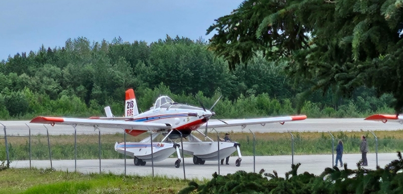
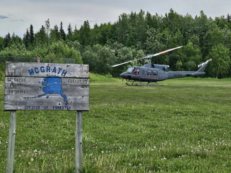
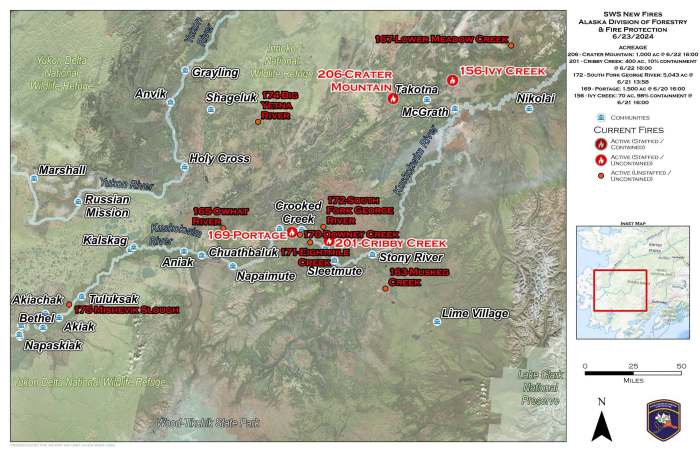
The new fire in the Southwest area Saturday was reported by Air Attack from McGrath responding to another fire. The Von Frank Fire (#219), 60 miles northeast of McGrath is burning in a limited response area. An update from a passing smokejumper aircraft later in the day estimated the fire to be 20 acres, burning in spruce with isolated tree torching. No nearby valuable assets are threatened. This fire will be placed into monitor status.
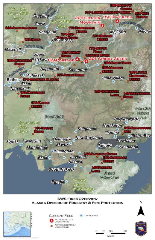
Below is an update of action taken Saturday on fires managed by the Type 3 organization in Southwest Alaska now known as the Red Devil Group. Personnel assigned and acreages have been updated to reflect the most recent numbers.
Cribby Creek Fire (#201) – 3 miles north of Red Devil is burning in a modified response area and is estimated to be 400 acres with 10% containment. 28 personnel assigned. BLM Alaska Fire Service Chena Hotshot Crew joined the eight smokejumpers working on the fire. Light rain in the morning dried out by mid-day and fire activity picked up. Firefighters will improve existing fire lines and work to secure the fire’s edge. There are minimal water supply options available, but crews will develop hose lays where practical. A helicopter assigned to the Red Devil Group will provide water drops and logistical support. Strong north winds forecast for the next two days are a concern for fire growth to the south.
South Fork George River Fire (#172) – 8.5 miles northeast of Georgetown in a modified response area. Satellite mapping has reduced the acreage to 5,043 acres. A planned reconnaissance flight was diverted to higher priority fires. Satellite monitoring shows no new heat signatures and has provided a better estimated size. The Red Devil Group will be assessing Native allotments in the area as they develop a response plan in anticipation of crews arriving from the Lower 48.
Portage Fire (#169) – 5.5 miles southwest of Georgetown, south of the Kuskokwim River, in a full response area and is estimated to be 1,500 acres. Rain across the fire area moderated activity. The U.S. Forest Service R-10 Type 2 Initial Attack crew was shuttled to the fire during the afternoon. The helicopter assigned to the group delivered supplies and additional equipment to support firefighters and suppression efforts. Work is focusing on protecting Native allotments to the east and west of the fire. Due to the moderation in fire behavior, personnel are working direct on the fire’s perimeter along the southern edge cutting saw line and building hose lays.
Additional active fires in Southwest Alaska follow with Saturday updates to suppression efforts, personnel, and acreage.
Beaver Creek Fire (#210) – 29 miles southwest of McGrath and east of the Takotna River is burning in a modified response area and is estimated to be 50 acres. Reconnaissance of the fire was not able to be completed. The nearest allotment is 3.25 miles northwest of the fire with the Takotna River and its riparian area providing a barrier to the fire. Precipitation over the fire moderated fire behavior. This fire will be monitored by fire managers. There will be no additional updates provided here unless significant activity occurs.
Crater Mountain Fire (#206) – 18 miles west of Takotna between Ganes and Beaver creeks, is burning in a full response area and is estimated to be 1,000 acres. The 12 smokejumpers have been moved to the Ganes Creek Mine, 3 miles north of the fire to assess what is needed for structure protection of the mine’s infrastructure. The change in tactics is due to the lack of water sources in the fire area. The fire received some precipitation from thunderstorms, moderating fire behavior.
Flat Creek Fire (#178) – 1.75 miles south of Flat mining area airstrip in a full response area, estimated to be 36 acres. Firefighters made a final grid the fire and found no areas of heat. The fire is contained, controlled, and called out. All personnel were released from the fire. This will be the final update to this fire.
Ivy Creek Fire (#156) – 14.5 miles north of McGrath in a modified response area. More accurate mapping has reduced the estimated acreage to 70 acres with 98% containment. 27 personnel assigned. Firefighters continue to increase their mopped-up area to 100 feet wide into the burned area along the fire’s perimeter. Thunderstorms impacted the fire with significant rain for 2.5 hours along with substantial lightening.
There are 22 additional fires burning in limited management areas that will continue to be monitored by the Southwest Area DOF office. The Division of Forestry & Fire Protection will continue to share information about the fires in Southwest Alaska as it becomes available from reconnaissance flights and ground resources.
For more information on fire response management options in Alaska, visit https://forestry.alaska.gov/fire/fireplans.
For more information on active fires in Alaska, read the daily Alaska Interagency Coordination Center Situation Report found online here, https://fire.ak.blm.gov/content/aicc/sitreport/AICC%20Situation%20Report.pdf
Categories: Active Wildland Fire, Alaska DNR - Division of Forestry (DOF)
