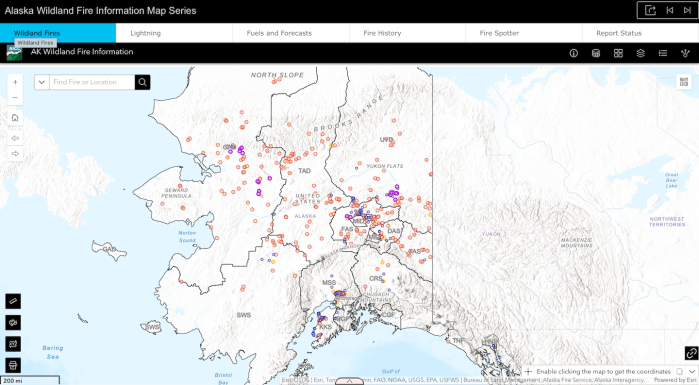
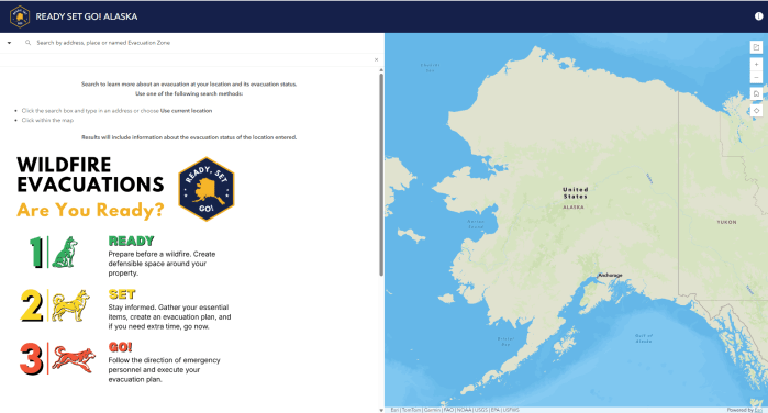
Interactive Alaska Wildland Fire Information Map Series with wildfire locations. Click on map for link to map.
The Alaska Interagency Coordination Center Wildfire Dashboard, what GIS has described as a living situation report that updates Alaska wildland fire information every 15 minutes. Click on graphic for link to online interactive map.
Map showing Alaska fire history and amount of acres from 2000 to 2021. Click here for PDF version.
Alaska Fire History 2000-2021
Map showing the Alaska fire management options for 2021. Click on map for PDF version.
Alaska Wildland Fire Management Options 2021
Alaska Wildland Fire Protection Responsibilities with BLM AFS acreage for 2021. Click on map for PDF version.
Alaska Fire Protection Responsibilities 2022
Map showing the Alaska wildland fire jurisdictions and protection boundaries for 2021. Click on map for PDF version.
Alaska Land Ownership and Responsibility Areas 2021