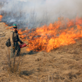
By working together, agencies can leverage their collective expertise and resources to address the complex challenges posed by wildfires and protect lives, property, and natural resources. The 2024 Intermediate Wildfire Academy currently underway in Chugiak marks a multiyear and… Read More ›
AK Fire Info
Leading Alaska’s firefighting efforts: prepare now for the fire season ahead
Alaskans saw what happened in Canada last year, and they know it can happen here too. They recognize we need to prevent and prepare for wildfires across the state – from the time the snow melts until it falls again.
Burning operations planned on military training lands near Fairbanks, North Pole to reduce wildfire threat
Starting as early as Thursday, BLM AFS will will implement prescribed fires in several live-fire ranges of the Yukon Training Area near Eielson Air Force Base and the Fort Wainwright Small Arms Complex south of Fairbanks.
BLM issues fire restrictions to protect properties and residences north of Fairbanks
The BLM Fairbanks District Office issued a fire prevention order prohibiting campfires, fireworks and explosives on federal lands in a fire-prone area of black spruce near Fox, Alaska and the NOAA facility site on the Steese Highway. The order begins on May 1.
Preparing Tomorrow’s Firefighters: The 2024 Alaska Basic Wildland Firefighter Academy
This immersive training program aims to equip entry level cadets with the skills, knowledge, and mental fortitude required to suppress wildfires in one of the most challenging environments. From April 21st to April 30th, 25 aspiring firefighters from across Alaska… Read More ›
Burning operations planned on Donnelly Training Area to reduce wildfire threat near Delta Junction
FAIRBANKS, ALASKA – Starting as early as Sunday, April 14, the Bureau of Land Management Alaska Fire Service (BLM AFS), in coordination with the U.S. Army Garrison Alaska, will implement prescribed fires in the Donnelly Training Area. The prescribed burning may continue through May 1,… Read More ›
Four small, early season wildfires on Interior military training lands reinforce importance of prescribed burning
Four small wildfires ignited in dry grass during military training south Delta Junction were swiftly extinguished Thursday. The fires occurred in the Jarvis Range in the Donnelly Training Area, a military range slated for upcoming annual prescribed burning by BLM Alaska Fire Service personnel to mitigate the risk of wildfire outbreaks from military activities.
Don’t let Mother Nature fool you – DOF burn permits required starting April 1st
Bright and sunny spring days are a good reminder as to why Alaska’s state law requires burn permits from April 1st through August 31st.
Recruitment for BLM AFS North Star Fire Crew is open for 2024 season
Recruitment for the 2023 BLM Alaska Fire Service Type 2 North Star Fire Crew is open until April 1. This entry-level crew provides a pathway to a career in wildland firefighting.
Alaska’s First Interagency Prevention, Investigation & Compliance-Enforcement Academy Strengthens Statewide Collaboration
Beyond skill-building, the academy fostered a shared understanding of the importance of wildfire prevention, investigation, and compliance-enforcement across agencies in Alaska. In a groundbreaking effort to bolster Alaska’s wildfire preparedness, the State of Alaska Division of Forestry & Fire Protection… Read More ›


