The AICC Dashboard includes the Situation Summary (shown here), Wildfire and Lightning, Jurisdictional Summary, Fire Management Summary (critical, full, modified, and limited) and Protection Responsibility Summary (U.S. Forest Service, U.S. Wildland Fire Service Alaska and Alaska Division of Forestry & Fire Protection). Click on graphic to access this map. Find instructions for the AICC Situation Dashboard online.
Interactive Alaska Wildland Fire Information Map series that includes lightning, fuels and fire behavior and fire history. This version is access through the Alaska Interagency Coordination Website and offers more overall situational information. Click here for online map. Find instructions for this map on the AICC maps page.
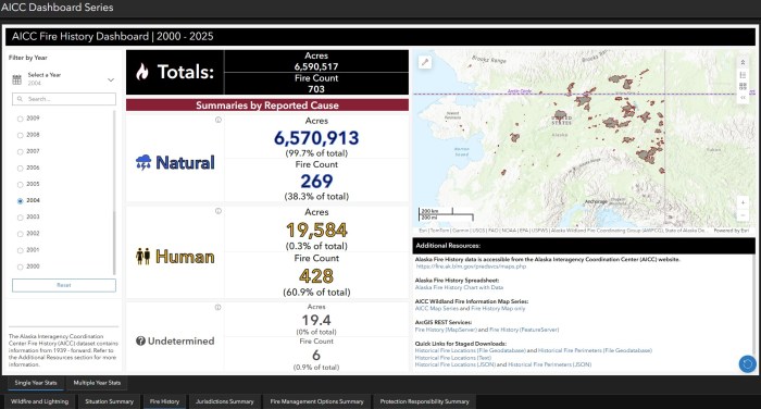
Fire History tab has been added to the AICC Dashboard Series. Under the Fire History tab, are two options: Single Year Stats for 2000-2025 and Multiple Year Stats for 1939 to previous year. This shows the statistics for Alaska’s record-breaking year in 2004.
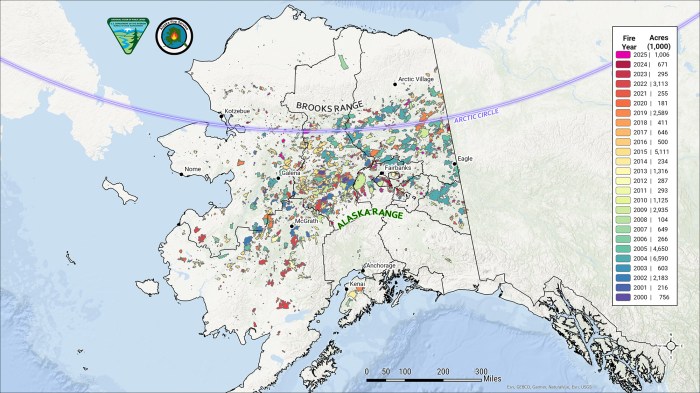
Map of Alaska showing the various different land management agencies within the various U.S. Wildland Fire Service, U.S. Forest Service and Alaska Division of Forestry & Fire Protection protection zones and areas. Click on this link for a PDF version of this map. Alaska Fire Service Map of Alaska showing the Arctic Circle and fire history from 2000-2025. Click on map to link to PDF version.
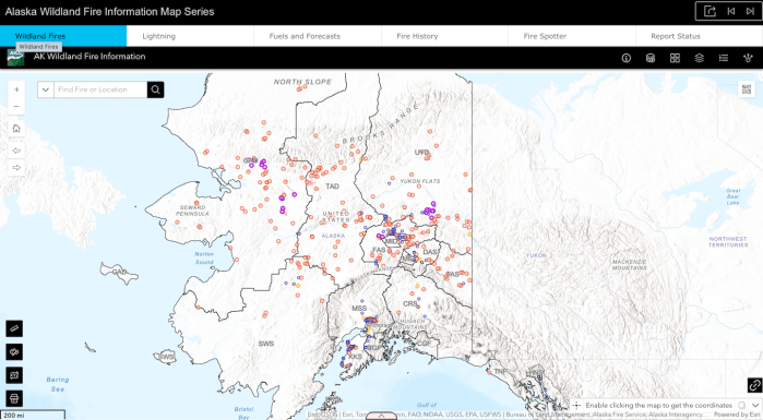
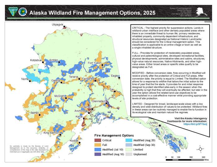
Basic interactive Alaska Wildland Fire Information Map with wildfire locations. Click on map or this link to go to online map. This web application displays information related to wildland fires in Alaska and is the best version for mobile devices due to its simplicity.Fire and land management agencies have agreed to a statewide plan with four response levels, ranging from very aggressive initial attack to site-specific protection that allows fire to continue to play its vital role in the ecosystem (Critical, Full, Modified, Limited described in the Alaska Interagency Wildland Fire Management Plan). Click on this link for a PDF version of the map.Map of Alaska showing the communities within the various protection areas divided between the the U.S. Wildland Fire Service (Alaska Fire Service), the U.S. Forest Service and the Alaska Division of Forestry & Fire Protection. Find a PDF version of this map on the AICC maps page.
Alaska Division of Forestry & Fire Protection Alaska Mushroom hunting web app. It is the end users responsibility to confirm land ownership. There is a generalized ownership layer in the layer list that can be turned on. Picking on State of Alaska lands may require a permit. This web application depicts JUST the last three years of fire and their locations on the landscape for the purpose of locations mushrooms post-fire.
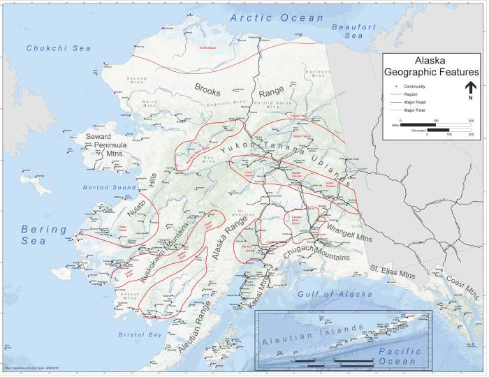
Map showing Alaska geographic features. Also found on the Alaska Interagency Coordination Center website on the maps page. Down a PDF version of this map.