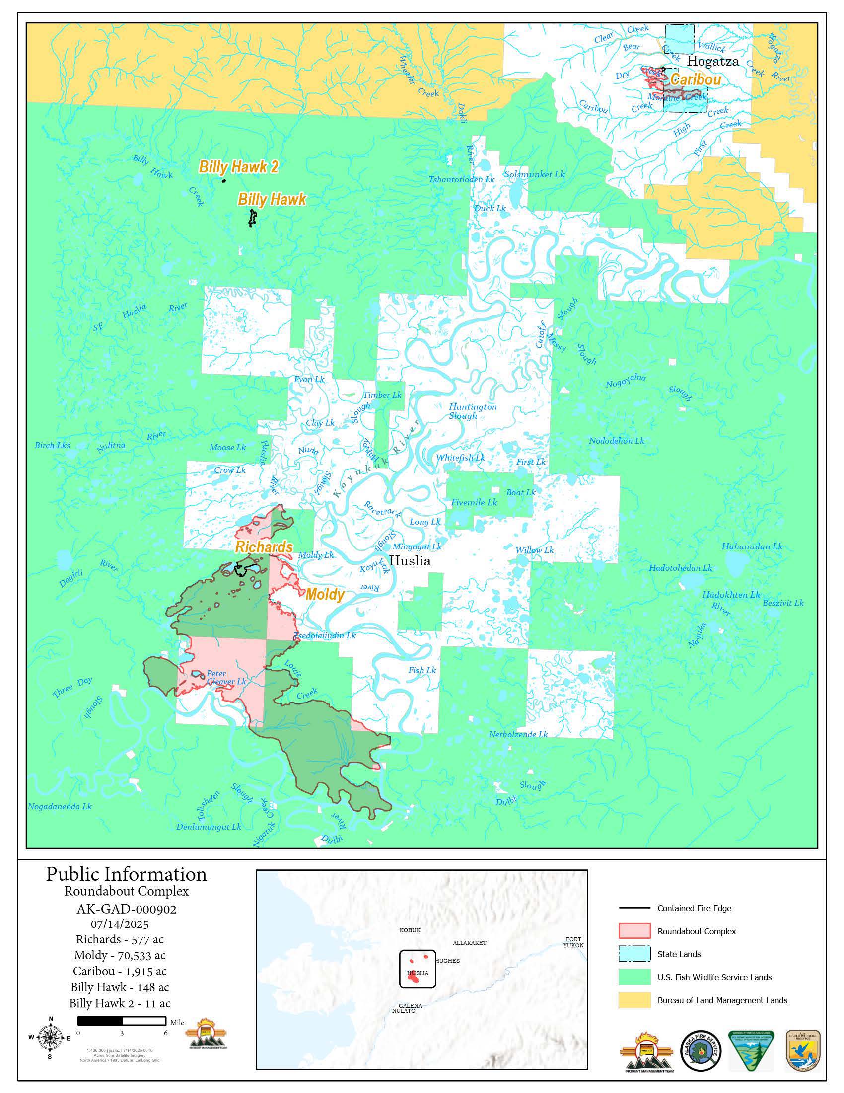
‘pio_8x11_port_20250713_2239_Roundabout Complex_AKGAD000902_0714day’

Image shows a map of the 73,185-acre Roundabout Complex for July 14, 2025. Map is mostly green with pink areas identifying individual fires. The Caribou Fire is in the northeast. The Moldy and Richards Fires are in the southwest. The Billy Hawk and Billy Hawk 2 Fires are in the northwest. The Moldy Fire is the largest on the map, at 70,533 acres.

Click image for downloadable map of the Roundabout Complex, July 14, 2025.