| Size: 35,618 acres | Personnel: 73 | Start Date: June 8, 2024 | Cause: Lightning |

Update 1:15 p.m. – The Fairbanks North Star Borough expanded the READY notice Tuesday to residences along the Johnson Road and near the Salcha Campgrounds. Find more information and an interactive map of these areas on the Fairbanks North Star Borough Emergency Services website.

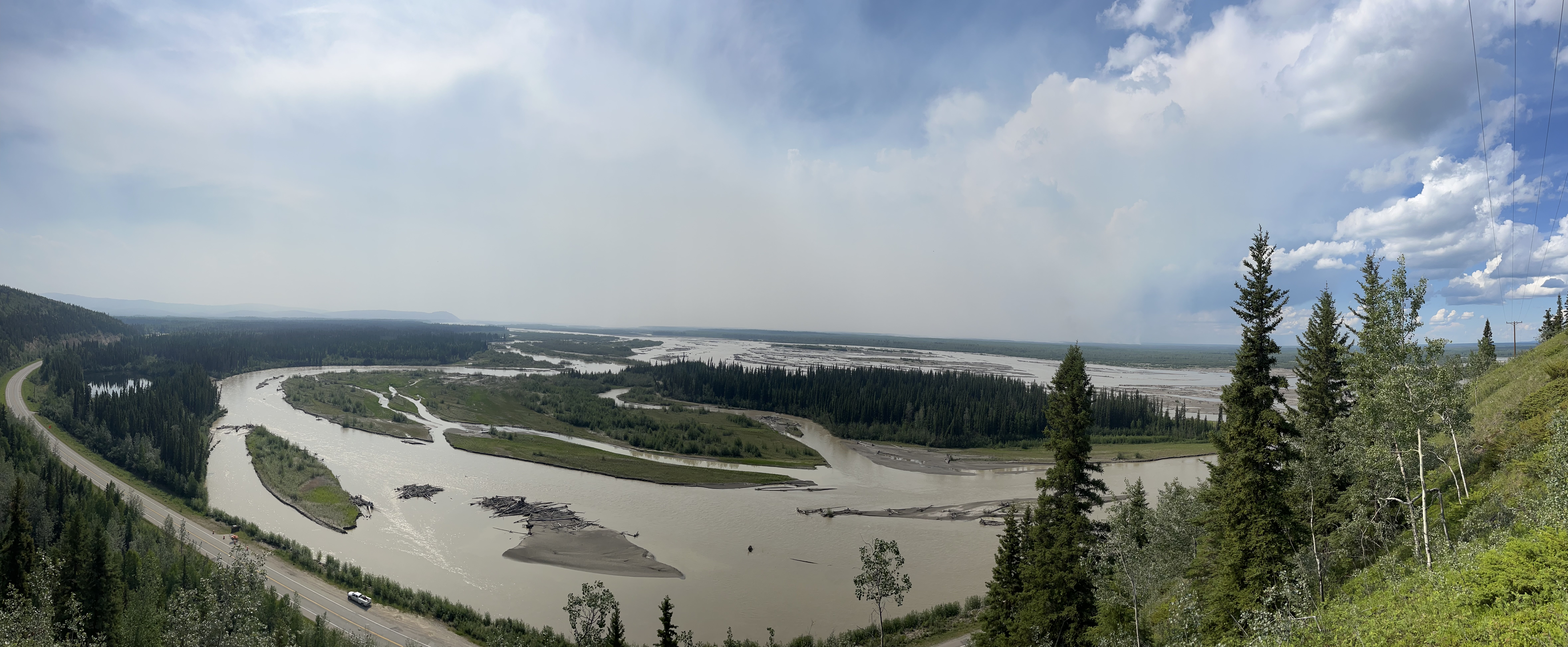
FAIRBANKS, Alaska – Forecasted gusty and erratic winds caused an increase in fire behavior on the McDonald Fire Monday afternoon with more expected to occur Tuesday. A large column of smoke referred to as a pyro cumulus clouds developed over the fire and could be seen be seen from much of Fairbanks and surrounding areas as the fire burned through unburned vegetation to the north. These clouds form from the extreme heat of the fire rising rapidly through the atmosphere. Forecasted weather Tuesday includes more thunderstorms bringing additional gusty and erratic winds. Fire danger remains high in the area.
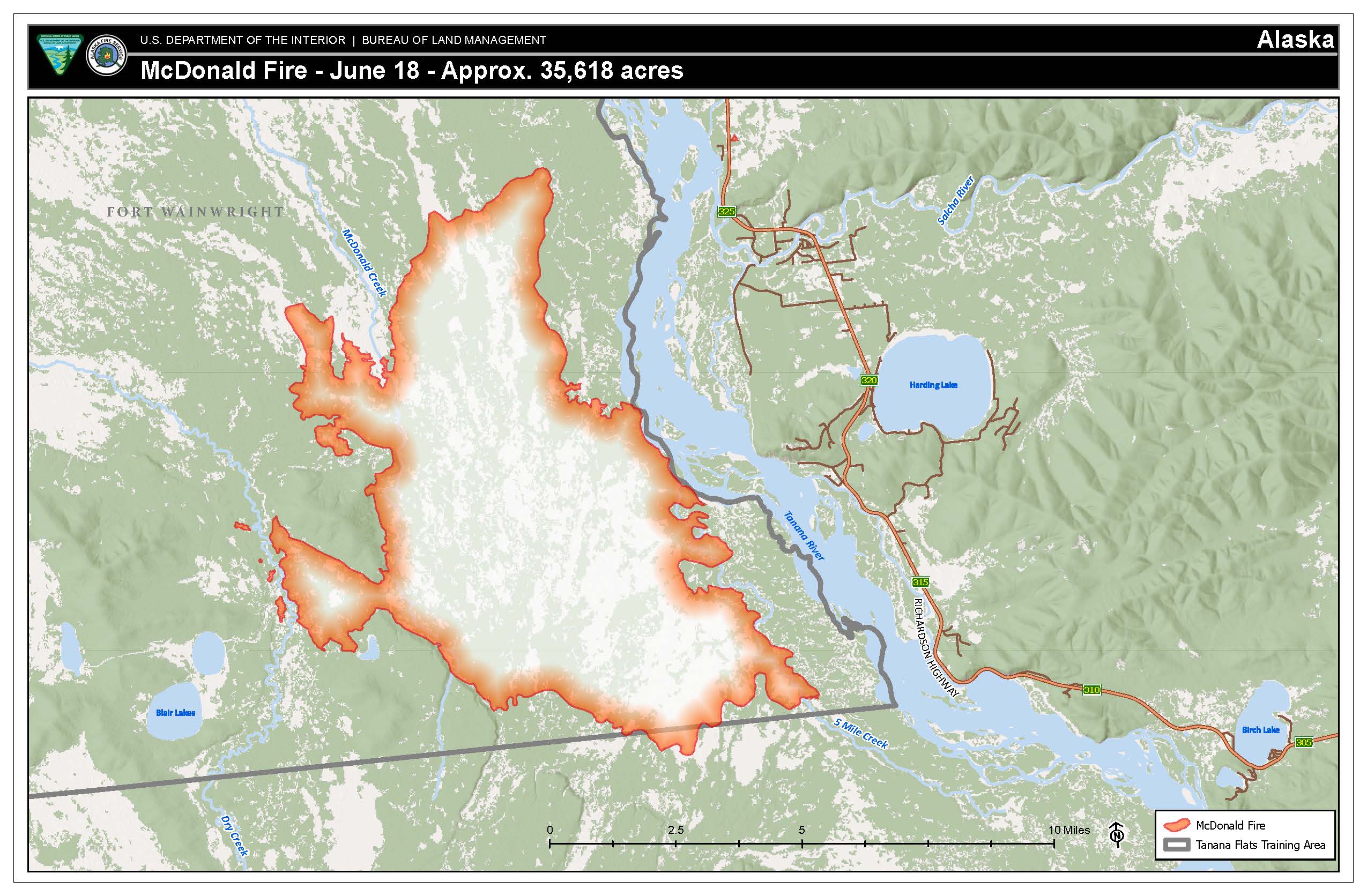
Two Alaska Division of Forestry & Fire Protection engines are currently patrolling the Richardson Highway corridor. The fire remains west of the Tanana River.
Meanwhile, crews continue mopping up and putting out any hot areas along the fireline to prevent the fire from moving south toward the cabins along 5 Mile Creek. Firefighters are prepping cabins with sprinklers and removing nearby burnable vegetation to provide additional protection. As the day heats up, firefighters will use the sprinkler systems to wet down the area around cabins. Other tasks assigned to the crews on Tuesday include clearing fallen and weakened trees from 5 Mile Creek, assuring safe access and egress from the east side of the fire. There are three designated firefighters at lookouts on the east side of the fire feeding timely fire behavior updates to other firefighters.
Weather: Tuesday expect isolated thunderstorms through the day, with scattered thunderstorms in the afternoon and evening. This afternoon and evening the thunderstorms could have frequent lightning, brief heavy rain, winds gusting to 30 mph and 1/2-inch hail. Today’s temperatures will be a few degrees cooler than yesterday with very warm conditions continuing into the weekend. No strong winds are expected other than gusty and erratic winds with thunderstorms
Burn Permits: The Division of Forestry and Fire Protection (DOF) has issued Burn Permit Suspensions for Fairbanks, Salcha, Tok and Railbelt areas. The fire danger in these areas remains HIGH.Please check https://dnr.alaska.gov/burn/fireareas or call the burn permit hotline for the Fairbanks Area Forestry at (907) 451-2631 for the most current updates.
Air Quality: The McDonald Fire, located in the Tanana Flats southeast of Fairbanks, has become an active smoke producer since late yesterday. Low-level smoke will affect communities near the McDonald Fire. During the evening hours, smoke will settle in the flats, impacting a larger number of communities in the area. We also expect increased smoke production from a few fires in the Yukon Flats during the advisory period. Currently, the smoke will move east into Canada. Find information on how to protect yourself from wildfire smoke at the Smoke Management page on akfireinfo.com.
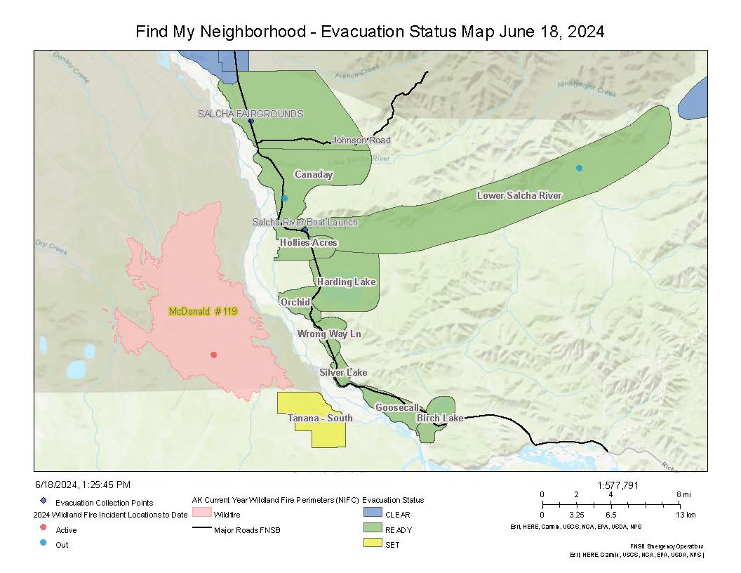
Evacuation notices: The Fairbanks North Star Borough (FNSB) issued a Level 2: SET evacuation notice for the approximately 20 cabins that are near the fire’s southern edge. The FNSB also put areas along the lower Salcha River, Harding Lake, Hollies Acres, and Canaday neighborhoods in a READY status. Find more information and an interactive map of these areas on the Fairbanks North Star Borough Emergency Services website.
Temporary Flight Restriction: Location is 30 nautical miles southeast of Fairbanks to provide a safe environment for firefighting aircraft. The TFR is posted at this link.

-BLM-
Bureau of Land Management, Alaska Fire Service, P.O. Box 35005 1541 Gaffney Road, Fort Wainwright, Ak 99703
Need public domain imagery to complement news coverage of the BLM Alaska Fire Service in Alaska?
Visit our Flickr channel!
Learn more at www.blm.gov/AlaskaFireService, and on Facebook and Twitter.
The Bureau of Land Management Alaska Fire Service (AFS) located at Fort Wainwright, Alaska, provides wildland fire suppression services for over 240 million acres of Department of the Interior and Native Corporation Lands in Alaska. In addition, AFS has other statewide responsibilities that include: interpretation of fire management policy; oversight of the BLM Alaska Aviation program; fuels management projects; and operating and maintaining advanced communication and computer systems such as the Alaska Lightning Detection System. AFS also maintains a National Incident Support Cache with a $18.1 million inventory. The Alaska Fire Service provides wildland fire suppression services for America’s “Last Frontier” on an interagency basis with the State of Alaska Department of Natural Resources, USDA Forest Service, National Park Service, Bureau of Indian Affairs, U.S. Fish and Wildlife Service, and the U.S. Military in Alaska.
Categories: Active Wildland Fire, AK Fire Info, BLM Alaska Fire Service