
11 new fires started on Thursday, July 27 in State of Alaska protection jurisdiction and 10 in BLM Alaska Fire Service. The interior region of Alaska remains in Very High Fire Danger despite temperatures and lighting activity slightly moderating from the beginning of the week. Over 7,000 ground strikes were detected Wednesday and fires continue to be discovered across the interior. Alaska moved to Planning Level 3 yesterday and there are 13 staffed fires statewide. Fairbanks, Tok, and Delta burn permits remain suspended.

Teklanika River Fire (#257) – [1000 acres] Fire managers conducted reconnaissance flights southwest of Nenana for more information on fire behavior and terrain. Multiple fires in the area were discovered and are suspected to be holdovers from earlier lightning starts this week. A Type 2 Incident Management Team will in-brief on Saturday morning.
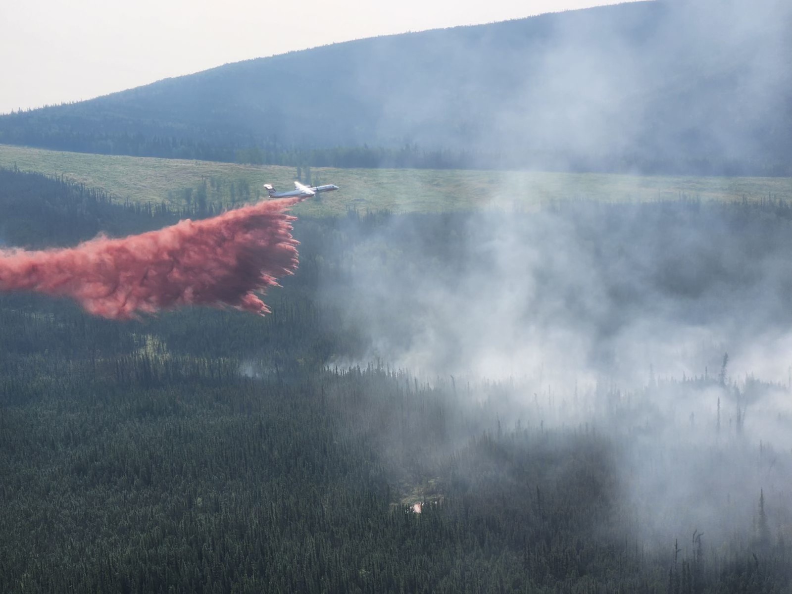
Our Creek Fire (#271) – [10 acres] Helicopters, Fire Bosses, and an air tanker performed cycles of water and retardant drops throughout the day on a fire burning in Goldstream Valley, just north of the Old Murphy Dome fuel break. They successfully prevented progression of the fire.
Sand Lake Fire (#250) – [10 acres] The fire was started by lightning 6 miles northwest of Dot Lake. Helicopters conducted bucket work throughout the day and the area received precipitation in the evening.
Olnes Pond Fire (#250) – [4 acres] The fire is burning within a mile of the pipeline corridor, 11 miles north of Fairbanks. Smokejumpers established hose lay around the fire with 5 feet of line secured.
Sargent Creek Fire (#255) – [14 acres] Firefighters continued wrapping edges of the fire with hose lay, focusing on securing the western flank closest to the Alaska Pipeline approximately 5 miles north of Fairbanks. Resources will continue working on the fire perimeter throughout the day.
McCoy Creek (#201) – [91.9 acres] The fire is 15 miles east of Salcha, south of the Salcha River. White Mountain and Fairbanks 1 firefighters were able to progress a hose lay and saw line along the eastern flank and a helicopter worked to secure the west with bucket drops.
Middle River Fire (#229) – [52 acres] The fire is roughly 23 miles east of Salcha on the north side of the river. Crews continued working on hose lays, mopping up the edges and gridding the fire area for remaining heat. Minimal fire activity and growth occurred on Wednesday.
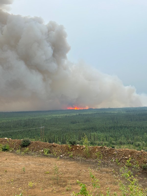
Pogo Mine Road Fire (#191) – [7,000 acres] Firefighters worked on structure protection for cabins and ground resources continued securing the road and power lines 7 miles northwest of Delta. Winds increased in the afternoon and pushed the fire to the east. Fire Bosses and a helicopter assisted in protecting structures with water drops.


Categories: Active Wildland Fire
