Much of interior Alaska was under light to moderate cloud cover yesterday and recorded slightly cooler temperatures. The number of new fires that showed themselves from last week’s lightning event also moderated, with two new fires in Alaska Division of Forestry & Fire Protection response area and six statewide. Additional resources are scheduled to arrive in Alaska later today including three interagency hotshot crews from the Lower 48. The Division of Forestry & Fire Protection continues to strategically use in-state resources to protect private properties, recreation areas, the public and infrastructure including roads, power lines, the Pogo Mine, the Alaska Pipeline, and timber areas.


HIGHLIGHTED FIRE ACTIVITY
McCoy Creek (#201) – [1,000+ acres] River mile 29, Salcha River. A GO! evacuation alert was issued July 28 by the Fairbanks North Star Borough for residents of the Lower Salcha River, approximately from river mile 3 to 40. The Middle Salcha was placed under a Set status, approximately river mile 40 to 61. Smokejumpers, White Mountain and Fairbanks 1 firefighters continued work on building a containment line along the west flank of the fire to protect properties along the Salcha River. Firefighters were aided by Air Attack, Fire Bosses, and Helicopters. The Salcha River boat launch and campground is closed to the public but remains open for residents with property on the river.

Anderson Complex – [8,000+ acres] Anderson, Kobe Ag Subdivision, and Clear area. This complex combines management of the Teklanika River (#257), Kobe Road (#297), Birch Creek (#285), Nenana River (#286), and Nenana River 2 (#287) fires. The cabins along the Teklanika River remain in a GO! status. A SET evacuation level was issued July 28 by the Denali Borough for the City of Anderson and all residents that use any road west of the George Parks Highway between Milepost 270 and the Rex Bridge. The Type 2 Great Basin Incident Management Team 3 will assume command of the fire Monday morning after working with existing fire managers today. Aerial suppression efforts continued on Saturday and Midnight Sun IHC mobilized along the Teklanika River for structure protection. An updated perimeter map of the Anderson Fire complex fires is currently being developed and a new map will be shared when available.

Mosquito Creek (#290) – [5+ acres] 5 miles east of Harding Lake. A nearby recreational area and additional infrastructure along the Richardson Highway are threatened. 8 smokejumpers were deployed to the fire and a helicopter completed multiple bucket drops on Saturday. The fire is burning in an area of continuous black spruce.
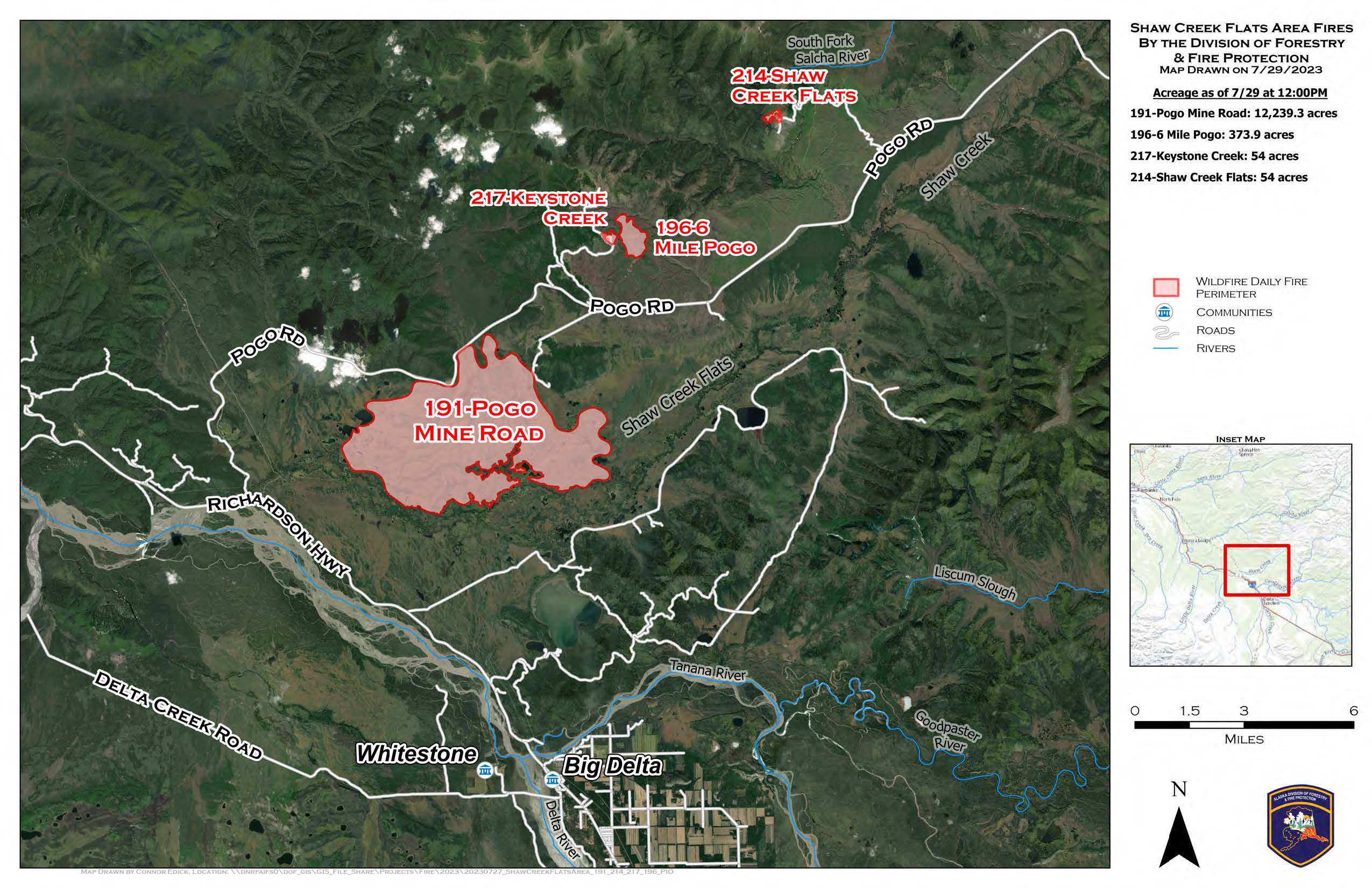
Indian Creek (#251) – [200+ acres] 2 miles north of Pogo Gold Mine. The fire is one mile from the Pogo Gold Mine airstrip. Helicopters completed bucket drops and crew shuttle operations on Saturday.
Sand Lake (#250) – [25+ acres] 6 miles northwest of Dot Lake. Helicopters conducted bucket work throughout the day to protect allotments and cabins east and west of the fire. A helispot was constructed to assist in aviation missions.
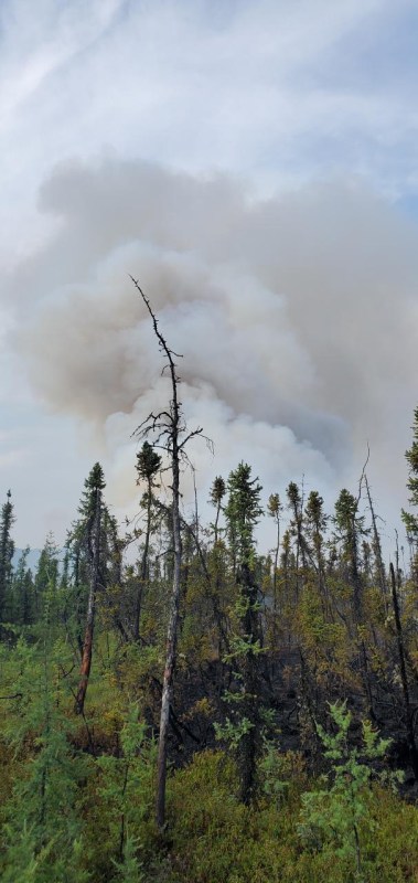
Pogo Mine Road (#191) – [8,500+ acres] 9 miles down Pogo Road. Tanana Chiefs Crew and DOF personnel continued burn operations on 9-mile Pogo Road, working east and west between 10-mile to near 8-mile. Efforts continue to focus on protecting the road and power lines.
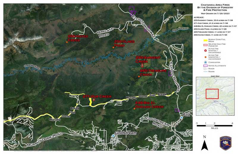
Our Creek Fire (#271) – [18+ acres] .5 miles north of Old Murphy Dome Road. DOF personnel and crews continued working and securing the fires edge with line and hose lay while helicopters continued suppression with bucket operations. The fire is boxed in on two sides by the Old Murphy Dome fuel break which is aiding in preventing the fire from threatening communities south of the dome road.

Categories: Active Wildland Fire
