Two retardant tankers, two Super Scoopers, and Fire Bosses along with aerial supervision were dispatched and worked to moderate the fire’s activity and slow its growth. The perimeter size is estimated to be 1,900 acres. Last evening the Fairbanks North Star Borough issued evacuation notices for parts of the Haystack Subdivision. A GO! evacuation level was issued for Upper Haystack Drive, including Sharmon Court and All of Middle Fork Road in the Haystack Subdivision.

Retardant tankers worked the fire Wednesday morning to box the fire in. Hot and dry conditions resulted in fire activity picking up significantly by the middle of the afternoon. Division of Forestry & Fire Protection and BLM Alaska Fire Service firefighters and engines responded to protect the Haystack Subdivision, which is approximately three miles south of the fire. Approximately twenty fire personnel remained in the Haystack Subdivision late into the evening until fire behavior decreased.
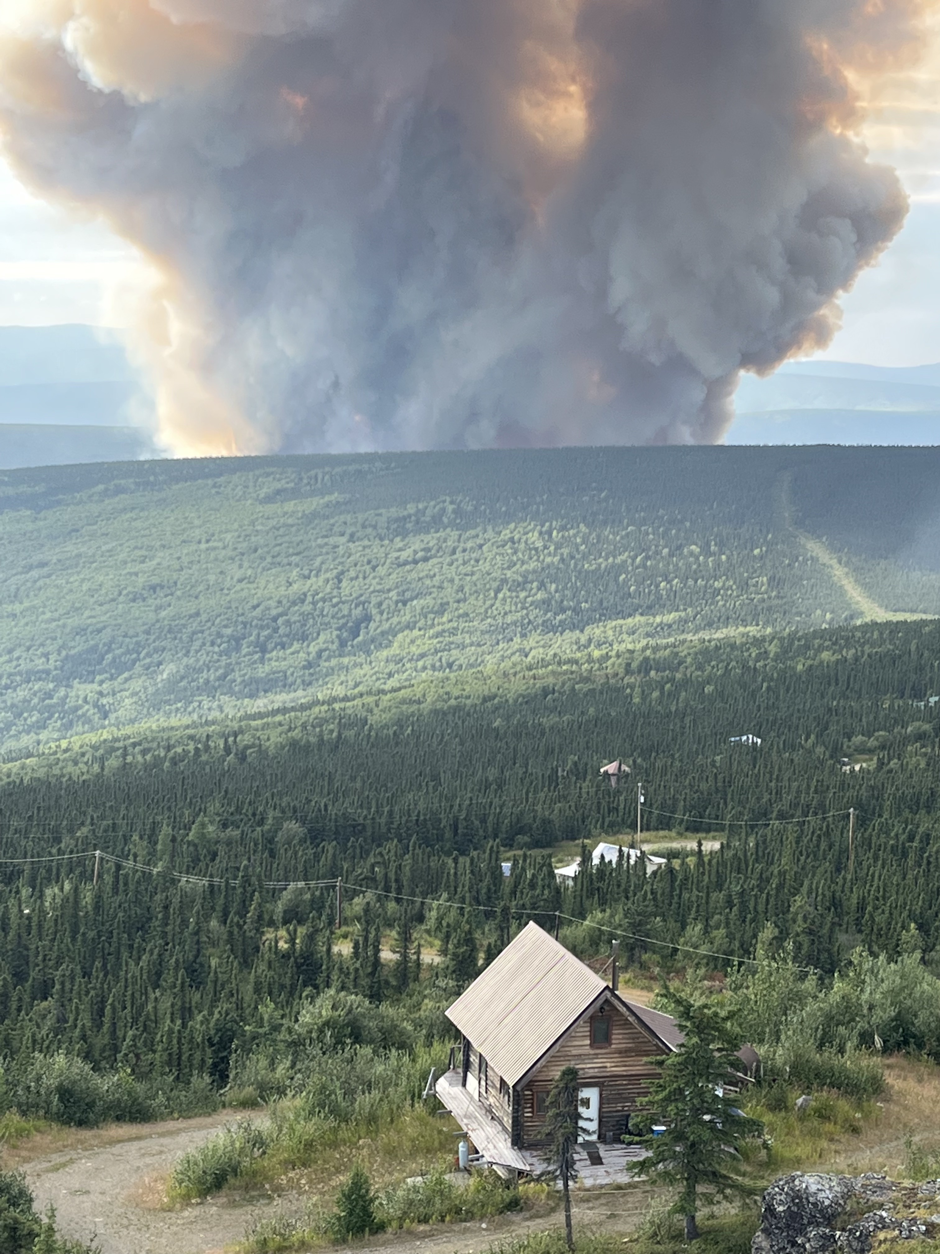
View of the Lost Horse Creek Fire (#296) smoke column north of Fairbanks. Togie Whiel / AK IMT 
View from the Hamalaya Road on the Elliott Highway. Credit: DOF/Kale Casey 
View from the Elliott Highway mile 13. Credit: DOF/Kale Casey 
Local residents Dave Turner and Bob Sands share information with their neighbors. Credit: DOF/Kale Casey
Fire personnel are able to utilize over 10 miles of existing fuel breaks in this area known as the Haystack Mountain Fuels Mitigation Project. Division of Forestry & Fire Protection’s five year long Haystack Mountain Fuels Mitigation Project includes widening preexisting control lines and establishing new treatment units along Washington Creek and Leuthold Drive. Fire personnel currently on scene have extensive experience working in the Haystack Subdivision. A complete and thorough structure protection plan was completed in the summer of 2021 during the last major wildfire in this area.
The best map to identify your FNSB neighborhood & evacuation status is FNSB’s Find My Neighborhood/Evac Neighborhood Status Map https://bit.ly/3BCKi62
Watch a field report on YouTube of the fire activity from the Elliott Highway from August 2nd:


Categories: Active Wildland Fire, Alaska DNR - Division of Forestry (DOF)
