
There was minimal fire growth in the region and no new fires have been reported from yesterday’s lightning storms across the interior. Burn permit suspensions were lifted for the Copper River and Tok areas due to recent wetting rains, though suspensions remain in place for the Fairbanks and Delta areas. An air quality advisory remains in effect for central and eastern Alaska. Low level clouds will trap smoke that is produced from the fires, increasing smoke concentrations, especially in the morning hours. There are currently 153 active fires: 53 in critical or full protection and 100 in limited management zones. 255,567 acres have burned statewide.
HIGHLIGHTED FIRE ACTIVITY
Lost Horse Creek (#296) – [8,979 acres] North of Old Murphy Dome Road, 3.5 miles east of Mile 18 Elliot Highway. Progress was made with construction of an indirect line on the southern side of the fire with masticators that recently arrived. Work will continue on the indirect line, securing the existing direct line, and improving structure protection measures. Evacuation levels remain in place from the Fairbanks North Star Borough. (285 Personnel)
Anderson Complex (#899) – [50,830 acres] Anderson-Clear area. Dense smoke will hold throughout the area which will continue to keep temperatures cool and fire activity low. The threat of afternoon thunderstorms remains for the rest of the week. Resources continue to secure spots and implement structure protection. Evacuation levels remain in place from the Denali Borough. (270 personnel)
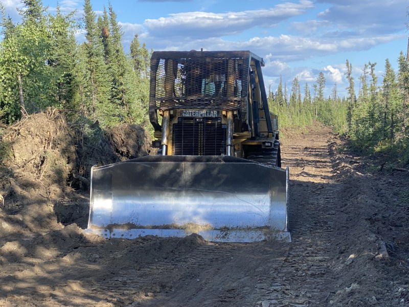
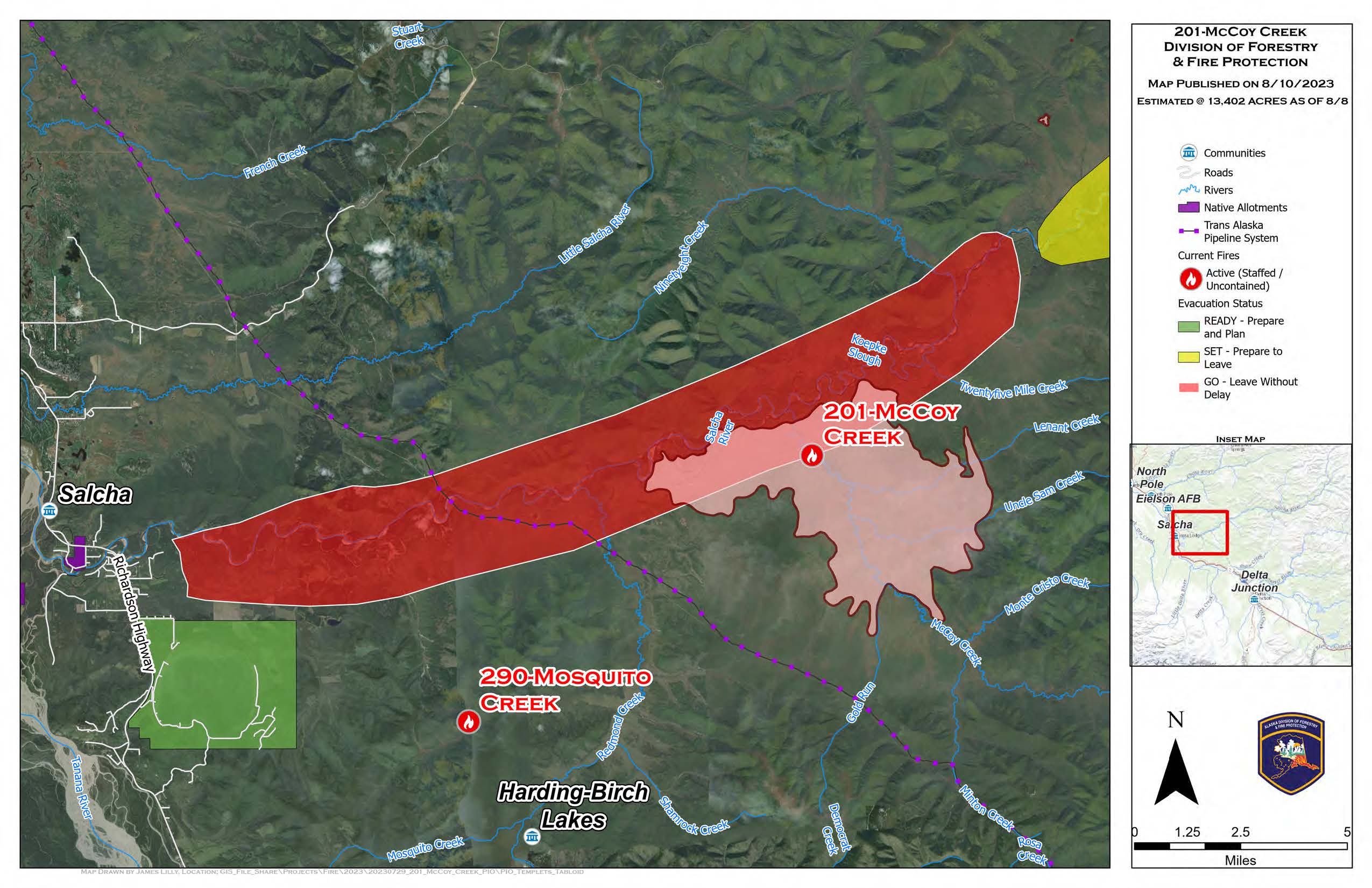
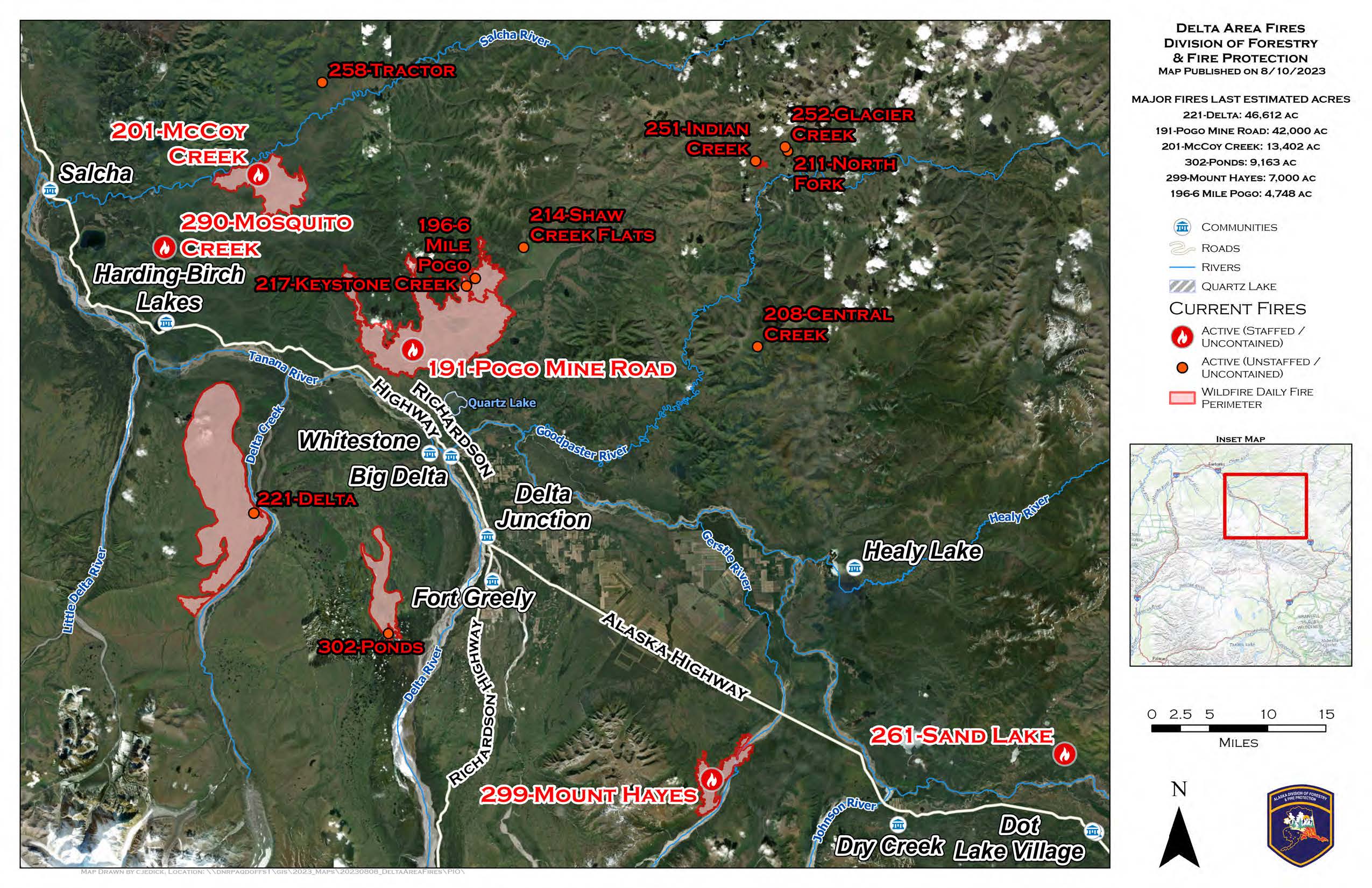
McCoy Creek (#201) – [13,502 acres] River mile 29, Salcha River. The fire showed minimal growth yesterday despite not receiving measurable precipitation. Crews continued securing the edge of the incident, structure assessment and mop up. Evacuation levels remain in place from the Fairbanks North Star Borough. (156 personnel)
Pogo Mine Road (#191) – [42,500 acres] 9 miles down Pogo Road. Dozers and hand crews went direct on the northwest flank of the fire. Structure protection continued on Shaw Creek. A helicopter and Fire Bosses conducted water drops along the western edge, towards the Richardson Highway, where the fire approached the Alaska Pipeline corridor. (32 personnel)
Sand Lake (#261) – [123 acres | 25% contained] 6 miles northwest of Dot Lake. Crews have nearly completed saw line around northern edge of fire and will be working from both the top and bottom towards each other on east flank. (64 personnel)
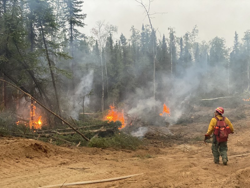
Mosquito Creek (#290) – [35 acres | 50% contained] 5 miles east of Harding Lake. Personnel continued to burn excess fuel in the interior of the fire, griding for heat and building a 50 foot saw line on both flanks. (43 personnel)
Mount Hayes (#299) – [7,000 acres] 24 miles southeast of Delta Junction. A dozer finished contingency line from the northeast corner of Gerstle field to Gerstle River and crews finished hose lay on a contingency line. (29 personnel)


Categories: Active Wildland Fire
