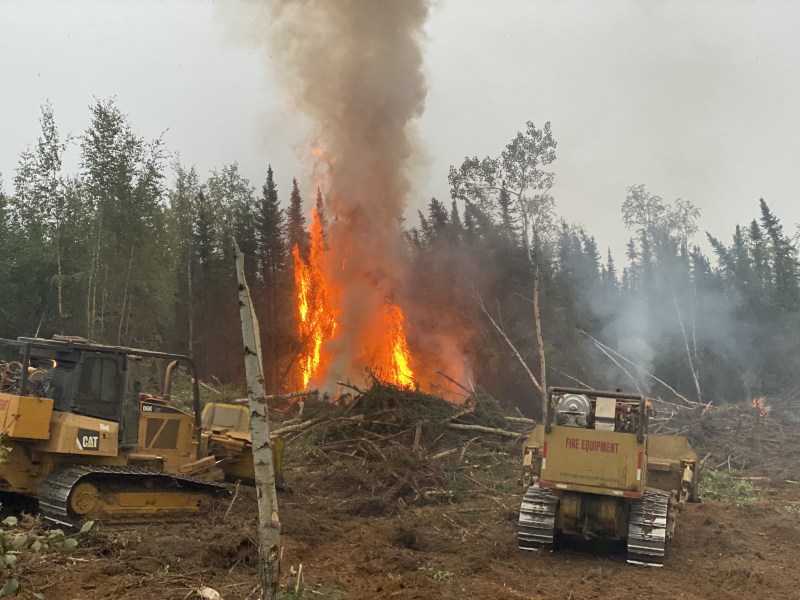
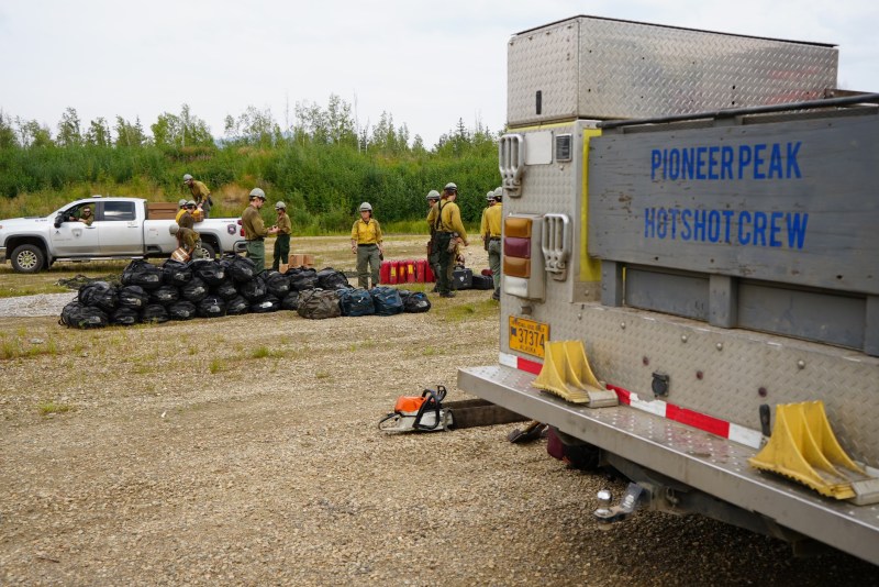
Winds tested the lines on fires across the Interior over the weekend and there was no significant movement or loss of ground. Temperatures are forecasted to begin cooling this week. The Drought Code and burnable duff layers have been the main drivers to fire activity and are showing a resistance to extinguishment. Fires are expected to burn and smolder until snow or significant, wetting rains fall in the Interior. Crews will continue working on securing line, point protection, and mopping up edges of fires to ensure lines continue holding. There are currently 8 staffed fires utilizing 1,011 personnel in the field and 276,964 acres have burned statewide.
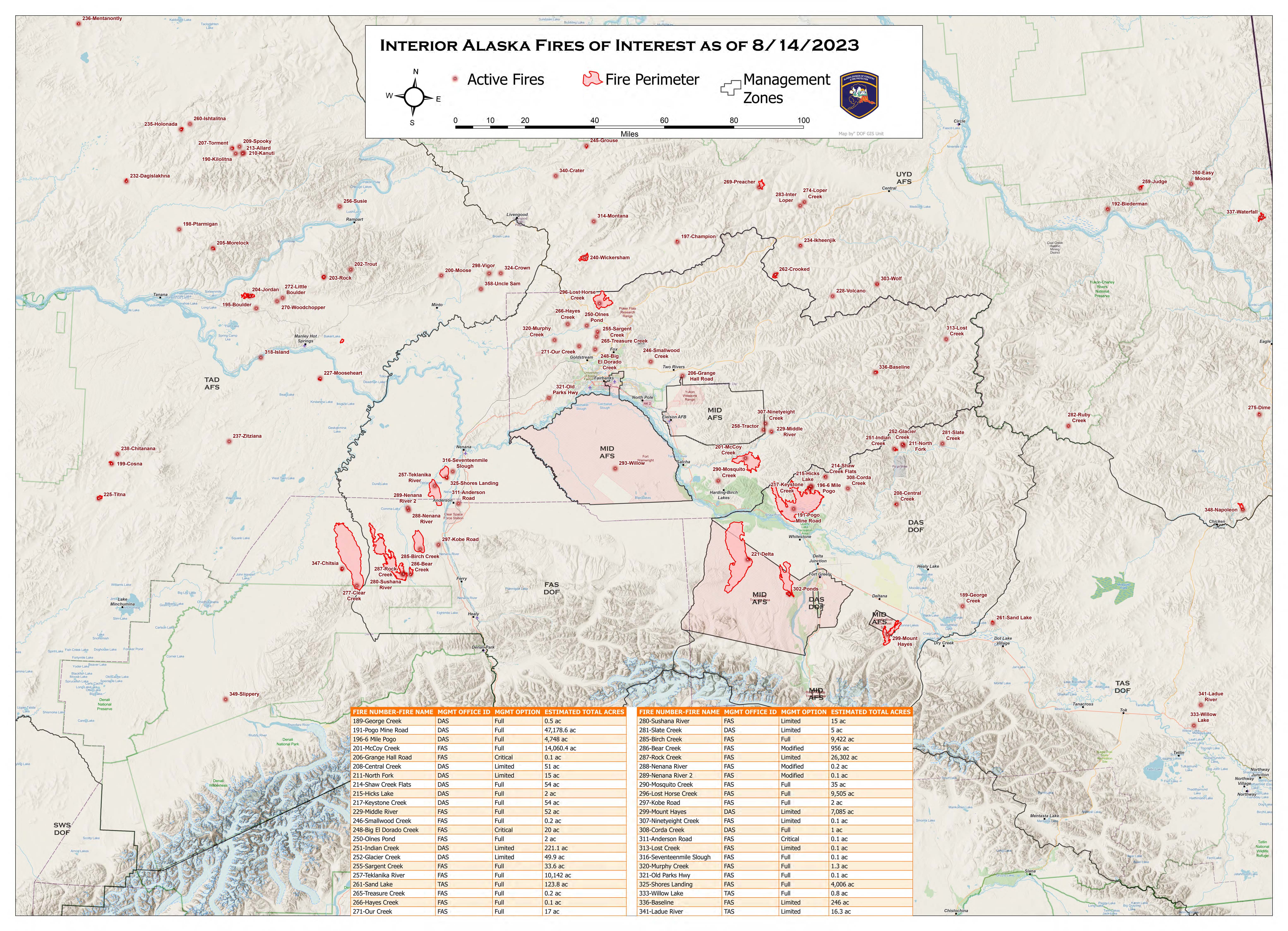
HIGHLIGHTED FIRE ACTIVITY
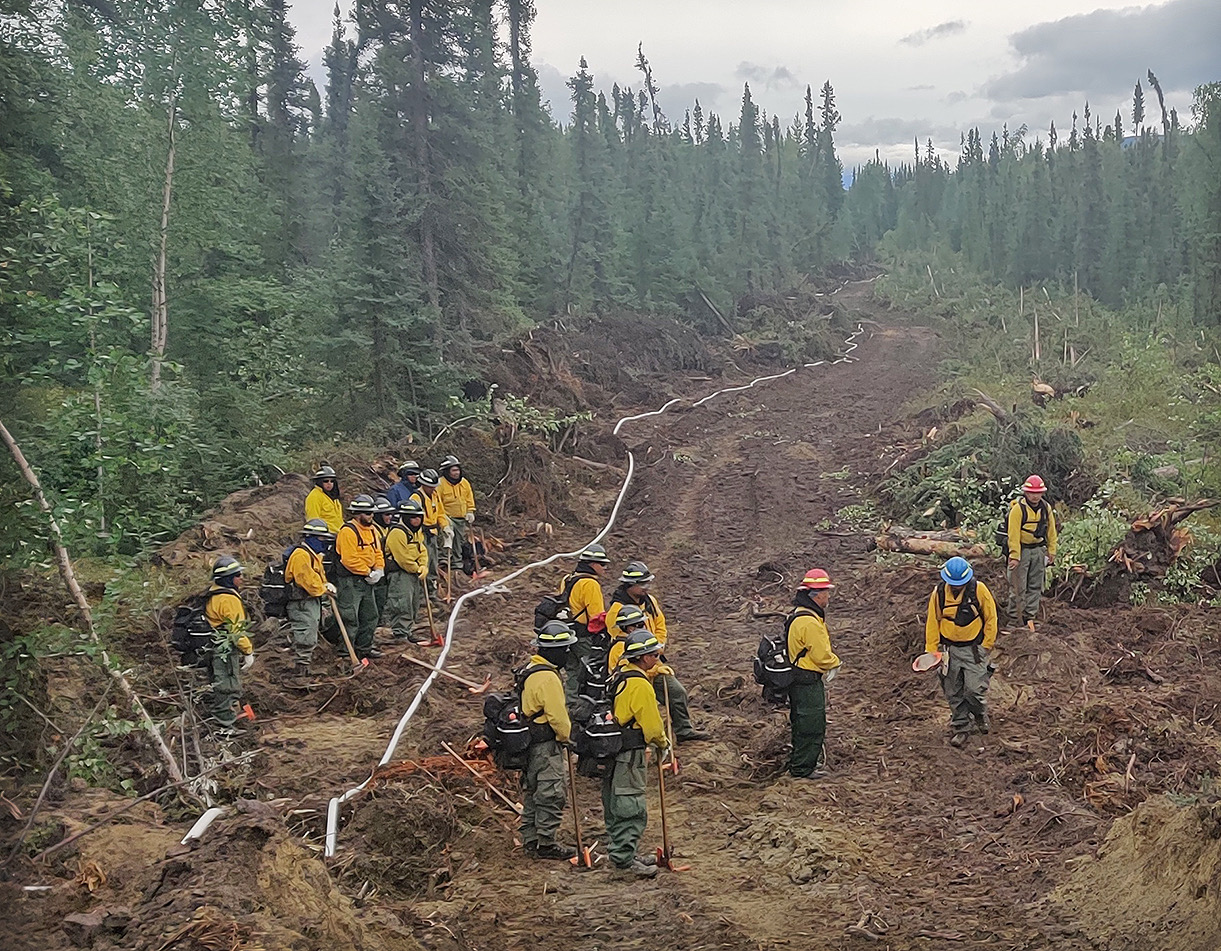
Lost Horse Creek (#296) – [9,505 acres | 37% completed] North of Old Murphy Dome Road, 3.5 miles east of Mile 18 Elliot Highway. Work continued towards securing the south, southwest, and southeast portions of the fire. This includes completion of handline and hose lays on the southwest side, work on indirect line on the western edge, and on a separate fuel break protecting Haystack and the Elliott corridor. There has been no acreage change since August 11. Evacuation levels remain in place from the Fairbanks North Star Borough. (360 Personnel)
Anderson Complex (#899) – [50,830 acres | 63% completed] Anderson-Clear area. The warmer weekend temperatures increased activity on the Shores Landing fire and it spread on the northeast and southeast corners. Resources continue to secure hot spots and the fire edge around structures and continue to secure line around Native Allotments. Suppression repair has begun in some areas and will continue through the week. Evacuation levels remain in place from the Denali Borough. (241 personnel)
McCoy Creek (#201) – [14,060 acres] River mile 29, Salcha River. Contingency hose line along the pipeline corridor is secured. Crews completed a section of 50` mop up behind the structures along the Salcha River. Evacuation levels remain in place from the Fairbanks North Star Borough. (124 personnel)
Pogo Mine Road (#191) – [47,178 acres] 9 miles down Pogo Road. Activity was confined to isolated areas of heat. Resources continued progressing with mop up around values at risk. (67 personnel)
Sand Lake (#261) – [123 acres | 50% completed] 6 miles northwest of Dot Lake. There has been no acreage change since August 11. Crews continued securing and mopping up the incident. (70 personnel)
Mosquito Creek (#290) – [35 acres | 50% completed] 5 miles east of Harding Lake. No significant fire activity during this operational period. Crews continue to mop up the interior of the fire area. (43 personnel)
Mount Hayes (#299) – [7,085 acres] 24 miles southeast of Delta Junction. Resources continued to patrol and monitor fire growth and implement structure protection on state public use cabins. (89 personnel)
Categories: Active Wildland Fire, Alaska DNR - Division of Forestry (DOF)
