
Size: 3,946 acres Location: 7 miles southwest of Tok, AK
Start Date: June 19, 2025 Cause: Lightning Containment: 55% Total Personnel: 131
Evacuation levels for neighborhoods near the 7 Mile Lookout Fire (#222): Residents north of Butch Kuth Ave and on Jack Wade Road are at READY (Level 1). Residents on Osprey, Moose Nugget, and Goshawk Roads are at SET (Level 2).
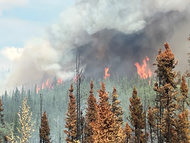
Activities: Yesterday there was some fire activity in the interior portions of the fire boundary. Smoke may be visible from town today. Firefighters will continue to dig line and secure the perimeter. Aviation resources are available and will assist as needed throughout the day.
There was minimal fire activity on the Tok River Fire yesterday with visible smoke in the interior. It continues to be monitored by helitack. Resources are nearby if needed.
Weather: Scattered rain showers are expected this afternoon with a possibility of isolated thunderstorms north of the fire.
Aircraft and Drone Restrictions: A temporary flight restriction (TFR) remains in place over the fire and will continue to be until further notice. The public is asked not to fly any type of aircraft, including drones, near the fire area. Unauthorized drone (UAS) flights pose serious risks to the effectiveness of wildfire suppression operations. Aerial firefighting is suspended when unauthorized UAS are in the area, allowing wildfires to grow larger.
Remember: If you fly, we can’t.
Categories: AK Fire Info
