Himalaya Road and Aggie Creek Fire Update
Aug. 1, 2025
Colby Crawford, Incident Commander
Doug Knight, Incident Commander Trainee
Acres: 6,057 (Himalaya Road); 34,837 (Aggie Creek) Start Date: June 19, 2025
Location: 25 miles North of Fairbanks Cause: Lightning/natural
Personnel: 34 on Himalaya Road; 16 on Aggie Creek. Fuels: Black spruce, grass
Containment: 60% on Himalaya Road, 5% on Aggie Creek
Highlights: Backhaul operations have been completed for Himalaya Road and Aggie Creek fires.
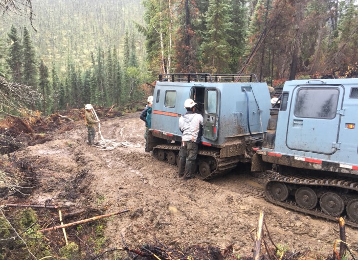
Operations: All the excess supplies and equipment have been removed from the firelines making way for suppression repair that is well underway. Two more excavators arrived Thursday and joined two others working in the Caribou Creek area where they are repairing 13 miles of dozer line. Repair involves pulling the duff mat back onto the bladed line and scattering trees and brush over the area to slow erosion. Water bars are being constructed on sloped areas to divert runoff. Areas of permafrost will need to be left until the ground freezes, so heavy equipment does not cause further damage.
Unmanned Areial Systems continue to fly the perimeters of the fires looking for hot spots. Some possible heat signatures were detected Thursday. Firefighters will investigate and extinguish any areas that could threaten containment lines.
Weather: A warming and drying trend started Thursday and will persist into the weekend for the Central Interior. Friday will be mostly clear over the area of the fires with temperatures from 68 to 78 degrees, relative humidity around 40%, and light and variable winds. No rain is in the forecast through Saturday.
Closures: Olnes Pond Campground remains closed to the public for use by the fire crews.
Evacuations: Level 1 “READY,” evacuations are still in effect. Level 1indicates that a fire is present in the area and to prepare for potential evacuation. Visit https://bit.ly/FNSBevac for current evacuation levels.
Safety: A Temporary Flight Restriction is still in place, but the affected airspace restrictions have been modified; check https://tfr.faa.gov/ for changes.
Do not fly drones over the fire area. Unauthorized drone use poses serious risks to firefighter and public safety – If you fly, we can’t.


Categories: Active Wildland Fire, Alaska DNR - Division of Forestry (DOF)
