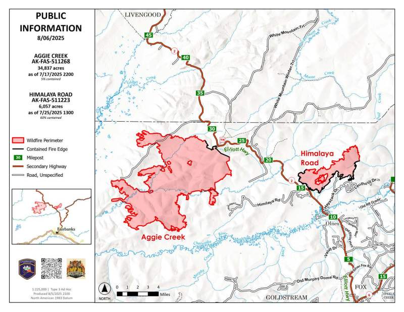
Acres: 6,057 (Himalaya Road); 34,837 (Aggie Creek)
Start Date: June 19, 2025
Location: 25 miles North of Fairbanks
Cause: Lightning/natural
Personnel: 40 on Himalaya Road; 3 on Aggie Creek.
Fuels: Black spruce, grass
Containment: 60% on Himalaya Road, 5% on Aggie Creek
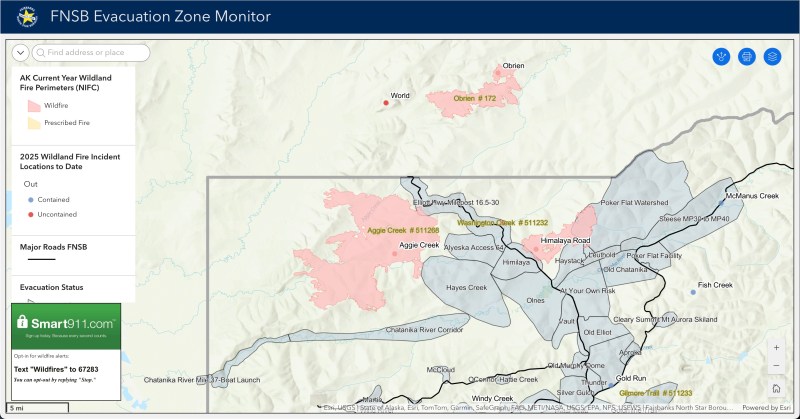
Highlights: With no reports of smoke or heat for several days, fire managers have recommended that all evacuation levels for the Himalaya Road and Aggie Creek Fires be lifted. As of last night, the Fairbanks North Star Borough lifted all evacuation levels within its boundaries, and the State Emergency Operations Center has also lifted the evacuation status for areas outside the borough along the Elliott Highway.
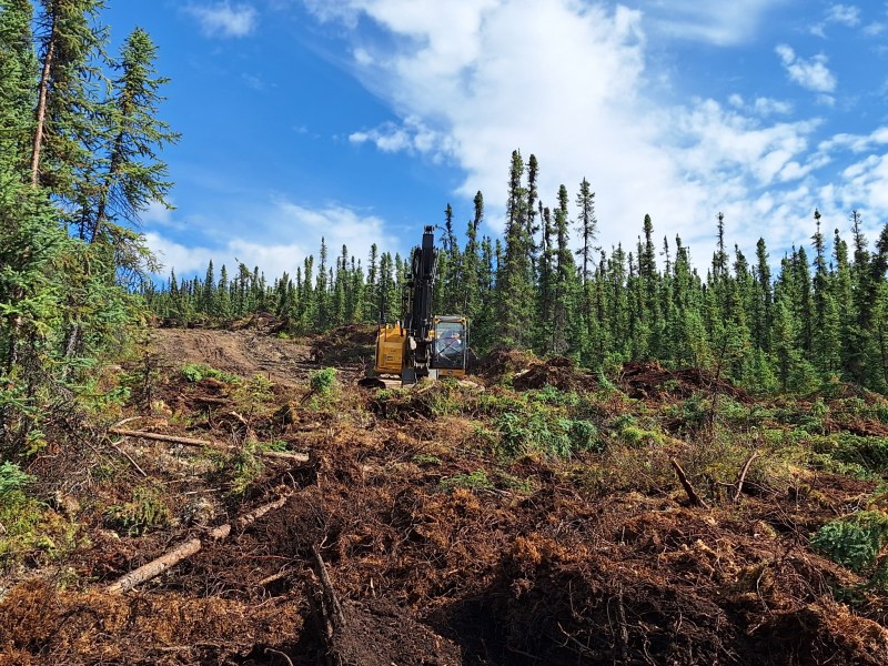
Operations: The rehabilitation for the dozer line in the Caribou Creek area has been completed. The excavators are now working on a steep, three-mile-long section between Cogan Drive and Middle Fork Road. This area is estimated to require at least five days of work as weather allows. Fire managers have also been working with Summit Telephone Company to repair some of their phone lines this morning. The resource advisor is assessing the areas of repair for the Aggie Creek fire today to be able to start rehabilitation work on the impacted areas from that fire as well.
There is still fire traffic on the Elliott Highway by Olnes Pond and Whitefish Campground. Heavy equipment also continues to work around the fire area. This includes trucks, heavy equipment on trailers and ATVs. Please drive carefully and mind your speed for public and firefighter safety.
Weather: Partly cloudy with a high of 75 degrees Fahrenheit. The chance of rain is low at 10%, and winds will be light, coming from the southeast at 5 mph.
Closures: No closures in effect for the Himalaya Road and Aggie Creek fires currently. Olnes Pond and Whitefish Campground have been reopened to the public.
Evacuations: Level 1 evacuation levels for the Himalaya Road, Aggie Creek, and Obrien Fires have been lifted completely. The areas that have lifted are the Murphy Dome Boat Launch, Chatanika River Mile 37-Boat launch, the Chatanika River Corridor (west of Shovel Creek), Hayes Creek, Olnes, Himalaya, Alyeska access 64, Haystack, Upper Haystack Drive, Leuthold, and Poker Flat Watershed zones. As well as the Elliott Highway from Milepost 16.52 to 30, and from Milepost 31 to 42, has also been lifted.
This will be the last standalone daily update. There will be a statewide fire update released as more information becomes available.
Categories: AK Fire Info
