August 13th, 2025
Tok Area:
7 Mile Lookout Fire (#222)
4,094 acres I Containment: 55% I Total Personnel: 58
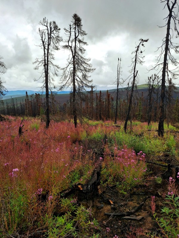
Update: Crews worked along the southern and eastern sides of the fire, focusing on cooling the heat found in earlier checks. The Mat-Su Crew arrived on Wednesday to help support suppression and mop-up efforts. A drone flight covered the perimeter to help locate any remaining hot spots, while a helicopter with a water bucket supported crews on the ground. The weather was warm and mostly sunny this week, but will shift to cooler and wetter conditions, helping crews secure the fire and complete mop-up. Please remain clear of the area as trees with unstable, burned shallow roots can fall without warning. Ash pits can also collapse and cause serious burns to anyone traveling through burned ground, as smoldering duff layers can continue to burn underground for weeks and months.
Tok area is also under a burn permit suspension since Sunday, August 10th, due to hot, dry, and windy conditions. This suspension will remain in place until conditions change. Find more information about the Burn Permit program and suspensions at https://dnr.alaska.gov/burn
Public Information Line: (907) 505-0362
Email: 2025.7milelookout@firenet.gov
Fairbanks Area:
Himalaya Road Fire (#223):
6,057 acres I 60% Containment
Aggie Creek Fire (#268):
34,837 acres I 5% Containment
Total Personnel: 39
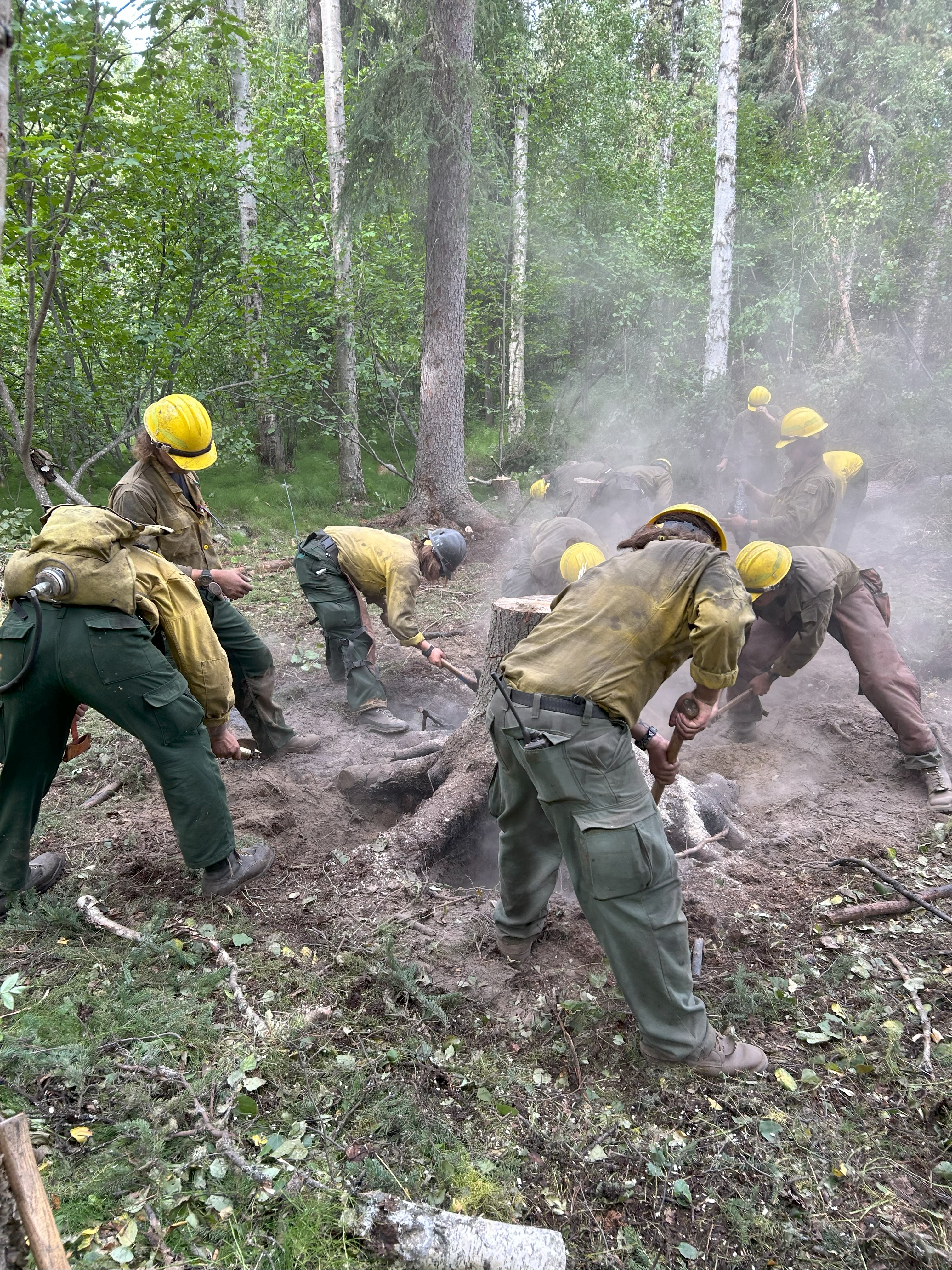
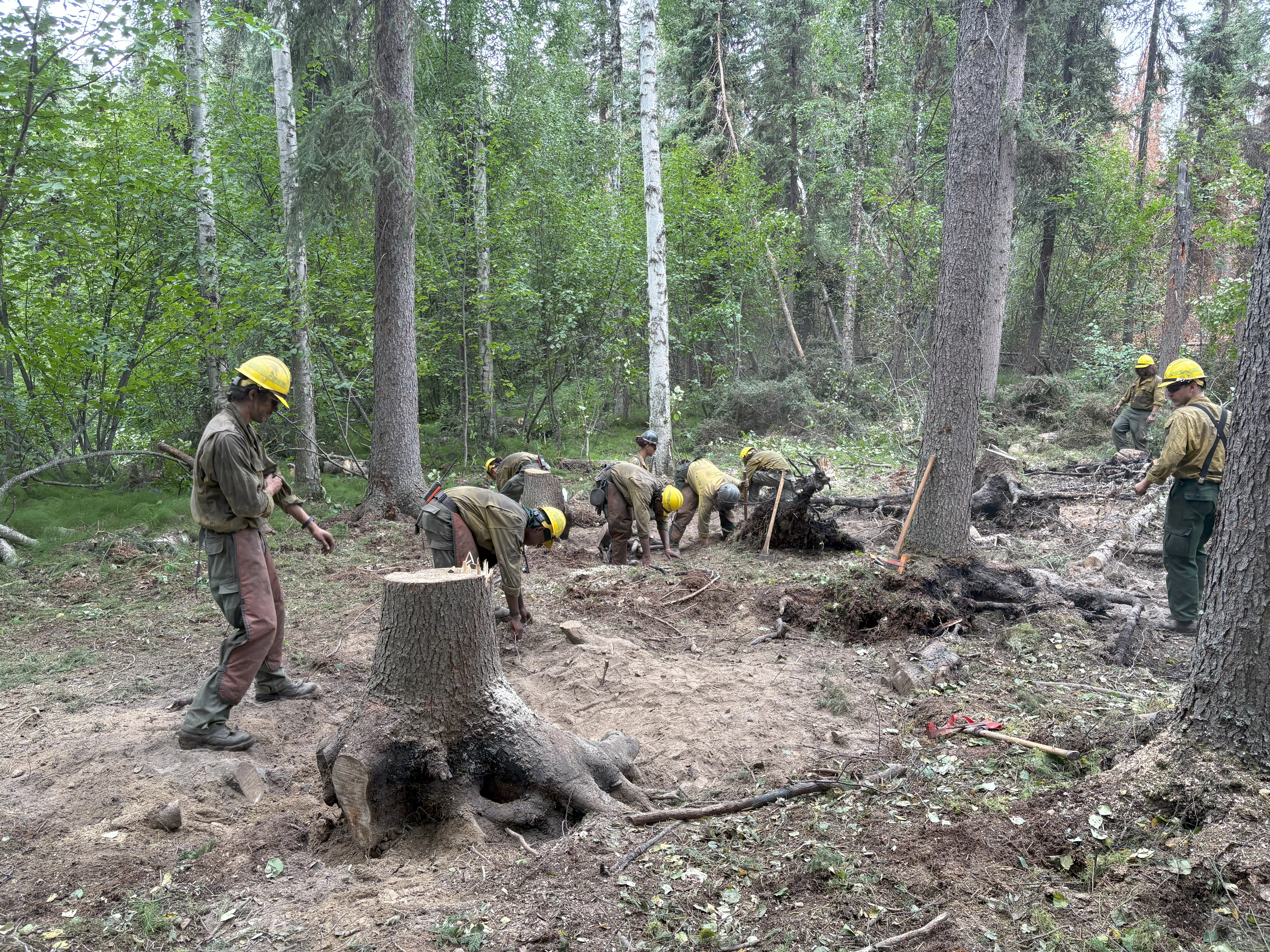
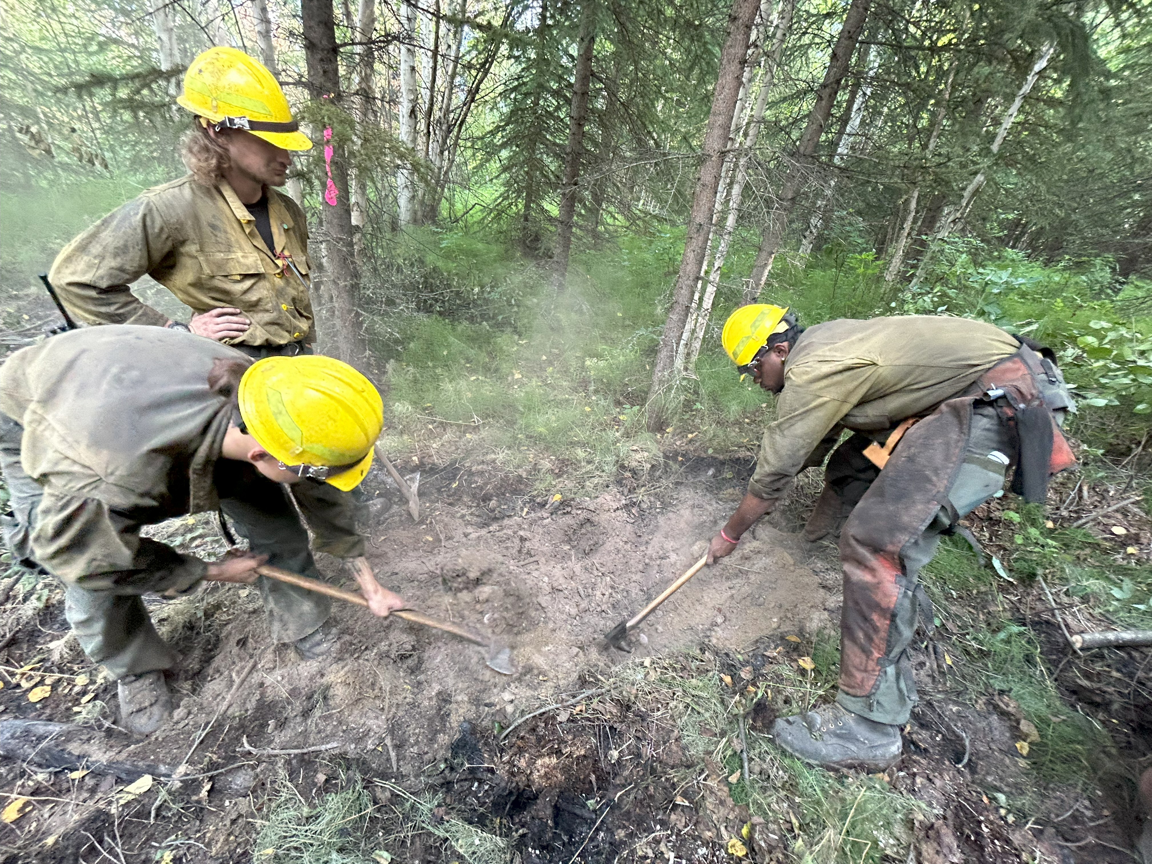
Update: Suppression repair efforts are making steady progress on the Himalaya and Aggie Creek Fires, with a focus on restoring the landscape affected by firefighting activities. Heavy equipment, specifically excavators, are actively working to repair dozer lines and other disturbed areas.
On the southeast side of the fire, excavators are currently working to repair a dozer line that was cut along an ATV trail. This work is critical for minimizing long-term damage and helping the area recover. Another team of excavators is moving north from the Pete Simpson Forestry Road, aiming to repair a two-mile section of dozer line. Their goal is to continue this work until the line connects with a nearby two-track trail.
In a separate but related effort, resource advisors are planning a trip to a more remote area. They will be accessing the location via the Chatanika River to scout a dozer line and identify potential repair opportunities.
To ensure the safety of everyone in the area, flaggers are periodically stationed on the Elliot Highway. Their job is to safely facilitate the movement of heavy equipment, including dozers and excavators, to and from the fire lines. This is a crucial step in maintaining a safe work environment for fire personnel and protecting the public.
For your safety and the safety of our crews, please drive with extreme caution through the area. Be mindful of your speed and watch for firefighters and heavy equipment operating on and near the roadways.
No evacuations and no TFR in place for the Himalaya and Aggie Creek Fires.
Public Information Line: (907) 921-7881
Email: 2025.himalayaroad@firenet.gov
Nenana Ridge Complex
Bonanza Creek Fire (#238):
12,576- acres I 15% containment
Goldstream Creek Fire (#270):
20,471 acres I 41% containment
Total Personnel: 51
Update: The Nenana Ridge Complex is still in suppression repair mode, and we need the public’s cooperation to keep everyone safe. Due to ongoing operations, forest roads in the Nenana Ridge Complex are restricted to fire personnel only.
This closure includes the following roads and all connecting roads:
* Nenana Ridge Road
* Bonanza Creek Road
* Maisch Logging Road
* Skinny Dick’s logging roads
*Standard Creek Road
We know that grouse season has recently opened, but please stay out of these areas. There are serious safety risks, including heavy equipment working on narrow roads. Additionally, there are still isolated pockets of heat and deep ash pits that pose a danger to anyone in the area. Your presence in the area can also slow down critical repair efforts.
A recent smoke report called in by a member of the public led crews to a section of the Goldstream Creek Fire. They found that, although some heat remained, it was not posing a threat to any values. We appreciate the public’s vigilance, but ask that you stay out of the fire areas for your own safety.
Currently, logging companies with parcels in the area are working with the Division of Forestry to coordinate safe access. Foresters are also working to salvage timber from the Tanana Valley State Forest that was impacted by the fire, creating log decks and preparing for future sales.
We will continue to provide updates as conditions change. Thank you for your understanding and cooperation.
No evacuations or TFR’s in place for Nenana Ridge Complex.
Public Information Line: (907) 331-0454
Email: 2025.nenanaridgecomplex@firenet.gov
Monte Cristo Creek Fire (#319)
8,773 acres I 0% Containment I Personnel: 0
Update: The Monte Cristo Fire (#319) is now being monitored. Located 12 miles south of river mile 48 of the Salcha River, it has burned 8,773 acres within a Limited Management Option area.
The White Mountain Crew was initially deployed to address hotspots identified by an unmanned aircraft system. However, they were demobilized due to difficult weather conditions after only a few shifts. The fire’s status was changed to monitored because its size is stable, the behavior is moderate, and there are no values at risk. The fire will continue to be monitored until a season-ending event occurs.
There are no evacuations or Temporary Flight Restrictions (TFRs) in effect for the Monte Cristo Fire.
Public Information Line: (907) 450-5512
Email: akfireinfo@alaska.gov
Categories: AK Fire Info
