7 Mile Lookout Fire (#222) Size: 3,120 acres Location: 7 miles southwest of Tok, AK. Start Date: June 19, 2025 Cause: Lightning Containment: 54% Total Personnel: 119 Evacuation levels for neighborhoods near the 7 Mile Lookout Fire (#222): Residents north… Read More ›
Tok
Firefighters Advance on 7 Mile Lookout Fire with 50% Containment and Latest on Tok River Fire Efforts
7 Mile Lookout Fire (#222) Size: 3,120 acres Location: 7 miles southwest of Tok, AK. Start Date: June 19, 2025 Cause: Lightning Containment: 50% Total Personnel: 140 Evacuation levels for neighborhoods near the 7 Mile Lookout Fire (#222): Residents north… Read More ›
Heat remains under duff, smoke visible on 7 Mile Lookout, Tok River fires
7 Mile Lookout Fire (#222) Size: 3,120 acres Location: 7 miles southwest of Tok, AK. Start Date: June 19, 2025 Cause: Lightning Containment: 16% Total Personnel: 117 Evacuation levels for neighborhoods near the 7 Mile Lookout Fire (#222): Residents north… Read More ›
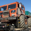
Smoke is still visible despite previous scattered rain showers on the 7 Mile Lookout Fire and Tok River Fire
7 Mile Lookout Fire (#222) Size: 3,120 acres Location: 7 miles southwest of Tok, AK. Start Date: June 19, 2025 Cause: Lightning Containment: 0% Total Personnel: 108 Evacuation levels for neighborhoods near the 7 Mile Lookout Fire (#222): Residents north of Butch Kuth Ave and on Jack Wade Rd are at READY (Level 1). Residents on Butch Kuth Ave,… Read More ›
A drone (unmanned aerial systems (UAS)) has been flown to evaluate acreage and document hotspot locations on 7 Mile River Fire and Tok River Fire
7 Mile Lookout Fire (#222) Size: 3,101 acres Location: 7 miles southwest of Tok, AK. Start Date: June 19, 2025 Cause: Lightning Containment: 0% Total Personnel: 101 Evacuation levels for neighborhoods near the 7 Mile Lookout Fire (#222): Residents north… Read More ›
Additional Support Arrives in Tok to Assist Suppression Efforts on the 7 Mile Lookout Fire and Tok River Fire
Evacuation levels for neighborhoods near the 7 Mile Lookout Fire (#222): Residents on Butch Kuth Ave, Osprey, Moose Nugget, and Goshawk Rd are at Level 2 “SET”. Residents north of Butch Kuth Ave and on Jack Wade Rd are at… Read More ›
Tok wildfires: evacuations in effect, structure protection underway, community meeting tonight
Evacuation orders are in effect for areas east of Tok due to fire activity from the Seven Mile Lookout Fire (#222), which is burning approximately three miles west of Mile 118 on the Tok cut off, about nine miles southwest… Read More ›
Pilot spots new fire; Kechumstuk Creek, 15 miles west of Chicken
Update 8:30pm The estimated acreage of the Kechumstuk Creek Fire (#192) has increased to 600 acres due to receptive fuels and shifting winds. Two scoopers have been on scene working on the east side of the fire perimeter. Smokejumpers have… Read More ›
Burn Permits suspended in Delta Prevention Area on Friday, June 13
Burn permits are suspended Friday, June 13, in the Delta Fire Prevention Area because of very high fire danger due to rising temperatures and dry conditions. This suspension will remain in place until conditions change. The National Weather Service forecasts… Read More ›
Burn Permits suspended in Tok Prevention Area on Friday, June 13
Burn permits are suspended Friday morning, June 13, in the Tok Fire Prevention Area because of very high fire danger due to rising temperatures and dry conditions. This suspension will remain in place until conditions change. The National Weather Service… Read More ›