BLM Alaska Fire Service is keeping an eye on fires burning in remote parts of the Donnelly Training Area west of the Delta River and the Yukon Training Area north of the Salcha River. None of the fires are near any sites identified as valuable. Both fires in the Donnelly Training Area are very active during the evenings, burning through a mixture of tundra grass and the occasional spruce trees. BLM AFS personnel are conducting daily flights to monitor these fires.

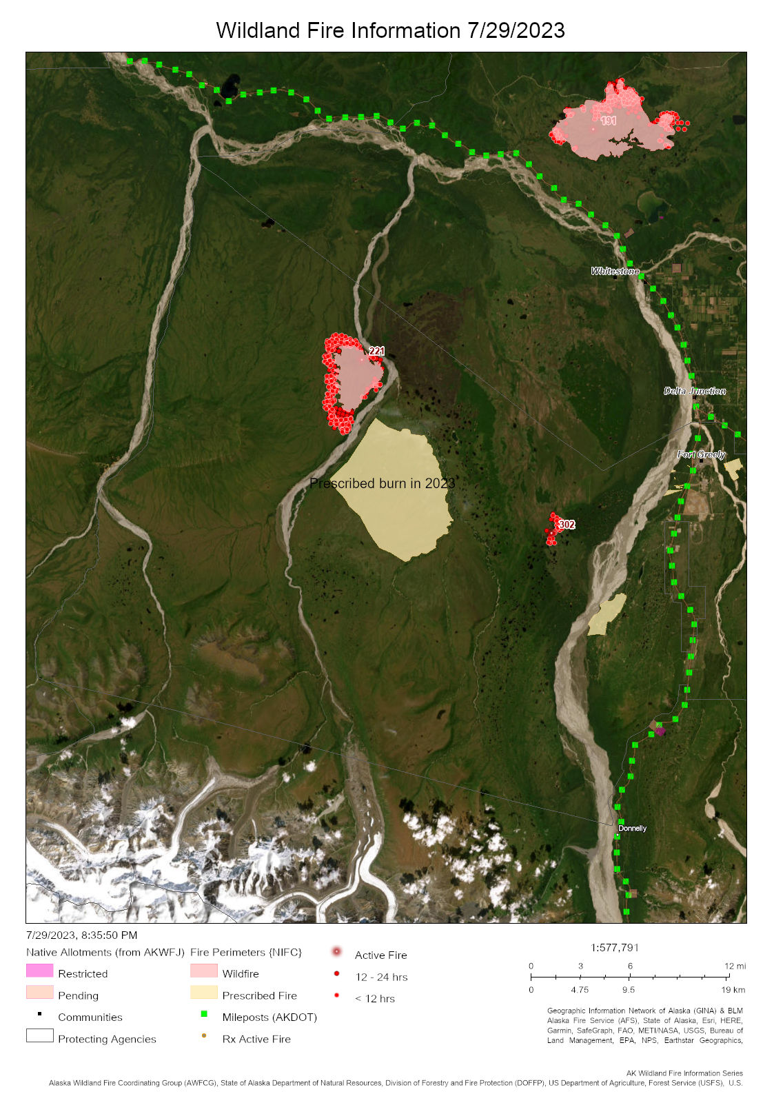
The approximatley 5,000 acre Delta Fire (#221) is burning on a remote part of the Donnelly Training Area west of the Delta Creek about 15 miles south of Whitestone. By Karen Scholl, BLM AFS 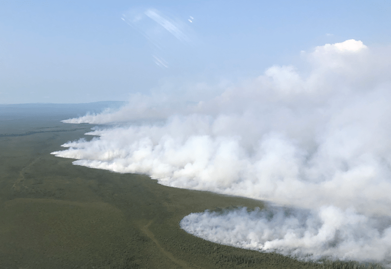
The Delta Fire (#221) is burning within the Delta Training Area west of the Delta Creek. Photo by Karen Scholl.
The largest and probably most visible, the Delta Fire (#221) is estimated at 5,000 acres. It’s been burning in a very remote part of the training range west of the Delta Creek not accessible by ground. It’s 15 miles southwest of Whitestone. The Delta Creek stands between the fire and the community. This lightning-caused fire was reported Tuesday and has been rapidly growing since, mostly toward the east where it’s bumping against the wide Delta Creek.
The Ponds Fire (#302) was discovered today and is estimated at 1,500 acres. It’s within the area burned in the 2019 Oregon Lakes Fire within the Oklahoma Impact Area where the threat of unexploded ordinances makes the area too dangerous to put people on the ground. It’s about 7.5 miles west of mile 258 Richardson Highway. It was smoldering, backing against the wind with some single-tree torching. It may be visible from the Richardson Highway south of Delta Junction
The concern is that possibility of chinook winds channeling through the Delta River corridor could push the Ponds Fire north and off of military training lands and onto State of Alaska lands, or worse, toward communities on the south side of the Delta River.
Fortunately, a coordinated interagency effort has been underway for years to remove hazardous fuels in a fuel break constructed in the Donnelly Training Area west of the Delta River. A new 349-acre fuel break was completed over the winter months by a Division of Forestry & Fire Protection contractor west of Delta Junction. Future work will expand the fuel break to help provide firefighting personnel a larger defensible space to work from to protect homes, infrastructure and important habitat along the Tanana River. The entire fuel break is a collaborated effort between the DOF, the Bureau of Land Management and the U.S. Army Garrison-Alaska.

BLM AFS Military Zone personnel are also monitoring the 25-acre Tractor Fire (#258) burning in black spruce, tundra and hardwoods on the Yukon Training Area about 2.5 miles north of the Salcha River. It’s about 2.5 miles from the nearest cabin on the Salcha River. It was discovered on Wednesday.
Contact BLM AFS Public Affairs Specialist Beth Ipsen at (907)356-5510 or eipsen@blm.gov for more information.
Categories: Active Wildland Fire, AK Fire Info, BLM Alaska Fire Service
