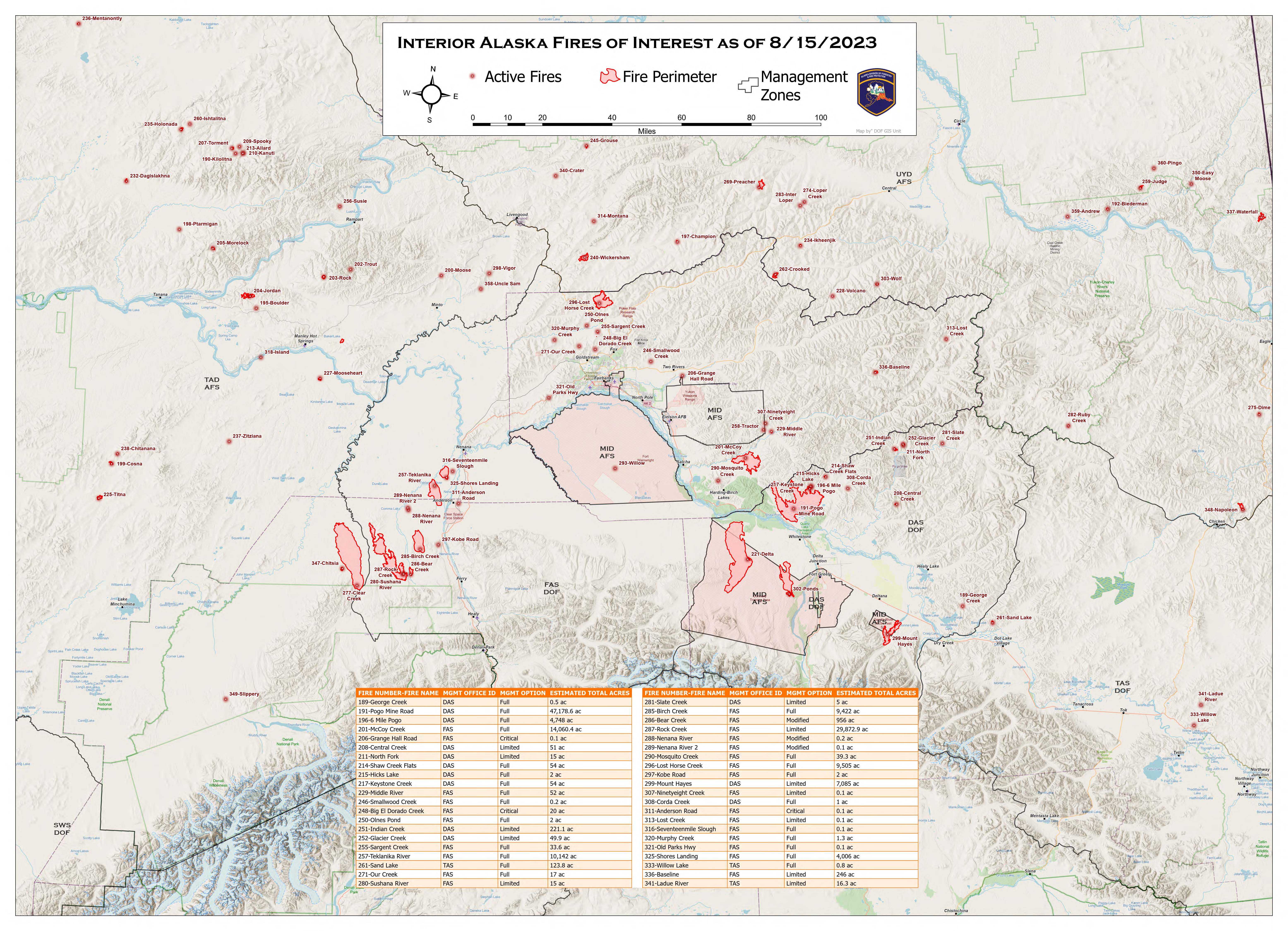
The Delta Junction area has not received similar precipitation levels as the rest of the Interior and continues to see active fire behavior on the Pogo Mine Road Fire. Fire behavior and spread has modified throughout the rest of the region and the long-term forecast is still predicting cooler, damper weather. Air quality advisories are no longer in effect for Central and Eastern Alaska. Crews will continue working on securing line, point protection, and mopping up edges of fires to ensure lines continue holding. There are currently 8 staffed fires utilizing 1,034 personnel in the field and 285,416 acres have burned statewide.

HIGHLIGHTED FIRE ACTIVITY
Lost Horse Creek (#296) – [9,505 acres | 37% completed] North of Old Murphy Dome Road, 3.5 miles east of Mile 18 Elliot Highway. An indirect contingency line has been completed from the southwest corner of the fire west to the Elliott Highway to protect Allotments and residences. Another indirect check line is being implemented west of the fire to keep fire out of a steep and narrow section of the Elliott Highway corridor. Contingency line construction east of Haystack Mountain is also occurring. Evacuation levels remain in place from the Fairbanks North Star Borough. (366 Personnel)
Anderson Complex (#899) – [58,933 acres | 63% completed] Anderson-Clear area. The Shores Landing Fire continues to see active fire behavior while the rest of the fire activity in the complex has moderated. Resources continue to secure hot spots and the fire edge around structures and continue to secure line around Native Allotments. Suppression repair has begun in some areas and will continue through the week. Evacuation levels remain in place from the Denali Borough. (223 personnel)
McCoy Creek (#201) – [14,060 acres] River mile 29, Salcha River. Line was completed northeast of the fire and tied into the slough system. Crews mopped up 50-100ft on the northern edge below the structures and Salcha river and were able to grid up to 100ft off the line into the black. Evacuation levels remain in place from the Fairbanks North Star Borough. (128 personnel)
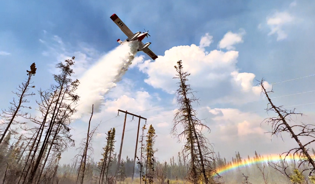
Pogo Mine Road (#191) – [47,178 acres] 9 miles down Pogo Road. The fire showed considerable activity on the southwest corner near Quartz Lake. Scoopers, Fire Bosses and air tankers were used in the afternoon to protect structures by Quartz. Smokejumpers and the Chena Hotshots were also added to the incident. (96 personnel)
Sand Lake (#261) – [123 acres | 50% completed] 6 miles northwest of Dot Lake. The fire transitioned from a Type 3 to a Type 4. There was limited movement on the fire, and no significant growth. (70 personnel)
Mosquito Creek (#290) – [39 acres | 50% completed] 5 miles east of Harding Lake. No significant fire activity during this operational period. Crews continue to mop up the interior of the fire area and monitor inside and around the burned area. (43 personnel)
Mount Hayes (#299) – [7,085 acres] 24 miles southeast of Delta Junction. Crews continued working on access and setting up structure protection. There was minimal fire behavior yesterday. (90 personnel)
Categories: Active Wildland Fire, Alaska DNR - Division of Forestry & Fire Protection (DFFP)
