To see the entire Video on Facebook, please click on the photo or the link below. https://www.facebook.com/BLMAFS/videos/1038790367904739
Grapefruit Complex Update July 3, 2024
Grapefruit Complex Update
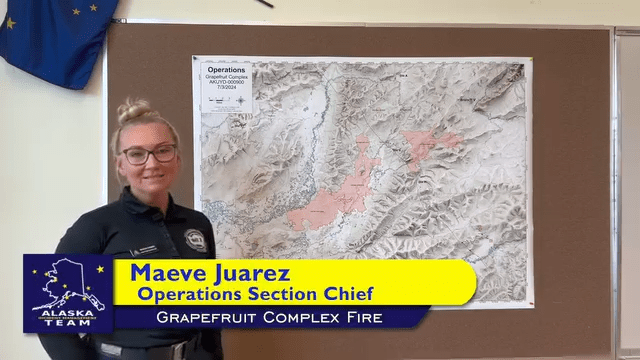
Alaska Incident Management Team 3
Incident Commander- Peter Butteri
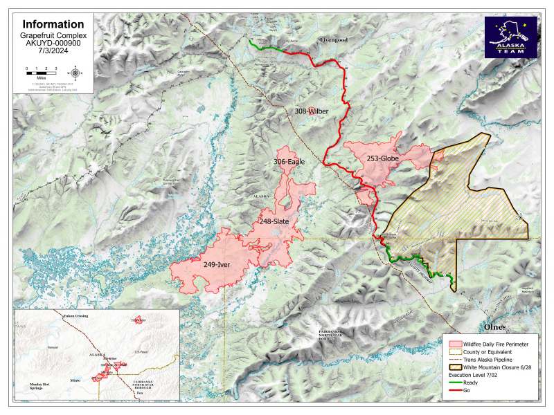
Location: 40 Miles north of Fairbanks
Complex Acres: 70,794
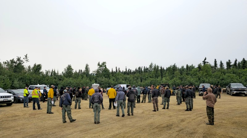
Personnel: 304
Containment: 0%
Strong southwest winds gusting up to 30 mph moved into the area as predicted Tuesday, increasing fire activity on the Grapefruit Complex.
State emergency managers, Alaska State Troopers, and fire managers worked together Tuesday to broadcast the increased evacuation levels along the Elliot Highway Corridor. The “GO” evacuation levels expanded to include mileposts 30 to 65 and “Ready” level to Milepost 65-70.
Weather is expected to be cloudy Wednesday with a wind advisory and a chance of rain showers with wind gusts up to 35 mph north of the Tatalina River. Temperatures will be cooler than Tuesday, with relative humidity averaging around 50%.
Firefighters will continue work to protect property and structures in the area as fires move toward the north and east. Firefighter and public safety remain the highest priority for fire managers, as well as the Elliott Highway, Trans-Alaska Pipeline, Native allotments, public and private structures, all remain high priorities for firefighters.
The Globe Fire (#253), estimated at 16,362 acres, continues to spread with estimated weather conditions primarily in an easterly direction and further into the White Mountains National Recreational Area. It also poses significant sites along the corridor. The Elliott Highway within mileposts 30-50 has active fires to the the east and west and is the primary focus for protection.
The Iver Fire (#249), estimated at 38,359 acres remains very active. Predicted southwest winds could impact the highway corridor despite moderate humidity.
Smoke: Overall, air quality should continue to improve and push smoke east towards Canada. However, higher winds may increase smoke in areas of active fire and decrease in air quality and visibility in some communities.
The complex also includes:
- The Eagle Fire (#306) is estimated at 2,521 acres. This lightning-caused fire has been burning since June 28. It has shown significant growth in the past few days and , along with the Wilber Fire, is likely to impact the Alyeska Pipeline, the Elliot and Dalton highways and neighborhoods along the highway corridor. Firefighters remain in place to continue structure protection to protect the surrounding infrastructure.
- The Wilber Fire (#308) is estimated at 281 acres and was reported at about June 29. It is expected to grow to the north and east of the Elliott Highway and is likely to impact the Alyeska Pipeline and the Elliott and Dalton highways. Structure protection is underway on clusters of cabins and homes along the highway corridor, and crews are prepping ahead of potential fire impact. It’s about 3 miles west of mile 51 Elliott Highway.
- The Noordor Fire (#192) is estimated at 13,263 acres. This lightning-caused fire is burning on BLM-managed land since June 20. This fire is being monitored by aircraft. Fire managers may send resources if fire threatens sites identified for protection as long as they can safely do so and there are enough resources.
- The Fossil Fire (#115) is estimated at 8 acres and exhibiting minimal fire activity or smoke but will still be grouped into the complex. It is located in the White Mountains National Recreation Area. This fire is being monitored by aerial resources and will be engaged if they start getting close to values at risk.
Evacuation: Evacuation levels were increased yesterday, July 2. The new levels are represented as:
- “Go” (Red) Elliott Highway Milepost 30-65
- “Ready” (Green) Elliott Highway Milepost 65-70
Road access: The section of the Elliott Highway near the Globe Fire is open. Expect significant delays between mileposts 25-65 if fire activity increases and plan accordingly by ensuring that you have food, water, and other necessities should you choose to travel. Please exercise caution and patience, turn on your headlights to help ensure the safety of firefighters and flaggers working in the area. Alaska Department of Transportation & Public Facilities contracted workers and a pilot car are helping keep the flow of traffic open. Check https://511.alaska.gov/ for road updates.
Temporary Flight Restriction: A TFR is in place during the day to provide a safe environment for firefighting aircraft.
Closures: The Bureau of Land Management (BLM) Eastern Interior Field Office closed the western portion of the White Mountains National Recreation Area surrounding the Wickersham Dome Trailhead at mile 28 Elliott Highway. The closure is in effect until Sept. 1, unless the BLM determines the area is safe for public use at an earlier time.
Fire Information Public Phone: 907-615-6793.
Inciweb: tinyurl.com/grapefruitcomplexfireinciweb
Facebook: www.facebook.com/BLMAFS
Twitter: twitter.com/BLM_AFS
Link Tree: https://linktr.ee/grapefruitcomplex
-BLM-
Bureau of Land Management, Alaska Fire Service, P.O. Box 35005, 1541 Gaffney Road, Fort Wainwright, AK 99703
Need public domain imagery to complement news coverage of the BLM Alaska Fire Service in Alaska?
Visit our Flickr channel! Learn more at www.blm.gov/AlaskaFireService, and on Facebook and Twitter.
The Bureau of Land Management Alaska Fire Service (AFS) located at Fort Wainwright, Alaska, provides wildland fire suppression services for over 240 million acres of Department of the Interior and Native Corporation Lands in Alaska. In addition, AFS has other statewide responsibilities that include: interpretation of fire management policy; oversight of the BLM Alaska Aviation program; fuels management projects; and operating and maintaining advanced communication and computer systems such as the Alaska Lightning Detection System. AFS also maintains a National Incident Support Cache with a $18.1 million inventory. The Alaska Fire Service provides wildland fire suppression services for America’s “Last Frontier” on an interagency basis with the State of Alaska Department of Natural Resources, USDA Forest Service, National Park Service, Bureau of Indian Affairs, U.S. Fish and Wildlife Service, and the U.S. Military in Alaska.
Categories: Active Wildland Fire, AK Fire Info, BLM Alaska Fire Service
