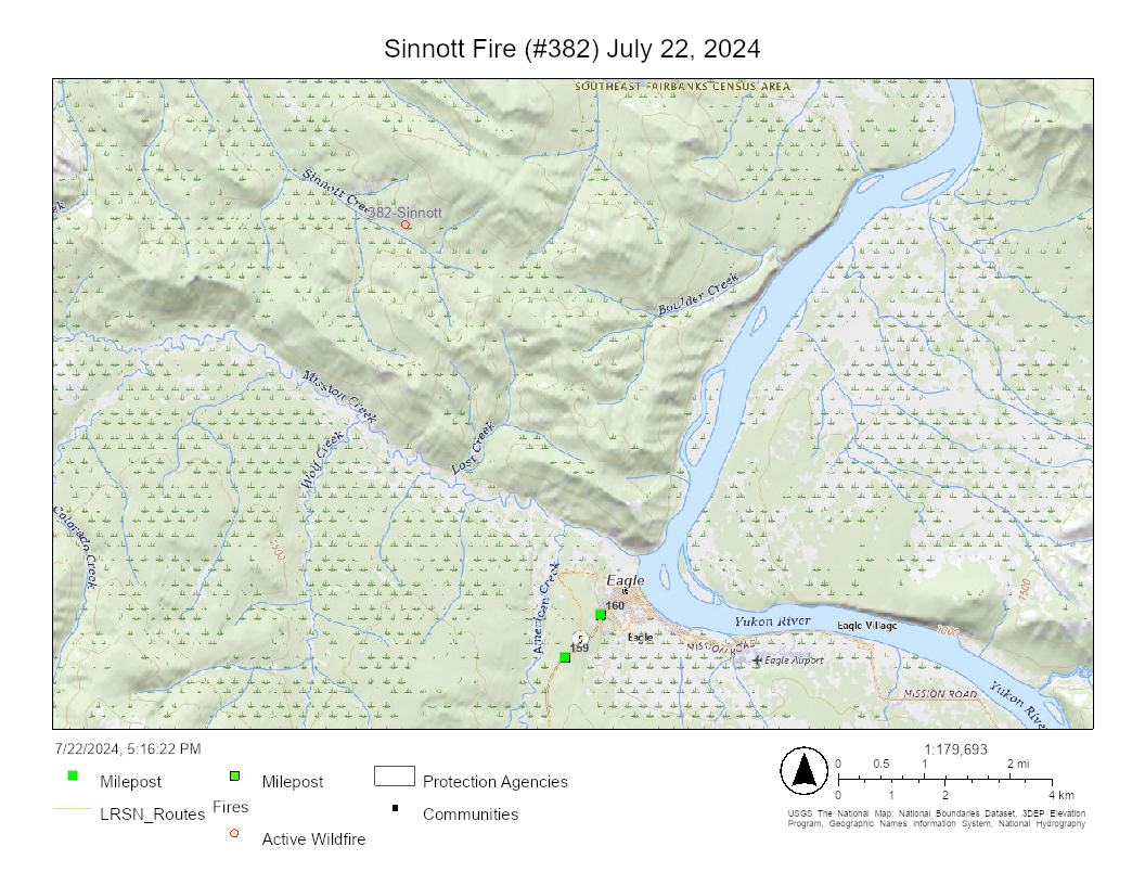
Update for 8:30 p.m., Monday, July 22: BLM Alaska Fire Service Upper Yukon Zone managers are strategizing the best deployment of limited available resources to address an estimated 720-acre fire burning about 3.2 miles northwest of Eagle. The Sinnott Fire (#382) was initially reported late Sunday in a remote area and estimated at 15 acres when flown Monday morning. By Monday afternoon, the fire had picked up speed and was very active, burning mostly in a northeasterly direction through a mixture of black and white spruce and hardwoods.
The firefighter also flew the King Fire, renamed the Dome Fire (#386) due to its close proximity to Dome Creek. This fire is burning exactly west of the Taylor Highway near milepost 117 and is estimated at about 2 acres with a moderate rate of spread. It is primarily burning in a northerly direction, running and torching in a mixture of black and white spruce.
Motorists driving in the area should be cautious of the fire burning next to the roadway and avoid driving through the area if visibility is poor or if there is extreme fire behavior.
This information will be updated on Tuesday.

The Sinnott Fire burning northwest of Eagle as taken during a flight over the area Monday night. Photo by John Lyons, BLM AFS 
The Sinnott Fire burning northwest of Eagle as taken during a flight over the area Sunday night. Photo by John Lyons, BLM AFS 
The Dome Fire is burning near the Taylor Highway as seen by an aircraft flying over the area Monday night. Photo by John Lyons, BLM AFS
Original information: A large portion of Alaska is now experiencing high fire danger and new fires including two near Eagle as Interior Alaska heads into its what meteorologists are calling the hottest period of the summer.
A BLM Alaska Fire Service airplane is enroute to Eagle for the Sinnott Fire (#382), about four miles northwest of Eagle, and a new fire just reported off the Taylor Highway near King Creek.
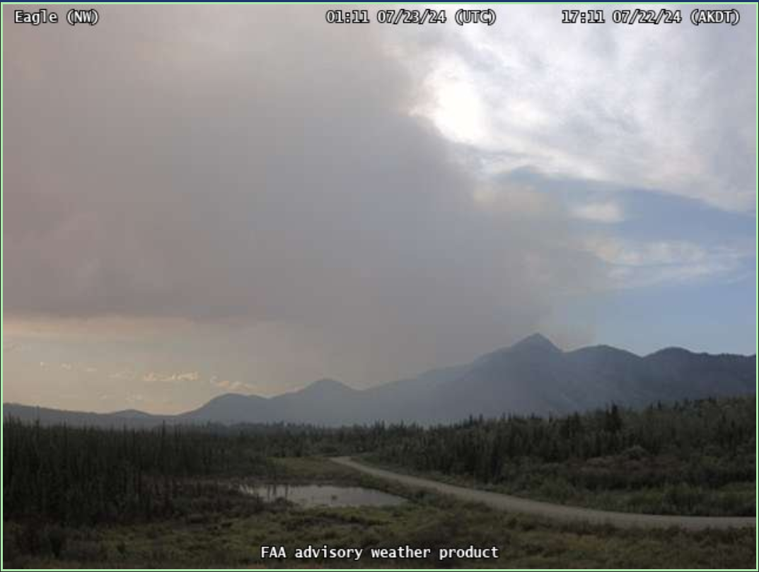
A firefighter flew the Sinnott Fire Monday morning where it was burning up both sides of a drainage north of the Mission Creek. It was not immediately threatening any structures or Native allotments. Fire activity increased in the afternoon as temperatures increased, making the fire very visible from Eagle. The fire is north of Mission Creek.
The King Fire (#386) was reported via a motorist at about 4:33 p.m.
The Sinnott Fire was also 3 miles from a Native allotment and 3 miles from structures. It is burning in modified management option that is treated as limited after July 10. This option is a pre-determined response for fire and allows wildfires to play its natural ecological role unless it threatens property or people. If it endangers a valuable site and people, firefighters may and did mobilize to protect the sites without stopping the wildfire’s spread. This strategy prioritizes firefighter safety, values at risk, and the impact on the surrounding area. This also allows other firefighting resources to remain available to respond to a new fire start that could immediately threaten people and property.
More information about these two fires will be released when available.
After a successful turn on a wildfire near Tanacross and another near Venetie Sunday, 12 smokejumpers were demobilized from these two fires to make them available for new starts. They were quickly redeployed from the plane picking them up to a new fire about 22 miles northwest of Fort Yukon. The Marten Fire (#383) is about a half an acre and burning in a full management option area about 24 miles southwest of the T’eedriinjik Fire (#380) north of Venetie.

The approximately 40-acre T’eedriinjik Fire was quelled Sunday night by 12 smokejumpers, four BLM Alaska Fire Service fire specialists, and water-scooping aircraft. The wind-driven fire burned in a spotty pattern within 3 miles of Venetie, posing no immediate threat to structures but being near numerous Native allotments. With the support of the helicopter and airplanes, the remaining firefighters – minus four of the original smokejumpers – will continue working to secure the edges and contain the T’eedriinjik Fire. The fire’s cause is still undetermined.
The Mooseheart Crew, a Type 2 BLM contract crew with firefighters from Minto and Tanana, will mobilize to the fire on Tuesday. The BLM AFS fire station at Fort Yukon, located in a region with the highest fire potential in the state, will see increased traffic from personnel and aircraft.
Fire managers are ensuring enough resources remain in Alaska to respond to the uptick in fire activity due to recent warmer, drier weather. Tuesday is predicted to be the hottest day of the year, with Fairbanks potentially reaching 90 degrees, before colder weather moves in from the Bering Sea on Wednesday. This new weather front could bring lightning, potentially sparking new fires after days of hot, dry conditions.
As predicted, fire activity increased on existing large fires such as the McDonald Fire southwest of Fairbanks, the Grapefruit Complex of fires burning on both sides of the Elliott Highway south of Livengood, and the Main Fire near Ruby. While this uptick is no cause for concern, firefighters are focusing on monitoring the fires, removing equipment, extinguishing hot spots, and rehabilitating lands affected by suppression efforts.

Except for smoke impacting the Yukon Flats from the Grapefruit Complex, most of the smoke haze over Alaska is drifting up from Canada and the Pacific Northwest. On Thursday, the National Interagency Coordination Center raised the National Preparedness Level to PL5, indicating the highest level of wildfire activity and resource needs nationwide. Alaska remains at Preparedness Level 2, with 344 reported fires burning just over 608,000 acres this year as of Monday.
There is a high demand for firefighting resources in western states experiencing very active to extreme fire behavior. The Alaska Complex Incident Management Team 1 (CIMT) is mobilizing for the 132,751-acre Falls Fire in Eastern Oregon on Tuesday. CIMTs handle large-scale, complex incidents by providing an organized and highly skilled response to emergencies. The Alaska team includes personnel from local, state, and federal ranks to manage not only suppression operations but also finance, logistics, safety, and public information.
The BLM Alaska Fire Service’s Midnight Sun Hotshots are headed to the Northwest U.S., and the BLM AFS Chena Hotshots demobilized Sunday from the McDonald Fire.
For now, fire managers have paused deploying more BLM AFS smokejumpers to the 24 already in western states until there is a significant change in the weather. Six of the nine available BLM Type 2 contract crews were mobilized for fires in the Pacific Northwest. With the Mooseheart Crew headed to Venetie, two remain for possible future fire assignments, which could likely happen if fire activity continues.
-BLM-
Bureau of Land Management, Alaska Fire Service, P.O. Box 35005, 1541 Gaffney Road, Fort Wainwright, AK 99703
Need public domain imagery to complement news coverage of the BLM Alaska Fire Service in Alaska?
Visit our Flickr channel! Learn more at www.blm.gov/AlaskaFireService, and on Facebook and Twitter.
The Bureau of Land Management Alaska Fire Service (AFS) located at Fort Wainwright, Alaska, provides wildland fire suppression services for over 240 million acres of Department of the Interior and Native Corporation Lands in Alaska. In addition, AFS has other statewide responsibilities that include: interpretation of fire management policy; oversight of the BLM Alaska Aviation program; fuels management projects; and operating and maintaining advanced communication and computer systems such as the Alaska Lightning Detection System. AFS also maintains a National Incident Support Cache with a $18.1 million inventory. The Alaska Fire Service provides wildland fire suppression services for America’s “Last Frontier” on an interagency basis with the State of Alaska Department of Natural Resources, USDA Forest Service, National Park Service, Bureau of Indian Affairs, U.S. Fish and Wildlife Service, and the U.S. Military in Alaska.
Categories: Active Wildland Fire, AK Fire Info, BLM Alaska Fire Service
