Update 8:30pm
The estimated acreage of the Kechumstuk Creek Fire (#192) has increased to 600 acres due to receptive fuels and shifting winds. Two scoopers have been on scene working on the east side of the fire perimeter. Smokejumpers have cut a helispot to sling in equipment and bring in more resources as needed. One of the forestry helicopters is doing aerial reconnaissance to map the perimeter and looking for structures at risk as well as providing intelligence for firefighters on the ground.
This is the last update for tonight. Return to AKfireinfo.com for continuing coverage on this fire and other fires across the state.
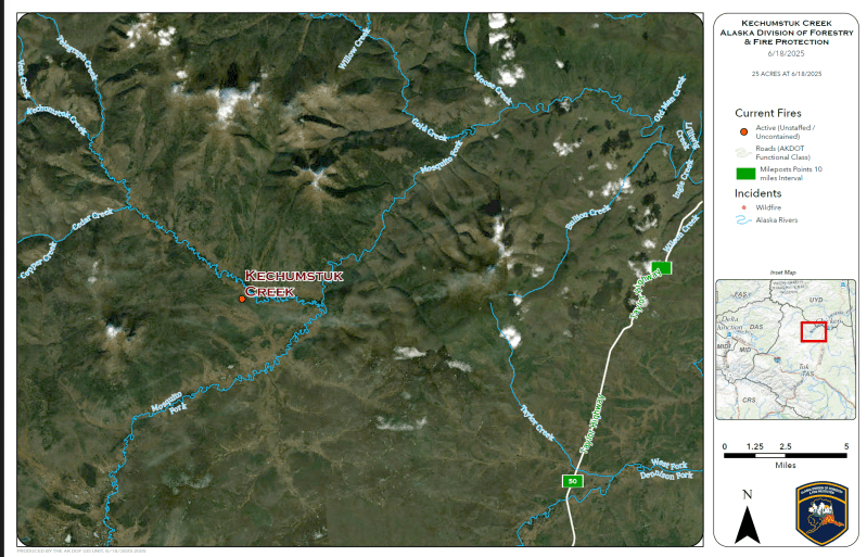
The Alaska Division of Forestry & Fire Protection is responding to the Kechumstuk Fire (#192), located approximately 15 miles west of Chicken. The fire was initially reported by a scooper pilot and is burning in tundra and black spruce, along a valley bottom.
The fire is active with flames driven by light winds. The estimated size is currently between 20 and 30 acres.
One load of 8 Smokejumpers landed and are actively working on the fire. Air support has been requested as well as another load of smokejumpers.
More information will be provided as it becomes available.
Categories: Active Wildland Fire, AK Fire Info, Alaska DNR - Division of Forestry (DOF)
