9 a.m., Wednesday (June 18) Update: Quick work by six smokejumpers and supporting aircraft stopped the spread of the Rabbit Fire (#176) near Unalakleet Tuesday night, holding it to just under 3 acres. The coordinated effort included single-engine water scoopers, other supporting airplanes, and a helicopter assisting six smokejumpers on the ground.
By 10:30 p.m. Tuesday, the fire was stopped enough for aircraft to be released, while smokejumpers remained on site to ensure the fire stayed in check.
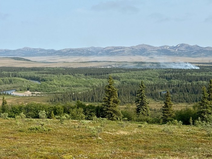
Earlier in the evening, around 7 p.m., a nearby Bible camp – located within a mile from the fire – evacuated approximately 80 people, including mostly third and fourth graders, as a precaution when smoke became visible. Once the situation stabilized hours later, campers were notified it was safe to return. The fire was burning in a mixture of grass and brush about 20 miles east of Unalakleet.
Smokejumpers will continue checking the fire area for any remaining hot spots to ensure it is fully extinguished.
Update: After the situation improved, the Bible camp was advised it was safe to go back at about 10:30 p.m., Tuesday. More information will be available later Wednesday.
Six smokejumpers and aircraft are responding to a new fire about 10 miles outside of Unalakleet Tuesday night. The Rabbit Fire (#176), located about 10 miles outside Unalakleet, was reported to the Galena Dispatch Center around 7:20 p.m. Tuesday by the local volunteer fire department. The fire was estimated at an acre and growing, burning in black spruce under sustained 20 mph winds.
The fire is burning near a Bible camp, which was evacuated by local officials as a precaution Tuesday afternoon. A BLM AFS reconnaissance aircraft arrived ahead of the smokejumpers and two single-engine scoopers to fly the fire and relay information to dispatch and those responding from Galena 132 miles northeast of the area. Also mobilizing are a helicopter and another airplane to coordinate the airspace over the fire.
More details will be shared as they become available.
For more information, contact BLM AFS Public Affairs Specialist Beth Ipsen at (907) 356-5510 or eipsen@blm.gov.

-BLM-
Bureau of Land Management, Alaska Fire Service, P.O. Box 35005 1541 Gaffney Road, Fort Wainwright, Ak 99703
Need public domain imagery to complement news coverage of the BLM Alaska Fire Service in Alaska? Visit our Flickr channel!
Learn more at www.blm.gov/AlaskaFireService, and on Facebook and Twitter.
The Bureau of Land Management Alaska Fire Service (AFS) located at Fort Wainwright, Alaska, provides wildland fire suppression services for over 240 million acres of Department of the Interior and Native Corporation Lands in Alaska. In addition, AFS has other statewide responsibilities that include: interpretation of fire management policy; oversight of the BLM Alaska Aviation program; fuels management projects; and operating and maintaining advanced communication and computer systems such as the Alaska Lightning Detection System. AFS also maintains a National Incident Support Cache. The Alaska Fire Service provides wildland fire suppression services for America’s “Last Frontier” on an interagency basis with the State of Alaska Department of Natural Resources, USDA Forest Service, National Park Service, Bureau of Indian Affairs, U.S. Fish and Wildlife Service, and the U.S. Military in Alaska.
Categories: Active Wildland Fire, AK Fire Info, BLM Alaska Fire Service
