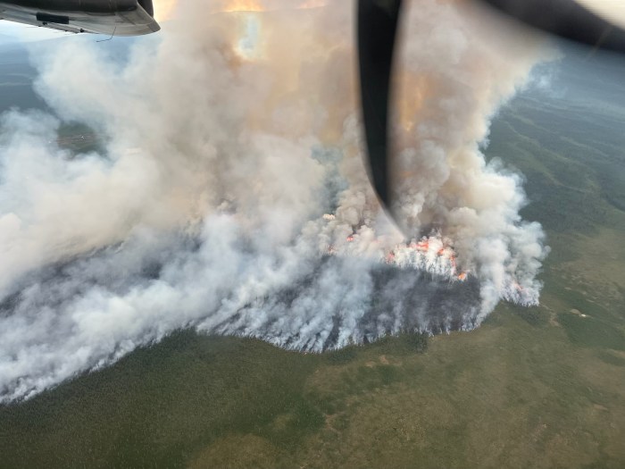
The lightning-caused Kechumstuk Creek Fire (#192), located 15 miles west of Chicken, is estimated at 600 acres with a 100% active perimeter. The fire is burning in mixed timber, black spruce, and tundra, continues to show flanking and high activity. Access remains limited due to the remote location.
Eight smokejumpers remain on scene, as well as 10 members of the Tanana Chiefs Type 2 Initial Attack Crew Bravo squad (10 personnel) and one Helitack Load from Tok are working on structure and point protection for Native allotments and structures approximately five miles south of the fire.

Additional firefighting resources are on order, including aviation support and more personnel.
The Kechumstuk Creek fire, burning along a valley bottom, was originally reported by a pilot on June 18th.
Updates will be provided as additional information becomes available.
Categories: Active Wildland Fire, AK Fire Info, Alaska DNR - Division of Forestry (DOF)
