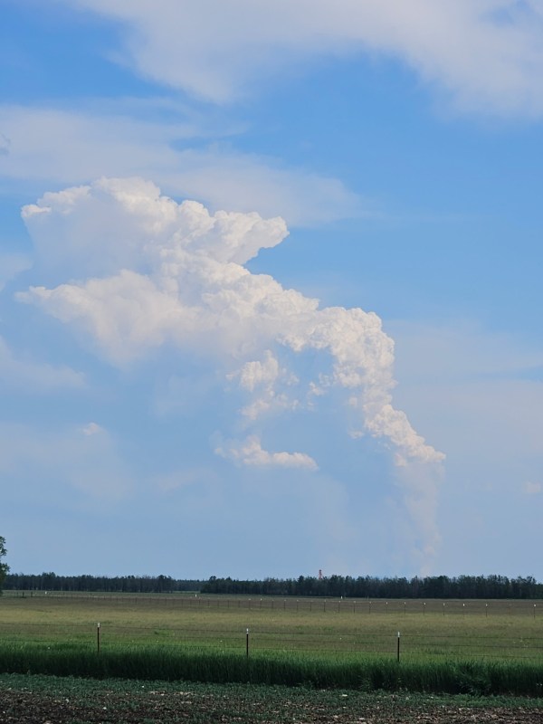
The Twelvemile Lake Fire (#220) is a Type 4 incident, located 2.5 miles northeast of Twelvemile lake, now approximately 1,975 acres burning in black spruce and brush.
The incident commander is conducting structure and allotment assessments. Additional resources have been ordered to support structure protection.
The Lake George Fire (#224) is located 1.5 miles east of Lake George in a full suppression area and remains estimated at .5 acres in size. Fire behavior is smoldering in black spruce and hardwoods and is being monitored.
Both fires are in a full suppression area.
As fire activity increases across the Interior, resources are prioritized and shared amongst numerous emerging incidents.
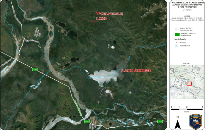
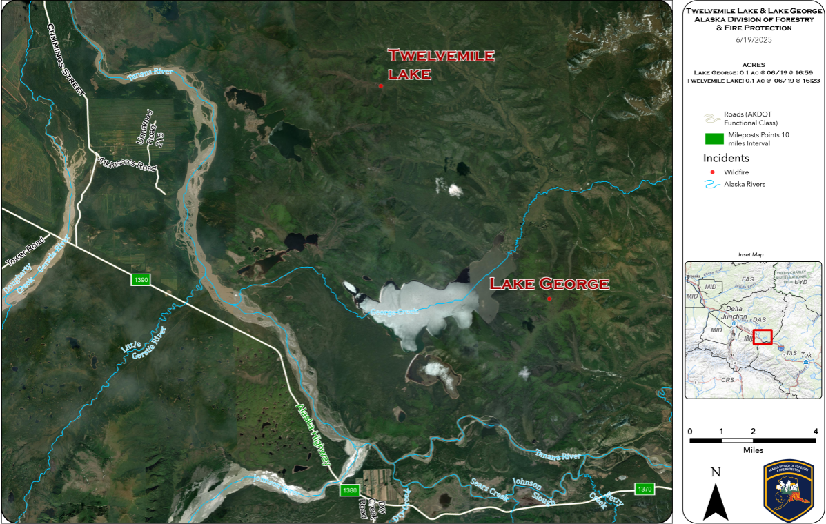
Map of the Twelve Mile and Lake George Fires. View printable PDF of map
Categories: Active Wildland Fire, AK Fire Info, Alaska DNR - Division of Forestry (DOF)
