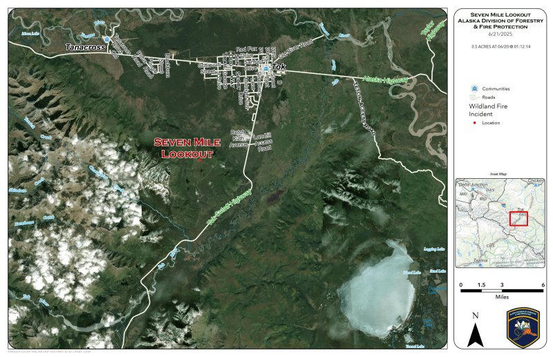
Level 3 ”GO!” evacuations have been issued for Goshawk Road and Moose Nugget Road just south of Tok due to the Seven Mile Lookout Fire (#222), burning west of Mile 118 of the Glenn Highway and is estimated to be 55 acres.

On Saturday, fire activity increased significantly, pushing through the retardant line on the east side. Light winds are driving fire growth to the north and east, towards of Tok. Scoopers, air tankers, and smokejumpers are actively engaged in suppression efforts. Structure protection measures are underway in areas near the fire’s advance.
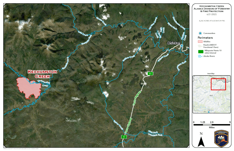
The Kechumstuk Creek Fire (#192) located 15 miles west of Chicken is estimated to be 4,202 acres. Tanana Chiefs Type 2 Initial Attack Bravo Squad conducted a successful burnout on the west side of Kechumstuk they work to protect the Native village site. They are mopping up a 10-foot area inside the west perimeter and continuing along the southern edge of the fire Saturday.
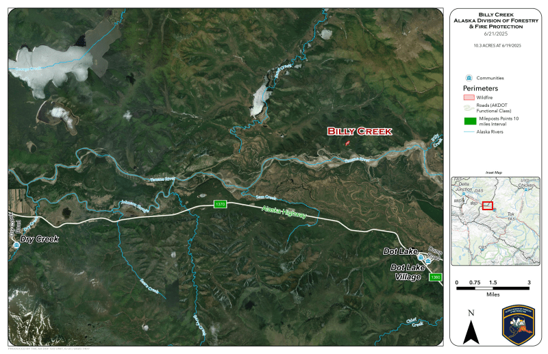
The Billy Creek Fire (#189) is burning on the north side of the Tanana River, approximately 5.5 miles northwest of Dot Lake. The Tanana Chiefs T2 IA Alpha Squad continues mop up of the contained fire. Helicopters remain assigned to the fire, conducting bucket drops on hotspots. A Temporary Flight Restriction (TFR) is in place.
Categories: Active Wildland Fire, AK Fire Info, Alaska DNR - Division of Forestry (DOF)
