The Bear Creek Fire (#237) experienced drastic wind shifts on Sunday, June 22nd, that redirected fire activity multiple times throughout the afternoon. Active fire behavior along the Parks Highway has posed a threat to structures and infrastructure in the area, including powerlines and cell towers. The Pioneer Peak Hotshots conducted tactical burning operations for point protection around these values at risk off Bear Creek and Washington Drive throughout the shift on Sunday. Aerial resources have been engaged in slowing fire spread around the perimeter of the fire.
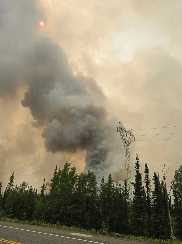
The Parks Highway has been subject to periodic temporary closures between mileposts 259-278, it is open at this time but be prepared for long delays and pilot car operations. Visibility along the highway is poor due to smoke. Firefighters are working in close proximity to the road. An Unmanned Aerial System (UAS/drone) is being utilized to detect spot fires and gather information about structures at risk around the perimeter of the fire. This intel is used to target helicopter bucket drops.
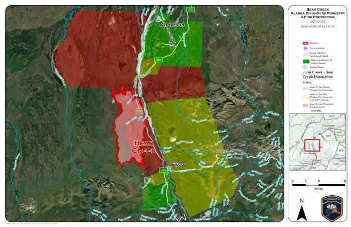
Level 1 “READY, 2 “SET” and 3 “GO!” are all in effect for this fire. Please visit http://www.facebook.com/denali.borough for the most current evacuation levels.
The Saint George Creek Fire (#246) and the Bonnifield Fire (#208) burned together during the shift on Sunday and are now managed as the Saint George Creek Fire. Air resources were unable to work this fire due to poor visibility and smoky conditions. Ground resources are working to protect the Gold King Air Strip and structures in the area. The current estimated size of this fire is 2,675 acres.
An Alaska Complex Incident Management Team was inbriefed on Sunday evening and will shadow with resources currently assigned to the fire today. The team will assume command of the Bear Creek, Bonnifield and Saint George Creek Fires Tuesday morning at 7:30 AM.
#AlaskaFireSeason #2025AlaskaFireSeason #AKFireInfo #BearCreekFire #SaintGeorgeCreekFire #BonnifieldFire
Categories: Active Wildland Fire, AK Fire Info, Alaska DNR - Division of Forestry (DOF), UAS/Drones
