
The Southwest Area Incident Management Team 3 assumed command of the Himalaya Road Fire (#223), Aggie Creek Fire (#268) and the Washington Creek Fire (#232) today.
Fire crews will size up the three fires today and deploy heavy equipment to construct and fortify containment lines. Firefighters are using existing fuel treatment areas and fuel breaks as containment lines. Today firefighters are continuing to assess structures for structure protection efforts. Fire activity is expected to be moderated by improvement in the weather, allowing crews to make progress on containment lines. Additional crews and resources are being ordered to the fires and should arrive later in the week.
High temperatures, wind and low humidity over the fire areas is expected to continue through today. Potential lightning could result in additional flare ups. Some precipitation and lighter winds expected Wednesday.
For smoke and air quality go to https://www.airnow.gov/
No road closures are reported. Check https://511.alaska.gov/map for current road conditions.
Level 1 “READY,” 2 “SET,” and 3, “GO!” are all in effect for these fires. Visit https://bit.ly/FNSBevac for current evacuation levels.
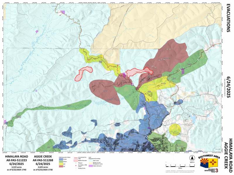
Click for PDF of the Himalaya Road Fire and Aggie Creek Fire evacuation map.
For everyone’s safety, please stay out of the fire area. Drive with caution and expect delays and visibility impacts due to smoke and fire crews working along roadways. Do not fly drones over the fire area; if you fly, we can’t. Unauthorized drone flights pose serious risks to firefighter and public safety and the effectiveness of wildfire suppression efforts.
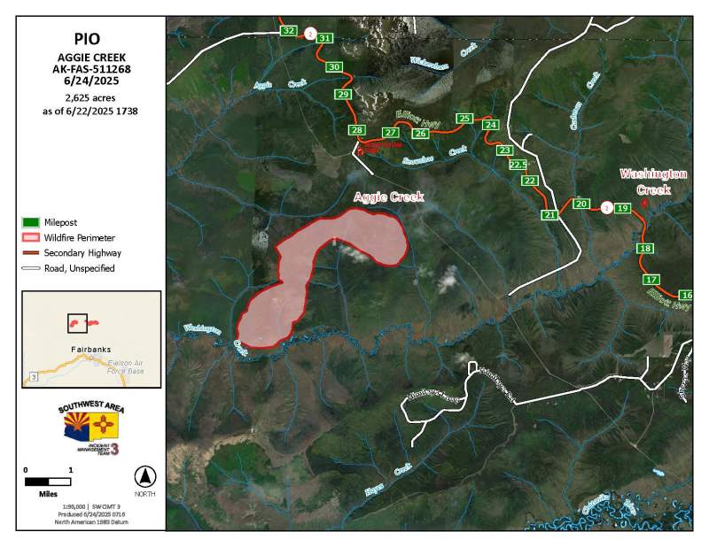
Acres: 3,319 (Himalaya Road); 2,625 (Aggie Creek); 5.7 (Washington Creek)
Start date: June 19, 2025
Location: Fairbanks North Star Borough
Cause: Lightning
Personnel: Approximately 100
Containment: 0%
Fuels: Black spruce, grass
Public Information/Media Phone Number: 907-921-7881 from 9 a.m. to 9 p.m.
Website: https://akfireinfo.com Email: 2025.himalayaroad@firenet.gov
Categories: Active Wildland Fire, AK Fire Info, Alaska DNR - Division of Forestry (DOF)
