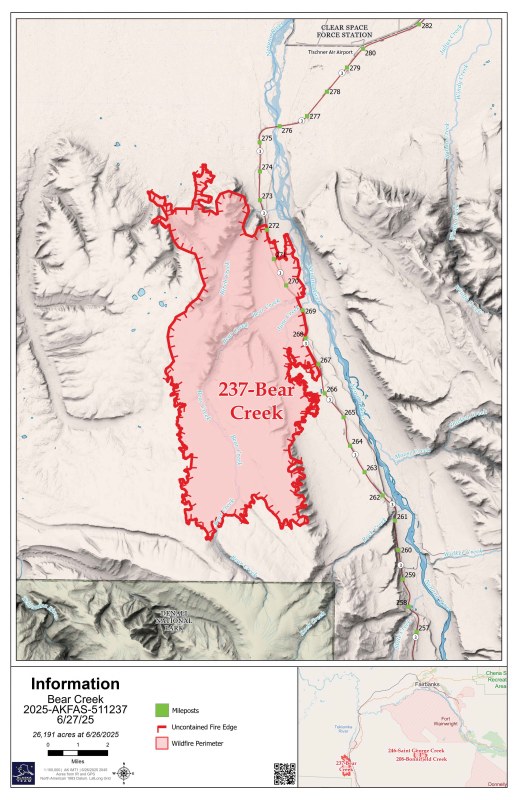
Bear Creek Fire (#237): 26,191 acres
Saint George Creek Fire (#246): 20,369 acres
225 personnel
After the last few days of scattered showers, today is the start of a warming and drying trend. Winds will remain light and variable. There is a potential for some open flames and fire growth in these conditions. Smoke may be visible as fuels inside the fire area continue to burn.
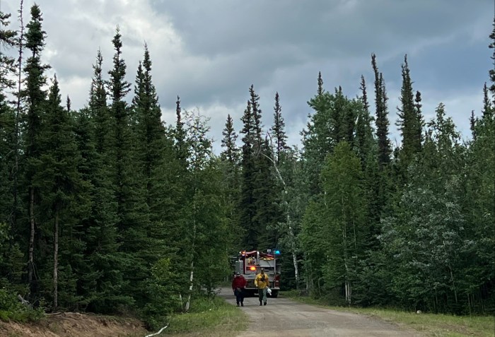
Bear Creek Fire. Bulldozer line with pumps and hose extends west from the Parks Highway to constrain the spread of the fire to the north. It encloses the northwest fire edge and joins the 2022 Clear Creek Fire burned area. Air support dropped water on the fire east of the Parks Highway to cool hotspots and reduce fire activity.
Structure protection has begun in the Kobe area. Crews are working on structure protection and mop up along Bear Creek, where they will likely continue work for the next week. In the June Creek area, crews now have a 5-foot-wide fire break around structures. Structure protection will continue here for at least a few more days.
Uncrewed Aircraft System (UAS) flights are assisting with the identification of remaining heat sources so they can be extinguished. The warmer and drier weather is helpful at this stage so that heat can be more easily identified.
The west side of the fire burned into the 2012 burned area. It is showing little heat and is in monitor status.
Saint George Creek Fire. A 15-person crew is working on structure protection and mop up in the Gold King Creek area. Once they complete actions on those structures, they will move on to the Wood River area on the northeast side of the fire. A UAS operation will be conducted today to assess remaining heat sources.
Evacuations remain in place and unchanged. Denali Borough and fire managers meet regularly to consider whether evacuation levels are accurate to provide for public safety and the safety of firefighters. The evacuation shelter has moved from the Baptist Church to the Tri-Valley School in Healy. For the most accurate information and evacuation status maps visit the Denali Borough website or Facebook page. You may also call or text the Denali Borough Fire Info line between 7 a.m. and 9 p.m. at 907-378-7985.
Traffic control on the Parks Highway will remain in place for firefighter and motorist safety. Even though fire activity has decreased, there is still fire danger and heavy equipment working along the highway. Expect pilot car escorts and delays. Check road conditions on the Alaska Department of Transportation website.
If you fly, we can’t! A temporary flight restriction (TFR; FDC 5/8646) is in place for the fire area to protect firefighter safety. Drones are prohibited in this area; any use of drones will ground aircraft and may endanger firefighters. An additional TFR is in place today over the Gold King Creek area in the Saint George Creek Fire to allow for UAS operations.
More information: Follow Alaska Wildland Fire Information, Inciweb, and updates on social media. For information about the Bear Creek Fire and Saint George Creek Fire, call 907-318-2018 or email 2025.bearcreek@firenet.gov.
Click here for a pdf version of this update.
Categories: Active Wildland Fire, AK Fire Info, Alaska DNR - Division of Forestry (DOF)
