The Birch Lake Fire (#309) is currently burning southeast of Salcha and 4 miles northeast of Birch Lake. The fire is lightning caused, and recent mapping estimates it to be 77 acres. As of June 27, 2025, there is 0% containment. While the fire continues to smolder, recent weather and rain have decreased fire activity.
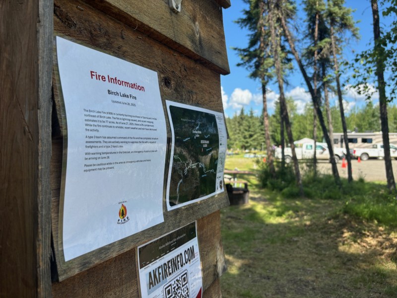
A type 3 team has assumed command of the fire and have completed structure assessments. They are actively working to suppress the fire with a squad of firefighters and a type 2 hand crew.

With warming temperatures in the forecast, an Interagency Hostshot crew will be arriving on June 28.
Please be cautious while in the area as emergency vehicles and heavy equipment may be present.
Categories: Active Wildland Fire, AK Fire Info, Alaska DNR - Division of Forestry (DOF)
