Tractor Trail Fire (#334), located 4 miles southeast of Northway, is estimated at 90 acres. Backhauling of supplies started on Saturday. Firefighters are preparing to place the fire into monitoring status.
Lake Mansfield Fire (#282), which may be visible from the road, is located 26.5 miles northwest of Tok and is estimated at 688 acres. Eagle Cap Wildland Fire Use Module from the Wallowa Whitman National Forest in Oregon was assigned to the fire on Saturday. They are continuing to work toward suppression and containment of the fire. Firefighters are clearing out an area near the fire for a helispot.

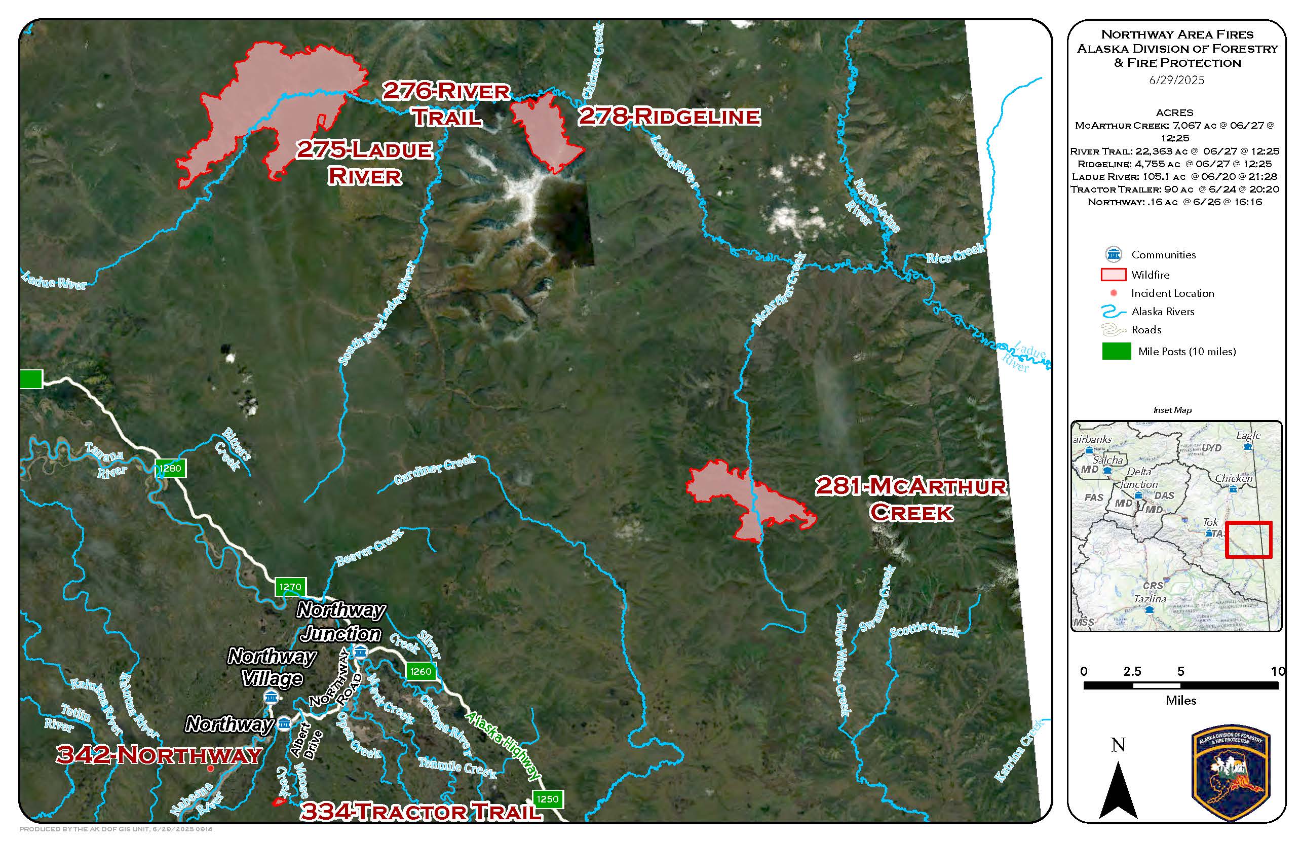
Limited Protection Area Fires (Northeast of Tok)
River Trail Fire (#276) is located 15 miles east of the Taylor Highway and is estimated at 22,363 acres. Ridgeline Fire (#278) is located 30 miles east of the Taylor Highway and is estimated at 4,755 acres. McArthur Creek Fire (#281) is located 58 miles east of Tok and 45 miles southeast of the Taylor Highway and is estimated at 7,067 acres. Kechumstuk Creek Fire (#192) is about 47 miles north of Tok. It is estimated at 12,417 acres. These fires are not a threat to communities or structures at this time. They are being monitored from the air.

Firefighters are working hard on suppressing these fires. Due to the large number of fires active throughout the state of Alaska, resources are limited and shared. Crews are rotated when they need to rest. Fire managers are continuously planning for changes in weather and fire activity that will require more resources.
For more information, please call the Tok Fire Information Line: (907) 505-0362
Categories: Active Wildland Fire, AK Fire Info, Alaska DNR - Division of Forestry (DOF)
