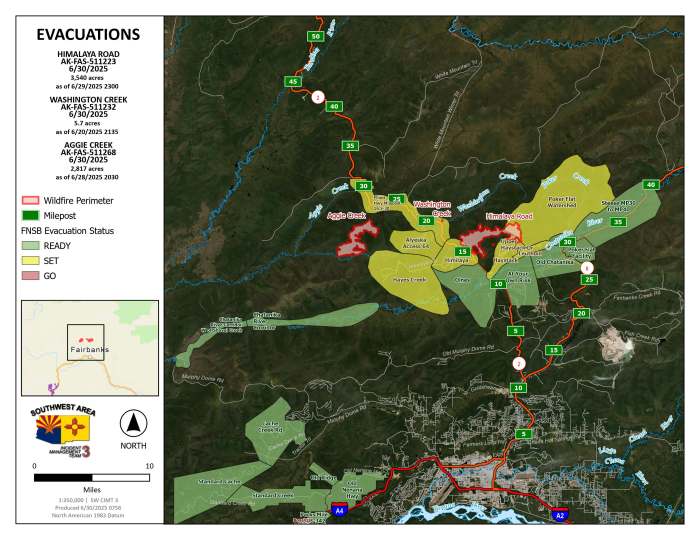
Himalaya Road Fire (#233): 3,540 acres
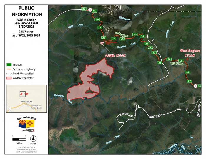
Aggie Creek Fire (#268): 2,797 acres
Washington Creek Fire (#232): 5.7 acres
0% containment for all three
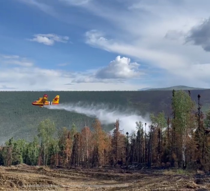
Helicopters, fixed-wing Scoopers and an air tanker assisted firefighters Sunday with consistent water drops on the Himalaya Road Fire (#223) and Aggie Creek Fire (#268). Uncrewed aerial systems (UAS) monitored fire perimeters for growth. On the ground, fire crews continued fire line construction and installed hose lays to protect residences and mop up. Potential fire growth is anticipated on the northwest side of the Aggie Creek Fire and the east side of the Himalaya Road Fire as warmer, drier weather approaches this week.

Today, firefighters on the Himalaya Road Fire (#223) will build direct line along the fire perimeter south into Glacier Creek with hose lays to mitigate any increased fire activity. Mop up will continue near residences on Haystack Mountain, while dozers will work a line into the Caribou drainage. Firefighters on the Aggie Creek Fire (#268) will continue structure protection efforts, while UAS will monitor potential fire growth. Masticators will continue to reduce vegetation near both fires. Helicopters will support suppression efforts with bucket drops on both fires. The Washington Creek Fire (#232) still shows no visible smoke but will continue to be monitored.
Monday will bring warm temperatures in the mid 70s and humidity around 30% with a chance of wet thunderstorms in the afternoon. High pressure will produce warmer, drier conditions into the week.
For smoke and air quality go to https://www.airnow.gov/. No road closures reported. Check https://511.alaska.gov/map for road conditions.
Level 1 “READY,” and Level 2 “SET,” evacuations are in effect for these fires. SET means be ready to evacuate on a moment’s notice. Visit https://bit.ly/FNSBevac for current evacuation levels.
Drivers: be alert, go slow and watch out for heavy equipment along Elliott Highway and other roads. Stay out of the active fire area and firefighter staging areas. A Temporary Flight Restriction is in place. Do not fly drones over the fire area; if you fly, we can’t. Unauthorized drone use poses serious risks to firefighter and public safety.

Call Fire Information at 907-921-7881 (9 am to 9 pm) or email 2025.himalayaroad@firenet.gov.
Categories: Active Wildland Fire, AK Fire Info, Alaska DNR - Division of Forestry (DOF)
