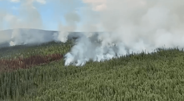
Fire activity accelerated on the Aggie Creek Fire (#268) Monday afternoon, backing down towards Washington Creek and along the fire’s eastern perimeter. Aircraft extinguished a spot fire that crossed over to the south side of Washington Creek. Firefighters installed sprinklers and pumps to protect a cabin in the area. The Himalaya Road Fire (#223) also ramped up on the southwest section near Elliott Highway and northeast near Caribou Creek. Fire crews are preparing for critical fire weather expected to start Wednesday.
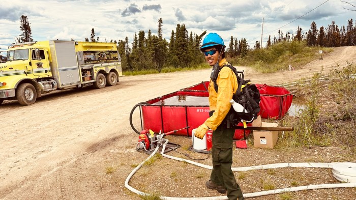
Today firefighters will assess the conditions and spread of the Aggie Creek Fire (#268) and get support from a full fleet of air resources that includes two helicopters, four scoopers, an “eyes in the sky” air attack aircraft and uncrewed aerial systems (UAS). On the Himalaya Road Fire (#223), removal of fuels for contingency line along Elliott Highway continues today, protecting residences west of the highway. Firefighters will continue to construct direct line along the fire perimeter with hose lays south into Glacier Creek, monitor fire growth and respond to flare ups.
Numbers:
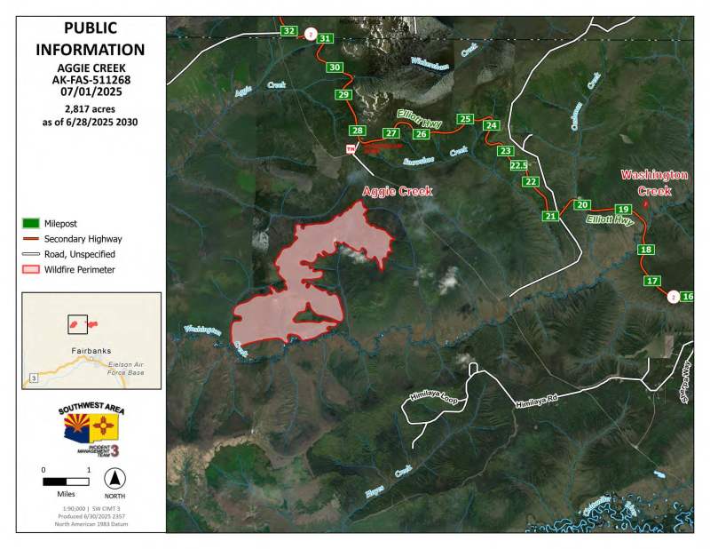
Aggie Creek Fire (#268): 2,797 acres, 0% contained
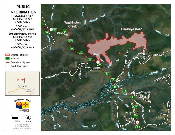
Himalaya Road Fire (#223): 3,543 acres, 0% contained
Washington Creek Fire (#232): 5.7acres, 0% contained
Weather: Expect warmer and drier conditions Tuesday with another slight chance for afternoon showers and thunderstorms. Wednesday has the potential to become a Red Flag Warning day with hot, dry and windy conditions.
Smoke: For Smoke Outlook updates go to https://outlooks.airfire.org/outlook/e16e3fa2.
Closures: No road closures reported. Check https://511.alaska.gov/map for road conditions. Alaska State Parks has closed Olnes Pond and the Whitefish Campground due to fire activity.
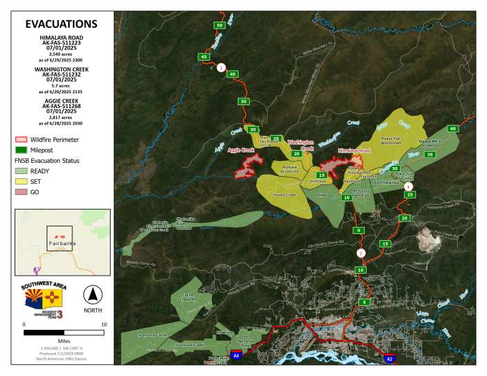
Evacuations: Level 1 “READY,” and Level 2 “SET,” evacuations are in effect for these fires. SET means be ready to evacuate on a moment’s notice. Visit https://bit.ly/FNSBevac for current evacuation levels.
Safety: Drivers are urged to be alert, go slow and watch out for firefighters and heavy equipment along Elliott Highway and other roads. Stay out of the active fire area and firefighter staging areas. A Temporary Flight Restriction is in place. Do not fly drones over the fire area; if you fly, we can’t. Unauthorized drone use poses serious risks to firefighter and public safety.
Categories: Active Wildland Fire, AK Fire Info, Alaska DNR - Division of Forestry (DOF)
