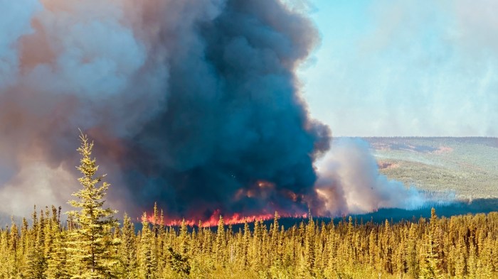
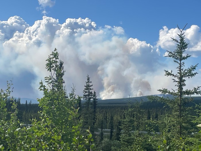
Highlights: As expected, gusty northeasterly winds and warm dry weather accelerated fire behavior, creating spot fires and flareups on the Aggie Creek (#268) and Himalaya Road Fire (#223) fires Wednesday. By 6 p.m., flames and black smoke from the Himalaya Road Fire were visible from Elliott Highway and other areas near Haystack Mountain. Aircraft dropped water on the fire through the evening and dispersed multiple loads of retardant over the flare ups to support firefighters on the ground. Firefighters worked through the night to protect homes. Smoke from the Aggie Creek Fire, which nearly doubled in size, was visible from areas near Elliott Highway. Yesterday, crews reinforced dozer breaks and masticated contingency lines. The Washington Creek Fire (#232) is 100% contained.
Operations: Firefighters will continue to protect homes near the Himalaya Road Fire Thursday as Red Flag conditions persist and work to secure direct line on the southern edge near Glacier Creek. Crews will also work slop overs on the southeast perimeter and survey for hot spots. On the Aggie Creek Fire, the fire is expected to cross Aggie Creek today but there is no immediate threat to homes or structures. Crews will reassess a cabin while masticators and other equipment develop contingency line and fuel break on the northwest perimeter. Firefighters continue to be vigilant in monitoring and responding to both fires.
Numbers:
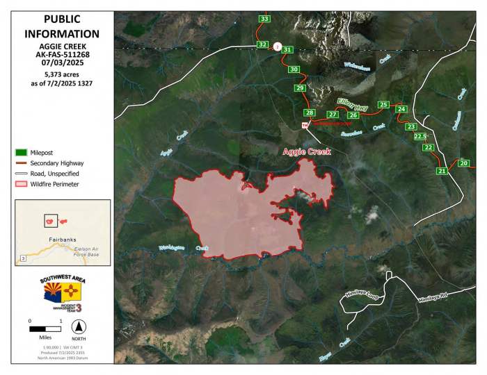
Aggie Creek Fire (#268): 5,373 acres, 0% contained
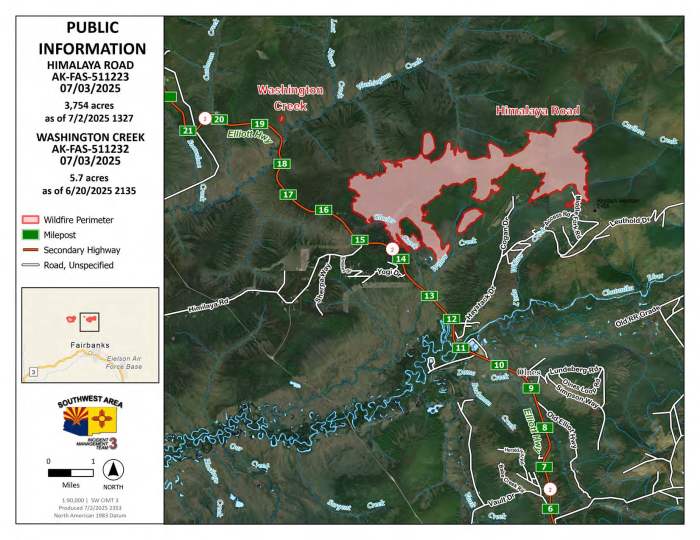
Himalaya Road Fire (#223): 3,753 acres, 0% contained
Washington Creek Fire (#232): 5.7 acres, 100% contained
Weather: A Red Flag Warning remains in effect. Temperatures are expected to be in the mid-80s through the week with low humidity and gusty east-northeast winds that should begin to diminish today.
Smoke: For air quality, go to airnow.gov. For smoke outlook updates go to outlooks.airfire.org.
Closures: No road closures reported at this time. Check 511.alaska.gov for road conditions. Alaska State Parks has closed Olnes Pond and the Whitefish Campground due to fire activity.
Evacuations: Level 1 “READY,” and Level 2 “SET,” evacuations are in effect for these fires. SET means be ready to evacuate on a moment’s notice.
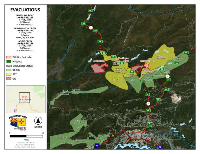
Safety: MOTORIST ALERT! Drivers must use extreme caution on Elliott Highway near Haystack Mountain. Do not stop, be alert and watch out for firefighters and heavy equipment working the area. A Temporary Flight Restriction is in place. Do not fly drones over the fire area; if you fly, we can’t. Unauthorized drone use poses serious risks to firefighter and public safety.
Information: Call 907-921-7881 (9 a.m. to 9 p.m.) or email 2025.himalayaroad@firenet.gov
Categories: Active Wildland Fire, AK Fire Info, Alaska DNR - Division of Forestry (DOF)
