
Both the Aggie Creek (#268) and Himalaya Road (#223) fires intensified Thursday in response to warm, dry, windy weather, impacting visibility and traffic on Elliott Highway especially near mile marker 28. The Aggie Creek Fire is spreading north towards the highway and the Alaska Pipeline and southwest into an old burn scar. The highway remains open but visibility may be limited at times due to heavy smoke. Ground crews worked the southwest side of the Himalaya Road Fire near Middle Fork and Willow Creek to protect homes and dozers helped stop spread towards the south in Caribou Creek. Aircraft supported firefighters with drops of retardant and water. The Washington Creek Fire (#232) is 100% contained.
Operations: For the Fourth of July holiday, hand crews, an excavator and aircraft on the Himalaya Road Fire will continue their diligent work in protecting homes and minimizing spread around Middle Fork, Willow and Caribou Creek. Firefighters are focused on keeping fire north of Willow Creek. Dozers will reinforce and defend the line on the west side with the goal of preventing impacts to the Elliott Highway. Labor intensive mop up is required as hot spots continually rekindle in the area. Dozers on the Aggie Creek Fire will cut line to minimize impacts to the Alaska Pipeline, a top priority, and masticators will continue to reduce vegetation near Himalaya Loop to protect homes and structures there.
Numbers:
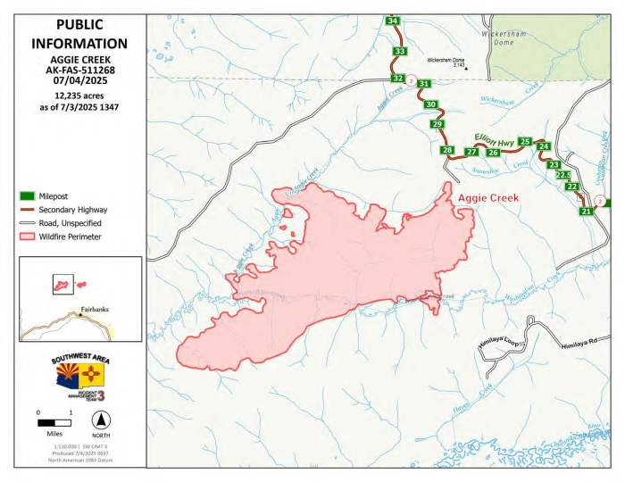
Aggie Creek Fire (#268): 12,235 acres, 0% contained
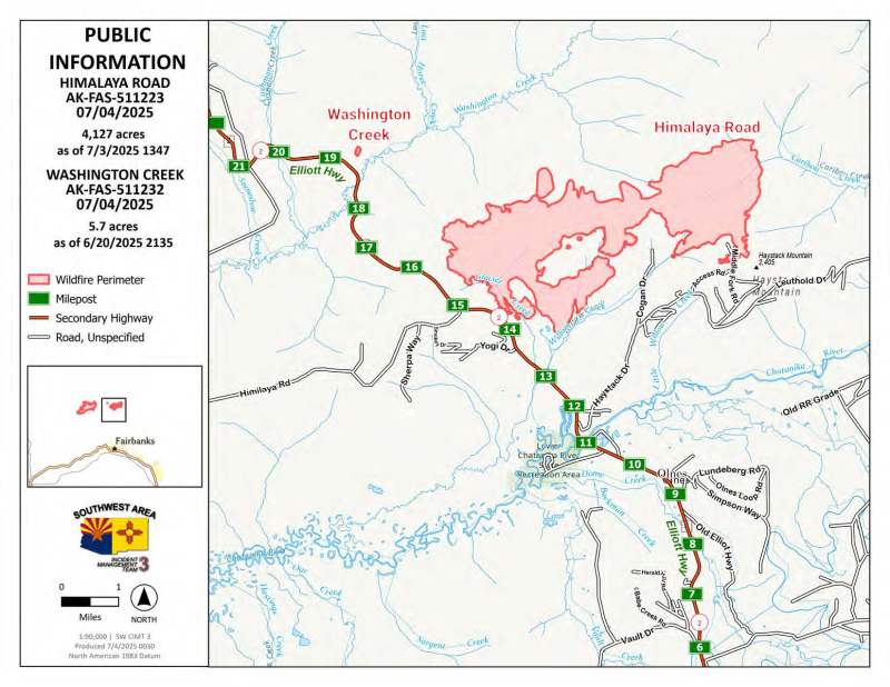
Himalaya Road Fire (#223): 4,127 acres, 0% contained
Washington Creek Fire (#232): 5.7 acres, 100% contained

Credit: Southwest Complex IMT3
Weather: A Red Flag Warning remains in effect with temperatures expected to climb to the mid-80s for the Fourth of July and exceptionally dry fuels. Another uptick in northeasterly winds is expected Friday.
Smoke: For smoke outlook updates go to https://outlooks.airfire.org/outlook/e16e3fa2.
Closures: No road closures reported at this time. Check https://511.alaska.gov/map for road conditions. Olnes Pond and the Whitefish Campground are closed due to fire activity.
Evacuations: Level 1 “READY,” and Level 2 “SET,” evacuations are in effect for these fires. SET means be ready to evacuate on a moment’s notice. Visit https://bit.ly/FNSBevac for current evacuation levels.
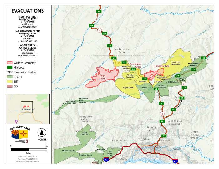
Information: Call 907-921-7881 (9 a.m. to 9 p.m.) or email 2025.himalayaroad@firenet.gov
Categories: Active Wildland Fire, AK Fire Info, Alaska DNR - Division of Forestry (DOF)
