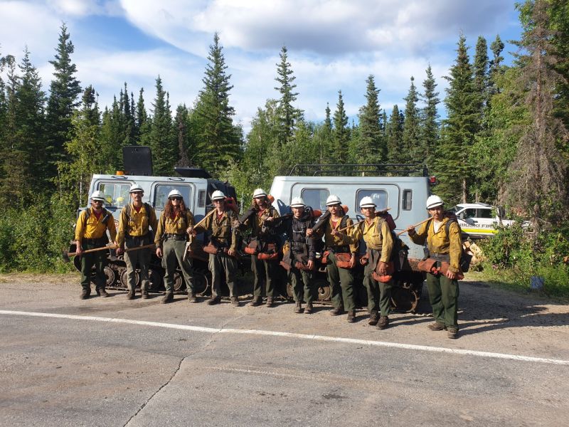
Firefighters took advantage of precipitation and cooler weather to go on the offensive with the Himalaya Road Fire (#223), Aggie Creek Fire (#268) and Obrien Fire (#172). Operational tactics shifted from building indirect line and firing operations to building direct line and securing all edges. Crews developed plans for structure protection along the Chatanika River and secured the Aggie Creek Fire along the pipeline. Mop up continued all around the Himalaya Road Fire and a hotshot crew supported by hose worked the fire’s edge down into Caribou Creek. On the Obrien Fire, firefighters assessed plans to defend the BLM recreation shelters and cabins and identified safe helicopter landing spots for delivering supplies and personnel.
Numbers:
Aggie Creek Fire (#268): 38,702 acres, 0% contained
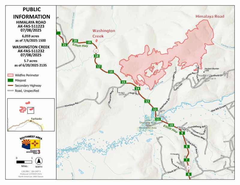
Himalaya Road Fire (#223): 6,095 acres, 0% contained
Obrien Fire (#172): 9,299 acres, 0% contained
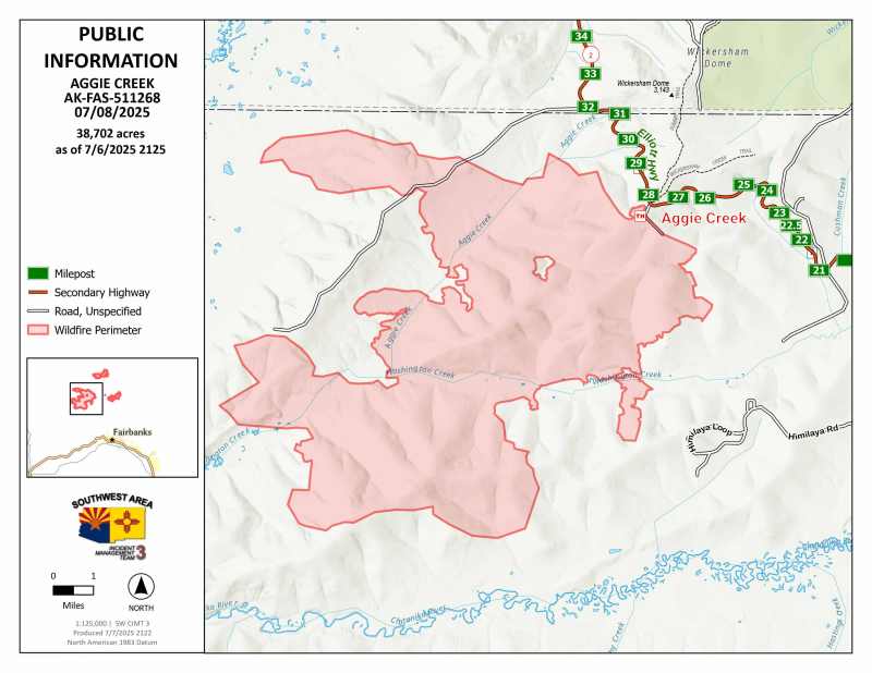
Operations: Firefighters will continue to build direct line and extinguish heat along the perimeters where accessible. On the Aggie Creek Fire, the masticator will continue building a fuel break along the Himilaya Road and a crew will scout options for direct line below Himilaya Road in Washington Creek. Mop up will continue along the pipeline and aircraft with infrared sensors will look for heat along the Chatanika if visibility is safe for flying. Crews will continue maintaining all pumps, hoses and sprinklers around the Himalaya Road Fire. Direct line construction will also continue in Caribou Creek to close off any opportunity for the fire to move further northeast. On the Obrien Fire, firefighters will continue with structure assessments and point protection as needed for Eleazar’s Cabin, Yeager’s Cabin, Summit Trail Shelter and Wickersham Creek Trail Shelter. The remote location of the fire is difficult to access, but aviation resources will be available if conditions are suitable for flying.

Weather: The change to cooler and more humid weather will prevail for a few days and should help moderate fire activity. There is a slight chance of thunderstorms today with southwest winds becoming gusty in the afternoon.
Smoke: For smoke outlook updates go to https://outlooks.airfire.org/outlook/e16e3fa2.
Closures: No road closures reported. Check https://511.alaska.gov/map for road conditions. Olnes Pond, the Whitefish Campground and the western portion of the White Mountains NRA are closed due to fire activity.
Evacuations: Level 1 “READY,” and Level 2 “SET,” evacuations are in effect for these fires. SET means be ready to evacuate on a moment’s notice. Visit https://bit.ly/FNSBevac for current evacuation levels.
Safety: Drivers must use extreme caution on Elliott Highway. Do not stop, be alert and watch out for firefighters working in the area. Smoke may limit visibility. A Temporary Flight Restriction is in place. Do not fly drones over the fire area. Unauthorized drone use poses serious risks to firefighter and public safety.
Information: Call 907-921-7881 (9 a.m. to 9 p.m.) or email 2025.himalayaroad@firenet.gov
Categories: Active Wildland Fire, AK Fire Info, Alaska DNR - Division of Forestry (DOF)
