Scattered rain fell over the Ptarmigan Complex throughout July 8. Fire resources within Central reported heavy rain while those closer to the Turtle Fire (#243) experienced more inconsistent precipitation earlier in the day. Given the shift in weather to cooler and wetter conditions, more direct tactics are being employed to protect values at risk.

Fire activity was reduced throughout Tuesday, with widespread cloud cover, reduced temperatures, and high relative humidity. The Birch Creek RAWS station, located within the Ptarmigan Complex close to Central, reported a third of an inch of rain. Thunderstorms are expected over the complex as well as continued rain throughout today. Gusty outflow winds could push the fire in a multitude of directions.
Turtle Fire (#243) – Smith River and Tatanka Hotshots engaged in direct suppression efforts on the north edge of the fire. The hotshot crews successfully established a foothold and are making good progress, working towards the east. Utilizing helicopter transport to access this part of the fire is necessary due to the crossing of Birch Creek and terrain. Today, that direct effort continues along the north edge as crews utilize the cooler weather. In prior days, low visibility has limited the use of aerial support on the north side of the fire. Efforts to improve the Alaska Native Allotment boundary to the north along the Steese Highway continue. Pumps, hose, and sprinklers will remain in place as firefighters work to improve protection around the allotment.
On the east side of the fire, point protection of fish camps along the west bank of the Yukon River were completed. Crews will continue to identify, assess, and protect values at risk along the Yukon. Fire behavior was moderated throughout Tuesday, and minimal growth continued in an eastward direction as the fire moves through the flat tundra.
To the south, firing operations were limited based on the high relative humidities and cooler temperatures brought on by the incoming front. The same conditions that moderate fire behavior for the benefit of firefighters also dictates the effectiveness of firing operations. As conditions change, firing operations will continue as needed. Fire growth on the southern portion of the fire was limited, and fire activity was low.
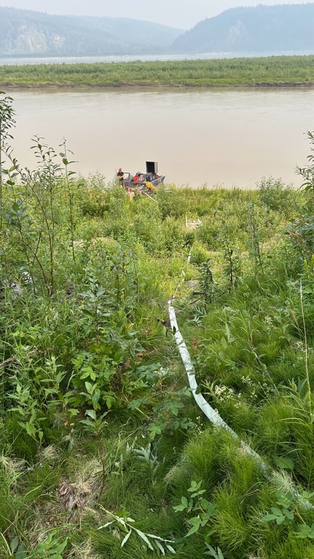
To the west, improvements and assessments have continued to be made to values at risk along the Steese Highway and Birch Creek.
The Turtle Fire was started by lightning. It was reported on June 19 and is burning about 10 miles east of Central and 12 miles south of Circle.
Alligator Fire (#265) – Crews continue to mop-up and secure the fire’s edge. Due to the level of containment, it is anticipated that personnel will be shifted to other assignments on the complex in the coming days. The fire will continue to be monitored as resources are reassigned.
The fire is about 3 miles north of Central. It was started by lightning and was discovered on June 20.
Birch Fire (#256) – Fire personnel continue to implement structure protection as needed. In addition, opportunities to take direct tactics are being taken as needed to protect those values at risk. The fire continues to be held on the east side of Birch Creek. On the northwest portion of the fire, the indirect line slop-over has had limited development in the hardwood fuels and is not expected to increase activity with the current weather.
The fire, which is about 4 miles northwest of Circle, is being monitored by air. It was discovered on June 20 and was caused by lightning.
Buckley Bar (#264) – Firefighters were inserted to a structure on the southeast side and began point protection using pumps and hoses. Fire activity was moderated due to weather but had moved within a quarter mile of the structure. Communication challenges and remote access are issues on the fire. The fire will continue to be monitored, and point protection actions will be continue to be taken.
The fire lies about 17 miles to the southwest of Central. It was discovered on June 20 and was caused by lightning.
The Deadwood Fire (#214) continues to be monitored and patrolled. The Ketchem Fire (#240) and Little Mosquito Fire (#241) are out.
A front will continue to bring widespread wetting rains to the area. This front is anticipated to stall over the area bringing rain chances until Thursday night. Wednesday afternoon could see an embedded isolated thunderstorm. The complex experienced a wind shift from the Southwest to North-Northwest Tuesday afternoon as the front moved over the fire. Today, the wind speed and gusts will begin to lower. Conditions will remain cool and wet through the week. Although these conditions support firefighter efforts and limit fire growth, lightning, combined with previous dry conditions creates concerns for new starts and holdovers in the area, and near the complex.
A Level 1 “Ready” Alert remains in effect for the community of Central, the Steese Highway from Milepost 123 to Milepost 151, Circle Hot Springs Road and Circle Hot Springs, and Deadwood Creek Road. Drivers should expect traffic delays on the Steese Highway, Circle Hot Springs Road, and Deadwood Creek Road due to firefighting operations. A Level 1 “Ready” alert means: begin preparing for a potential evacuation; make plans for family members with special needs, pets, or livestock; gather essential items such as prescriptions, important documents, and valuables; and stay alert and watch for updates from local authorities.
NOTAM #06/201 is in place for the Central Airport (CEM): Increased air traffic 5,000 ft MSL and below within a 20 nautical mile radius of the Central Airport (CEM) due to firefighting aviation operations
-BLM-
Need public domain imagery to complement news coverage of the BLM in Alaska? Visit our Flickr channel!
Learn more at www.blm.gov/Alaska, and on Facebook, Instagram, Twitter, and YouTube.
The BLM manages more than 245 million acres of public land located primarily in 12 western states, including Alaska, on behalf of the American people. The BLM also administers 700 million acres of sub-surface mineral estate throughout the nation. Our mission is to sustain the health, diversity, and productivity of America’s public lands for the use and enjoyment of present and future generations.
Categories: Active Wildland Fire, AK Fire Info, BLM Alaska Fire Service
