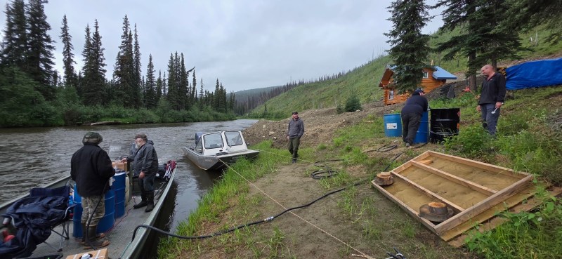
Firefighters continue to find heat around the perimeters’ edges but are making progress on the Himalaya Road Fire (#223), Aggie Creek Fire (#268) and Obrien Fire (#172). Personnel were transported to the Obrien Fire to begin work on structure protection to defend the BLM recreation shelters and cabins. On the Himalaya Road Fire, crews were engaged and working on mop up and cold trailing.
Numbers:
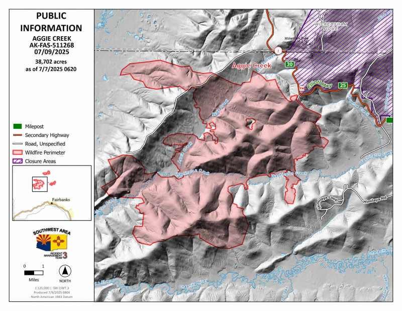
Aggie Creek Fire (#268): 38,702 acres, 0% contained
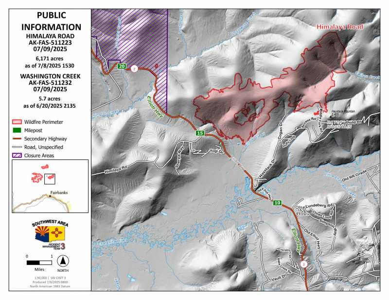
Himalaya Road Fire (#223): 6,171 acres, 0% contained
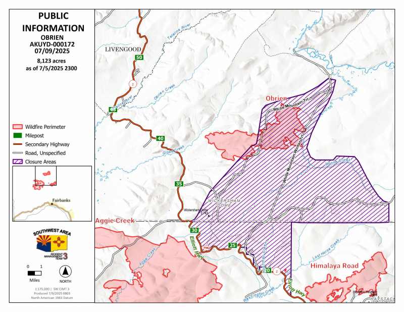
Obrien Fire (#172): 8,123 acres, 0% contained
Operations: Firefighters will continue to mop up and extinguish heat along the perimeters where accessible. On the Aggie Creek Fire, the masticator completed the fuel break along the Himilaya Road. Structure protection in the Hayes Creek Drainage will continue and crews will work on mop up. All pumps, hoses and sprinklers around the Himalaya Road Fire will continue to be maintained. Line construction is wrapping up and crews will begin looking for hot spots and mopping up.On the Obrien Fire, firefighters will continue with structure assessments and point protection as needed for Eleazar’s Cabin, Yeager’s Cabin, Summit Trail Shelter and Wickersham Creek Trail Shelter. Low visibility has limited the ability for aviation resources to fly the fire, but resources remain available if conditions improve.
Weather: Cooler and more humid weather will continue for the next couple of days and should help moderate fire activity. A warming and drying trend is expected later this week.
Smoke: For smoke outlook updates go to outlooks.airfire.org.
Closures: No road closures reported. Check 511.alaska.gov for road conditions. Olnes Pond, the Whitefish Campground and the western portion of the White Mountains NRA are closed due to fire activity.
Evacuations: Level 1 “READY,” and Level 2 “SET,” evacuations are in effect for these fires. SET means be ready to evacuate on a moment’s notice. Visit Fairbanks North Star Borough for current evacuation levels.
Safety: Drivers must use extreme caution on Elliott Highway. Do not stop, be alert and watch out for firefighters working in the area. Smoke may limit visibility. A Temporary Flight Restriction is in place. Do not fly drones over the fire area. Unauthorized drone use poses serious risks to firefighter and public safety.
Categories: Active Wildland Fire, AK Fire Info, Alaska DNR - Division of Forestry (DOF)
