There was minimal fire activity present yesterday across the complex, with observed fire behavior consisting of creeping and smoldering, including isolated single tree torching on the Turtle (#243). The weather area forecast for the Ptarmigan Complex calls for scattered moisture, cooler temperatures, and potential thunderstorms over the next few days.

As a result of new thermal imaging and improved mapping, the Ptarmigan Complex total fire acreage increased to 50,266 acres. The acreage for the largest fire, the Turtle Fire (#243) is 35,075 acres. The Ikheenjik Fire (#242) is being combined as part of the Turtle Fire for management and acreage.
A drone equipped with thermal imaging capability, referred to as a UAS (uncrewed aerial system) module, continues to be assigned to the Ptarmigan Complex and will be operating in the area. Members of the public should be aware that a Temporary Flight Restriction (TFR) will be in place for areas where the UAS module is working each day. Please check FAA.gov for updated TFR and NOTAM notices in the area. Remember, if you fly, we can’t!
Turtle Fire (#243) – The Tatanka Hotshots (South Dakota), Smith River Hotshots (California), and the National Park Service Alaska Range Module completed the direct line and began mop-up operations on the north edge of the fire on July 13. Tatanka Hotshots and the Alaska Range Module will continue the mop-up operations today on the north end.
A small group of firefighters from Smith River will be used to pull equipment and mop-up on the southwest corner of the Turtle Fire today. The drone (UAS) module will be used to look for heat on the south end of the Turtle Fire and help to determine any further actions needing to be taken on the south end. The Turtle Fire was started by lightning. It was reported on June 19 and is burning about 10 miles east of Central and 12 miles south of Circle.
Buckley Bar (#264) — Cabin preparation on the Birch Creek Cabin was completed, and cabin preparation on the Buckley Bar Cabin will begin today. The fire lies about 17 miles to the southwest of Central. It was discovered on June 20 and was caused by lightning.
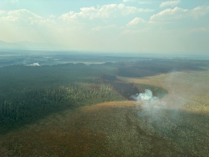
Birch Fire (#256) – The drone (UAS) module flew the fire yesterday and found three hotspots twenty feet inside of the fire’s edge. The fire will remain unstaffed and in monitor status. The fire was discovered on June 20, caused by lightning, and is about 4 miles northwest of Circle, AK.
Alligator Fire (#265) – The fire remains in monitor status. The fire was discovered on June 20, started by lightning, and is about 3 miles north of Central, AK. Deadwood Fire (#214) –The fire remains in monitor status. The Deadwood Fire was started by lightning, discovered on June 20, and is in Central, AK.
A Level 1 “Ready” Alert remains in effect for the community of Central, the Steese Highway from Milepost 123 to Milepost 151, Circle Hot Springs Road and Circle Hot Springs, and Deadwood Creek Road. Drivers should expect traffic delays on the Steese Highway, Circle Hot Springs Road, and Deadwood Creek Road due to firefighting operations. A Level 1 “Ready” alert means: begin preparing for a potential evacuation; make plans for family members with special needs, pets, or livestock; gather essential items such as prescriptions, important documents, and valuables; and stay alert and watch for updates from local authorities.
NOTAM #: 07/118 is in place for the Central Airport (CEM): Increased air traffic 5,000 ft MSL and below within a 20 nautical mile radius of the Central Airport (CEM) due to firefighting aviation operations.
–BLM-
Bureau of Land Management, Alaska Fire Service
P.O. Box 35005 1541 Gaffney Road, Fort Wainwright, AK 99703
Need public domain imagery to complement news coverage of the BLM Alaska Fire Service in Alaska? Visit our Flickr channel!
Learn more at http://www.blm.gov/AlaskaFireService, and on Facebook.
The Bureau of Land Management Alaska Fire Service (AFS) located at Fort Wainwright, Alaska, provides wildland fire suppression services for over 240 million acres of Department of the Interior and Native Corporation Lands in Alaska. In addition, AFS has other statewide responsibilities that include: interpretation of fire management policy; oversight of the BLM Alaska Aviation program; fuels management projects; and operating and maintaining advanced communication and computer systems such as the Alaska Lightning Detection System. AFS also maintains a National Incident Support Cache. The Alaska Fire Service provides wildland fire suppression services for America’s “Last Frontier” on an interagency basis with the State of Alaska Department of Natural Resources, USDA Forest Service, National Park Service, Bureau of Indian Affairs, U.S. Fish and Wildlife Service, and the U.S. Military in Alaska.
Categories: Active Wildland Fire, AK Fire Info, BLM Alaska Fire Service
