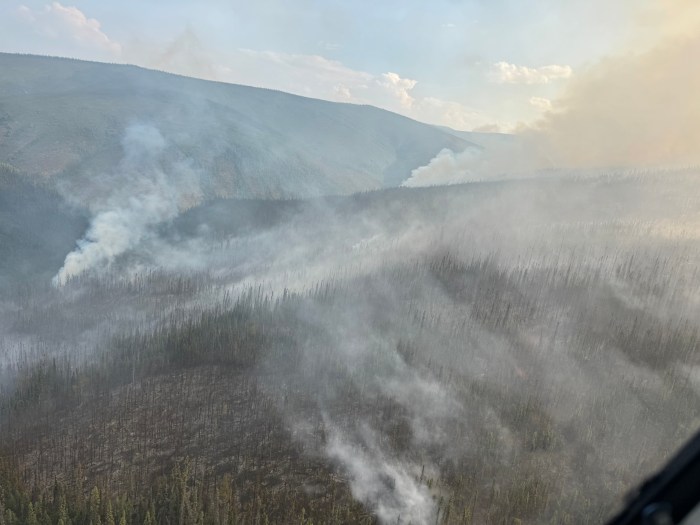
A new wildfire, the Tiozhavun Fire (#448) was discovered 10 miles south of Fort Yukon by an Alaska Fire Service detection flight just before 9 p.m. on July 13.
Tlozhavun (#448) – Initial attack response included ten smokejumpers, two water scoopers, and an air attack. The fire was initially sized up as 25 acres with single tree torching, backing and smoldering within black spruce and tundra. Hose and pumps have been installed on the heal of the fire and the left flank and will continue to along the rest of the fire. The nearest values at risk include allotments located 4.5 miles to the northwest. The fire’s progress has been halted by the initial attack response and is held at 25 acres.
The fire is being managed under a full suppression strategy. Additional ground resources are mobilizing to the fire.
Polly (#435) – Point protection around the Steele Creek Roadhouse was completed on the evening of July 13. Protection of values at risk continues along the Fortymile River. Structure protection includes the set up of pumps, hoses, sprinklers, and removal of fuels.
The fire is estimated at 300 acres, and has begun moving down the Steele Creek drainage to the north. The perimeter has progressed to 1.5 miles away from the Taylor Highway, directly east of milepost 108. A travel advisory has been issued for mileposts 100 to 115 for low visibility due to smoke, and the proximity of the fire to the highway. There are currently no closures or evacuations for the area. No measurable rain fell on the fire over July 13. Winds were light, originating from the west and southwest.
The fire is being managed under a point protection strategy and was discovered on July 10. It is located on the east side of the Taylor Highway and south of the Fortymile River, 34 miles south of Eagle.
Tsukon (#382) – The fire has not seen a large amount of growth for the past several days, and is currently estimated at 1450 acres. Torching was observed on the southwest side of the fire, with behavior increasing late in the evening of July 13. No measurable precipitation has fallen over the fire.
The Tsukon Fire is located between Venetie and Fort Yukon. It was discover on July 4. It will be unstaffed tomorrow as resources are assigned to nearby incidents.
-BLM-
Bureau of Land Management, Alaska Fire Service
P.O. Box 35005 1541 Gaffney Road, Fort Wainwright, AK 99703
Need public domain imagery to complement news coverage of the BLM Alaska Fire Service in Alaska? Visit our Flickr channel!
Learn more at http://www.blm.gov/AlaskaFireService, and on Facebook.
The Bureau of Land Management Alaska Fire Service (AFS) located at Fort Wainwright, Alaska, provides wildland fire suppression services for over 240 million acres of Department of the Interior and Native Corporation Lands in Alaska. In addition, AFS has other statewide responsibilities that include: interpretation of fire management policy; oversight of the BLM Alaska Aviation program; fuels management projects; and operating and maintaining advanced communication and computer systems such as the Alaska Lightning Detection System. AFS also maintains a National Incident Support Cache. The Alaska Fire Service provides wildland fire suppression services for America’s “Last Frontier” on an interagency basis with the State of Alaska Department of Natural Resources, USDA Forest Service, National Park Service, Bureau of Indian Affairs, U.S. Fish and Wildlife Service, and the U.S. Military in Alaska.
Categories: Active Wildland Fire, AK Fire Info, BLM Alaska Fire Service
