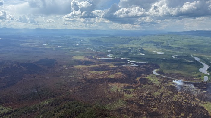
The weather area forecast for the Ptarmigan Complex continues to call for scattered moisture, cooler temperatures, and potential thunderstorms over the next few days. Fire activity across the complex yesterday was minimal with the increased activity occurring on the Buckley Bar Fire and the southern end of the Turtle Fire after a series of thunderstorms brought strong winds to the complex in the early evening.

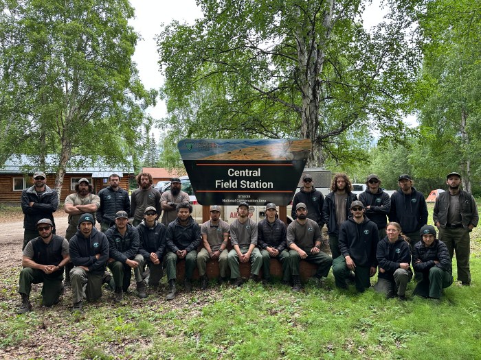
The Crow Peak Wildland Fire Module arrived yesterday and will replace the outgoing Smith River Hotshots. Smith River Hotshots completed their assignment and were demobilized off the Ptarmigan Complex today.
A drone equipped with thermal imaging capability, referred to as a UAS (uncrewed aerial system) module, continues to be assigned to the Ptarmigan Complex and will be operating in the area. Members of the public should be aware that a Temporary Flight Restriction (TFR) will be in place for areas where the UAS module is working each day. Please check FAA.gov for updated TFR and NOTAM notices in the area. Remember, if you fly, we can’t!
Turtle Fire (#243) – Yesterday, July 14, a squad of firefighters from Smith River Hotshots pulled hose lines from the west side of Steese Highway. Another squad of Smith River Hotshots were utilized in tandem with the UAS module to identify and mop-up any hotspots to the southwest end of the Turtle Fire. Tatanka Hotshots and the Alaska Range Module worked to mop up and extinguish any heat found on the northern edge of the Turtle Fire, and will continue to do so today. The Turtle Fire was reported on June 19. It is burning about 10 miles east of Central, AK and 12 miles south of Circle, AK and was started by lightning.
Buckley Bar (#264) — Cabin preparation on the Buckley Bar Cabin was completed. The fire lies approximately 17 miles to the southwest of Central. It was discovered on June 20 and was caused by lightning.
Alligator Fire (#265) – Crow Peak Wildland Fire Module will begin to pull hose and backhaul equipment from the Alligator Fire today. The fire was discovered on June 20, started by lightning and is located about 3 miles north of Central, AK.
Deadwood Fire (#214) –The fire remains in monitor status. The Deadwood Fire was started by lightning, discovered on June 20, and is in Central, AK.
Birch Fire (#256) – The fire is unstaffed and remains in monitor status. The fire was discovered on June 20, caused by lightning, and is located about 4 miles northwest of Circle, AK.
A Level 1 “Ready” Alert remains in effect for the community of Central, the Steese Highway from Milepost 123 to Milepost 151, Circle Hot Springs Road and Circle Hot Springs, and Deadwood Creek Road. Drivers should expect traffic delays on the Steese Highway, Circle Hot Springs Road, and Deadwood Creek Road due to firefighting operations. A Level 1 “Ready” alert means: begin preparing for a potential evacuation; make plans for family members with special needs, pets, or livestock; gather essential items such as prescriptions, important documents, and valuables; and stay alert and watch for updates from local authorities.
NOTAM #: 07/118 is in place for the Central Airport (CEM): Increased air traffic 5,000 ft MSL and below within a 20 nautical mile radius of the Central Airport (CEM) due to firefighting aviation operations.
–BLM–
Bureau of Land Management, Alaska Fire Service
P.O. Box 35005 1541 Gaffney Road, Fort Wainwright, AK 99703
Need public domain imagery to complement news coverage of the BLM Alaska Fire Service in Alaska? Visit our Flickr channel!
Learn more at http://www.blm.gov/AlaskaFireService, and on Facebook.
The Bureau of Land Management Alaska Fire Service (AFS) located at Fort Wainwright, Alaska, provides wildland fire suppression services for over 240 million acres of Department of the Interior and Native Corporation Lands in Alaska. In addition, AFS has other statewide responsibilities that include: interpretation of fire management policy; oversight of the BLM Alaska Aviation program; fuels management projects; and operating and maintaining advanced communication and computer systems such as the Alaska Lightning Detection System. AFS also maintains a National Incident Support Cache. The Alaska Fire Service provides wildland fire suppression services for America’s “Last Frontier” on an interagency basis with the State of Alaska Department of Natural Resources, USDA Forest Service, National Park Service, Bureau of Indian Affairs, U.S. Fish and Wildlife Service, and the U.S. Military in Alaska.
Categories: Active Wildland Fire, AK Fire Info, BLM Alaska Fire Service
