The Lush Fire (#199), remains at 26,544 acres and is located on the north side of the Yukon River across from Rampart. Yesterday’s partly sunny skies and no precipitation meant there was a drying day for fuels on the fire. Lingering areas of heat began to smolder and creep and small, light gray columns of smoke were observed. A warming and drying trend will occur into the weekend and atmospheric instability will increase the chance of showers and thunderstorms. After the weekend, southwest flow will be in the forecast bringing widespread light rain.
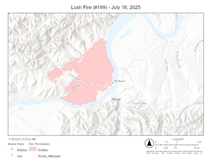
Yesterday, firefighters completed going direct on the northern edge of the fire to corral the fire away from the northern most cluster of Alaska Native Allotments. Today, the Wyoming hotshot crew will be moved to work direct on line between Squaw Creek and Lush Creek. Crews will continue mop up work on the southern and eastern edge of the fire and will also continue to secure lines around structures. Unneeded equipment will continue to be backhauled off of the line.
The Elephant Fire (#225) remains at 8,941 acres. Fire behavior remains minimal with limited smoldering. Recent rainfall has increased relative humidities and moderated fire activity. A warming and drying trend will continue into the weekend and winds will remain light. The atmosphere will become more unstable each day, supporting and increasing chance for shower and thunderstorm activity. After this weekend, a moist west-southwest flow will develop with more widespread light rain late Sunday into Tuesday.
Crews will continue to secure the fire along Minook Creek Road and the area of structures near the northeast edge of the fire, rechecking for heat and mopping up as necessary. The fire south of Minook Creek and north of the divide near Eureka Dome will continue to be monitored. Structure protection planning will continue and backhaul will begin as able.
Overall, fire managers are monitoring 45 other fires in the zone and will staff those fires if conditions warrant. For a printable version of today’s update, please CLICK HERE.
-BLM-
Bureau of Land Management, Alaska Fire Service, P.O. Box 35005 1541 Gaffney Road, Fort Wainwright, Ak 99703
Need public domain imagery to complement news coverage of the BLM Alaska Fire Service in Alaska? Visit our Flickr channel!
Learn more at http://www.blm.gov/AlaskaFireService, and on Facebook.
The Bureau of Land Management Alaska Fire Service (AFS) located at Fort Wainwright, Alaska, provides wildland fire suppression services for over 240 million acres of Department of the Interior and Native Corporation Lands in Alaska. In addition, AFS has other statewide responsibilities that include: interpretation of fire management policy; oversight of the BLM Alaska Aviation program; fuels management projects; and operating and maintaining advanced communication and computer systems such as the Alaska Lightning Detection System. AFS also maintains a National Incident Support Cache. The Alaska Fire Service provides wildland fire suppression services for America’s “Last Frontier” on an interagency basis with the State of Alaska Department of Natural Resources, USDA Forest Service, National Park Service, Bureau of Indian Affairs, U.S. Fish and Wildlife Service, and the U.S. Military in Alaska.
Categories: Active Wildland Fire, Alaska DNR - Division of Forestry (DOF), BLM Alaska Fire Service
