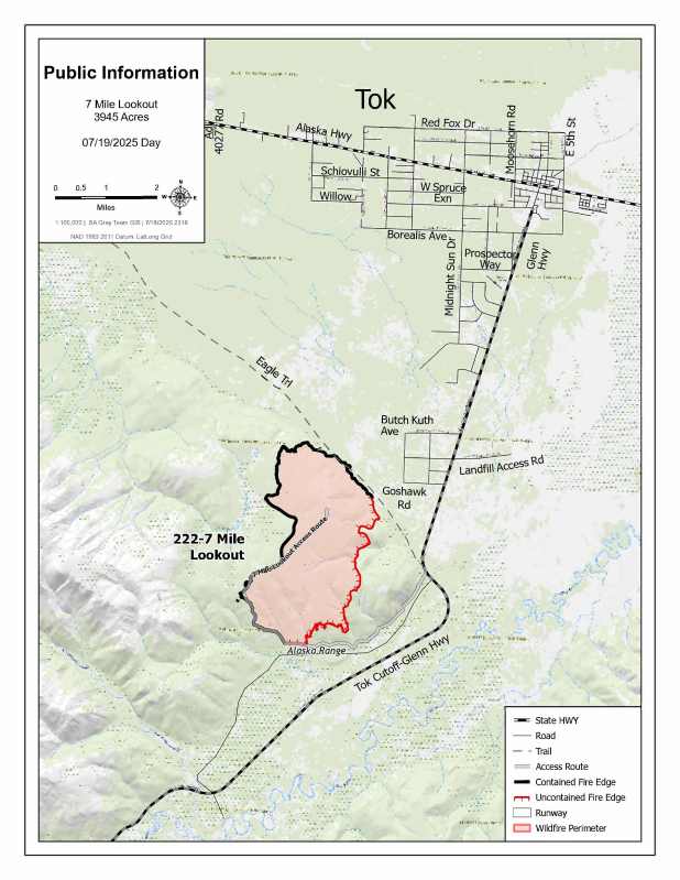
Size: 3,946 acres Location: 7 miles southwest of Tok, AK
Start Date: June 19, 2025 Cause: Lightning Containment: 55% Total Personnel: 65
Evacuation levels for neighborhoods near the 7 Mile Lookout Fire (#222): Residents north of Butch Kuth Ave and on Jack Wade Road are at READY (Level 1). Residents on Osprey, Moose Nugget, and Goshawk Roads are at SET (Level 2).

Activities: Fire activity picked up yesterday afternoon in the interior portions of the fire. Some tree torching and slow spread was observed throughout the evening. Aviation resources will be on site today doing bucket drops and firefighters will continue to dig fireline on the southeast side of the fire perimeter.
Weather: Scattered rain showers are expected through the weekend with temperatures remaining in the 70s. Fire managers continue to remain vigilant due to forecasted higher temperatures and low relative humidities that may lead to increased fire activity.
Aircraft and Drone Restrictions: A temporary flight restriction (TFR) remains in place over the fire and will continue to be until further notice. The public is asked not to fly any type of aircraft, including drones, near the fire area. Unauthorized drone (UAS) flights pose serious risks to the effectiveness of wildfire suppression operations. Aerial firefighting is suspended when unauthorized UAS are in the area, allowing wildfires to grow larger.
Remember: If you fly, we can’t.
Categories: Active Wildland Fire, AK Fire Info, Alaska DNR - Division of Forestry (DOF)
