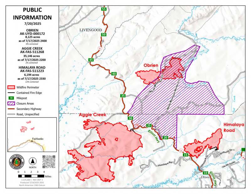
Fire activity was minimal within the Himalaya Road Fire (#223), Aggie Creek Fire (#268) and Obrien Fire (#172), with hot spots popping up on the west side of Aggie Creek. More hot spots and smoke columns are expected tomorrow with another warm, dry day. There were two incursions into the Temporary Flight Restriction over these fires yesterday, which poses serious risks to firefighter and public safety.
Numbers:
Aggie Creek Fire (#268): 35,146 acres, 2% contained
Himalaya Road Fire (#223): 6,194 acres, 12% contained
Obrien Fire (#172): 8,125 acres, 0% contained
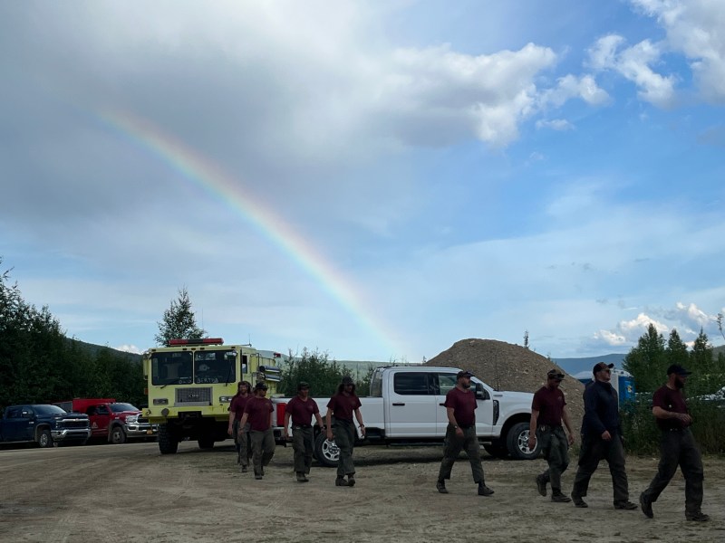
Operations: Areas of heat were revealed on the Aggie Creek Fire, evidenced by smoke columns along the fire’s northwestern perimeter. A Type 1 Wildfire Suppression Module will be inserted today along the Chatanika River near Murphy Dome Road boat launch to support structure assessment and protection measures south of the Aggie Creek Fire. Direct and indirect line construction is expected to be completed in the next few days along the ridge south of Washington Creek, while structure assessment is also a focus along Himilaya Loop Road. Aircraft surveillance remains an effective tool for monitoring inaccessible areas. No significant heat was detected yesterday on the Obrien Fire, and a plan is being developed for strategic firing operations and future fuel mitigation work for protection around the Eleazar cabin on the Bureau of Land Management White Mountains Recreation Area. Excavators and heavy equipment are exposing concealed heat within large berms, where crews continue to monitor, mop up and patrol on the Himalaya Road Fire.
Weather: Temperatures are expected today in the upper 70s with a shift later in the day to light rain with increased cloud cover. A cold front will roll in tonight into Monday with widespread rain up to a quarter of an inch and wind gusts ranging from 25-30 mph. Expect Monday and Tuesday to be cooler and wetter.
Smoke: For smoke outlook updates go to https://outlooks.airfire.org/outlook/e16e3fa2.
Closures: No road closures reported. Check https://511.alaska.gov/map for road conditions. Olnes Pond, the Whitefish Campground and the western portion of the White Mountains NRA are closed due to fire activity.

Evacuations: Level 1 “READY,” and Level 2 “SET,” evacuations are in effect for these fires. SET means be ready to evacuate on a moment’s notice. Visit https://bit.ly/FNSBevac for current evacuation levels.
Safety: Drivers must use extreme caution on Elliott Highway. Do not stop, be alert and watch out for firefighters working in the area. Smoke may limit visibility. A Temporary Flight Restriction is in place. Do not fly drones over the fire area. Unauthorized drone use poses serious risks to firefighter and public safety.
Categories: Active Wildland Fire, AK Fire Info, Alaska DNR - Division of Forestry (DOF)
