7 Mile Lookout Fire (#222)
Size: 3,969 acres Location: 7 miles southwest of Tok, AK
Start Date: June 19, 2025 Cause: Lightning Containment: 55% Total Personnel: 58
Evacuation levels for neighborhoods near the 7 Mile Lookout Fire (#222):
- READY (Level 1): Residents north of Butch Kuth Avenue and on Jack Wade Road.
- SET (Level 2): Residents on Osprey Road, Moose Nugget Road, and Goshawk Road.
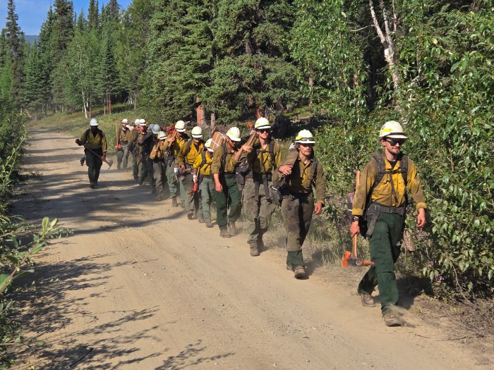
Activities: Fire behavior increased yesterday evening on the northeast edge of the 7 Mile Lookout Fire as south winds intensified. The fire spotted across the control line near Eagle Trail, but quick response by the Mat-Su and Tanana Chiefs hand crews, assisted by a bulldozer, kept the spot fire to approximately 1 acre. Crews also conducted grid searches in the surrounding unburned (green) area to confirm no additional spot fires had breached the control lines. Four single-engine aquatic air tankers (commonly known as “scoopers”) supported the effort with multiple water drops.
Today, crews will begin installing a 1.5-mile-long hose lay along the northeastern dozer line as a precautionary measure in case of renewed fire activity or to support a potential burnout operation, if needed. Firefighters will also continue mop-up efforts along the southeastern perimeter, where the fire is burning in steep terrain. Two helicopters equipped with water buckets will assist ground crews throughout the day.
Weather: A cold front moving northeast is expected to bring scattered showers today. Morning cloud cover and precipitation may delay the lifting of the overnight temperature inversion, limiting heating and drying through the early afternoon. Winds are forecast to be 6–10 mph, with temperatures in the upper 60s. Fire managers remain vigilant as fluctuating temperatures and dry conditions continue to pose a risk for fire activity until the area receives significant, sustained rainfall.
Aircraft and Drone Restrictions: A Temporary Flight Restriction (TFR) remains in effect over the fire area until further notice. The public is reminded not to fly any aircraft, including drones, near the fire. Unauthorized drone (Unmanned Aircraft System or UAS) operations endanger aerial firefighting efforts and force suspension of air missions, which can allow wildfires to grow.
View the TFR details here: https://tfr.faa.gov/tfr3/?page=detail_5_1075
Remember: If you fly, we can’t.
Click here for printable PDF of update

Categories: Active Wildland Fire, AK Fire Info, Alaska DNR - Division of Forestry (DOF)
