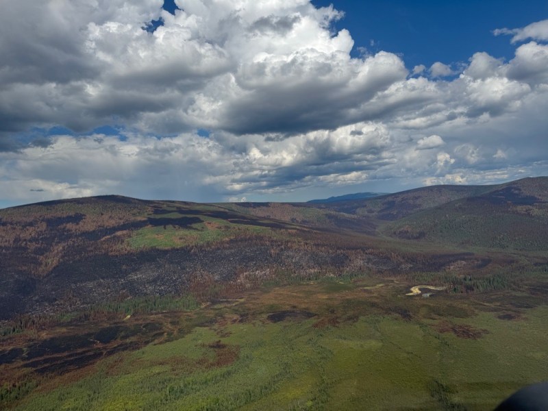

Fire activity was minimal within the Himalaya Road Fire (#223), Aggie Creek Fire (#268) and Obrien Fire (#172) yesterday. Cooler and wetter conditions will continue through Wednesday. Evacuation levels were downgraded from “Set” to “Ready” in multiple areas near the Himalaya Road Fire and the Aggie Creek Fire. Additional containment was established in Glacier Creek for the Himalaya Road Fire, bringing total containment up to 39%.
Numbers:
Aggie Creek Fire (#268): 35,146 acres, 5% contained
Himalaya Road Fire (#223): 6,194 acres, 39% contained
Obrien Fire (#172): 8,125 acres, 0% contained
Operations: A Level 1 “Ready” evacuation notice is now in effect for the Chatanika River Mile 37-Boat Launch, Chatanika River Corridor, Hayes Creek, Himalaya, Alyeska Access 64, and Elliott Highway Mile Post 16.5 – Mile Post 30 Evacuation Zone(s). Evacuation statuses for Old Chatanika, At Your Own Risk, Poker Flat Facility, and Steese Highway Mile Post 30 – Mile Post 40 Evacuation Zone(s) have been Lifted. A Type 1 Wildfire Suppression Module remains in place along the Chatanika River near Murphy Dome Road boat launch and continues to support structure assessment and protection measures south of the Aggie Creek Fire. Aircraft surveillance using infrared imagery remains an effective tool for monitoring areas for heat on the Aggie Creek and Himalaya Road fires when cloud cover is not present. Excavators, followed by hand crews continue to expose and extinguish heat concealed within large berms. Roads were inventoried and monitored for potential deterioration from increased vehicle activity, and road improvements were initiated on Himalaya Road and other impacted areas. Backhauling of excess equipment from Aggie Creek and Himalaya Road fires will continue throughout the week.
Weather: Temperatures are expected today in the upper 60s, with a light drizzle and cloud cover throughout the day. The cold front is expected to continue through Wednesday, with drier and warmer weather forecast starting on Thursday. Winds will gust up to 15 mph.
Smoke: For smoke outlook updates go to https://outlooks.airfire.org/outlook/e16e3fa2.
Closures: No road closures reported. Check https://511.alaska.gov/map for road conditions. Olnes Pond, the Whitefish Campground and the western portion of the White Mountains NRA are closed due to fire activity.

Evacuations: Level 1 “READY,” evacuations are in effect for these fires. Level 1 means “BE READY” for potential evacuation. Visit https://bit.ly/FNSBevac for current evacuation levels.
Safety: Drivers must use extreme caution on Elliott Highway. Do not stop – be alert and watch out for firefighters working in the area. A Temporary Flight Restriction is in place. Do not fly drones over the fire area. Unauthorized drone use poses serious risks to firefighter and public safety – If you fly, we can’t.
Categories: Active Wildland Fire, AK Fire Info, Alaska DNR - Division of Forestry (DOF)
