7 Mile Lookout Fire (#222)
Size: 3,969 acres Location: 7 miles southwest of Tok, AK
Start Date: June 19, 2025 Cause: Lightning Containment: 55% Total Personnel: 113
Evacuation levels for neighborhoods near the 7 Mile Lookout Fire (#222):
- READY (Level 1): Residents north of Butch Kuth Avenue and on Jack Wade Road.
- SET (Level 2): Residents on Osprey Road, Moose Nugget Road, and Goshawk Road.
Activities: On Wednesday, hand crews continued mop-up operations and prepared for a potential burnout if conditions allow. While rain fell in Tok, the fire area remained dry, experiencing sun, partial clouds and winds up to 30 mph.
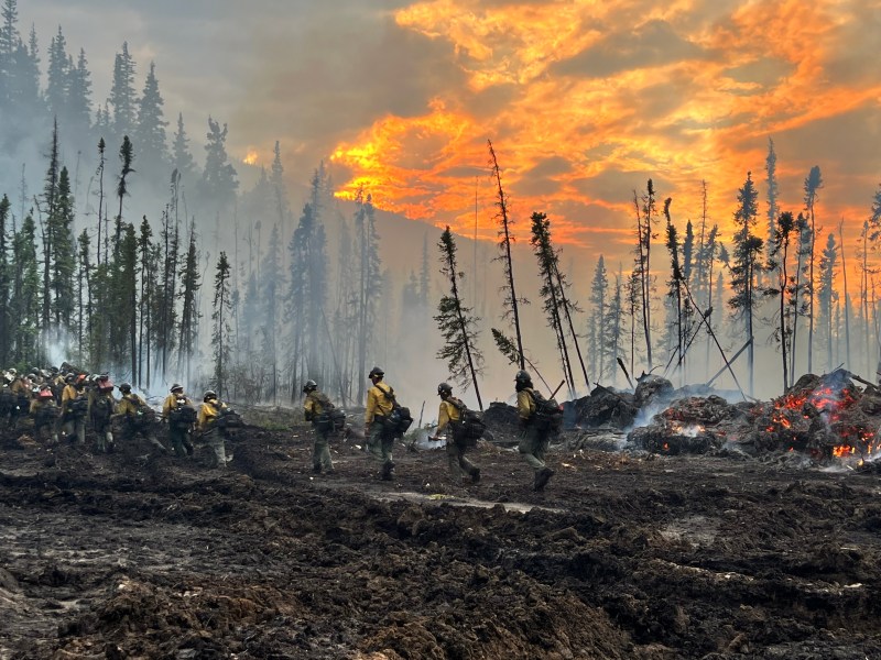
Today, crews are clearing vegetation along the Eagle Trail (7 Mile Access Road) and a bulldozer control line south of the Eagle Trail. Work includes removing downed logs and brush that could compromise control lines. If weather permits in the coming days, fire managers may conduct a burnout to remove fuels between the fire and control lines, helping protect homes and infrastructure.
The North Star Handcrew is expected to arrive today. This entry-level training crew provides a pathway to become part of the Alaska Fire Service interagency hotshot crews. The program accepts applicants with little or no fire experience, provides Red Card certification during the first two weeks of training, and teaches wildfire suppression skills over a three-month season. Although classified as a Type 2 crew, North Star trains and operates to hotshot standards, with leadership positions staffed by current Alaska Fire Service hotshots with three to five years of experience.
Weather: Breezy northwest winds will continue Thursday, but calmer than Wednesday. Temperatures are forecast to rise paired with possible showers over the fire area through the next few days.
Aircraft and Drone Restrictions: A Temporary Flight Restriction (TFR) remains in effect over the fire area until further notice. The public is reminded not to fly any aircraft, including drones, near the fire. Unauthorized Unmanned Aircraft System (UAS) operations endanger aerial firefighting efforts and force suspension of air missions, which can allow wildfires to grow.
View the TFR details here: https://tfr.faa.gov/tfr3/?page=detail_5_1075
Remember: If you fly, we can’t.

Categories: Active Wildland Fire, AK Fire Info, Alaska DNR - Division of Forestry (DOF)
