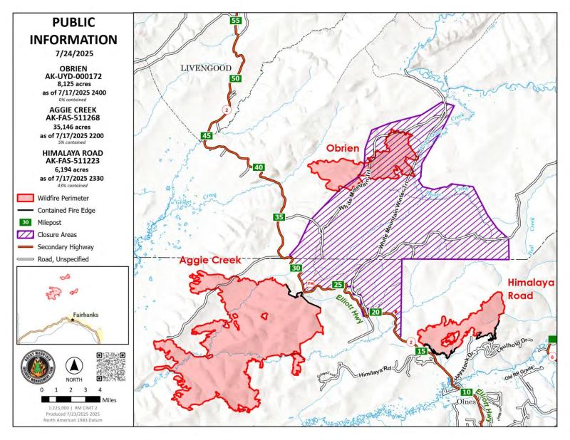
Fire activity was minimal within the Himalaya Road Fire (#223), Aggie Creek Fire (#268) and Obrien Fire (#172) yesterday. Cooler and wetter conditions will continue through Friday. Additional containment was established along Haystack Road and Glacier Creek for the Himalaya Road Fire, bringing total containment up to 43%. The evacuation status along the Elliott Highway between milepost 31 and 38 was reduced from Level 2 “SET” down to Level 1 “READY”.
Numbers:
Aggie Creek Fire (#268): 35,146 acres, 5% contained
Himalaya Road Fire (#223): 6,194 acres, 43% contained
Obrien Fire (#172): 8,125 acres, 0% contained
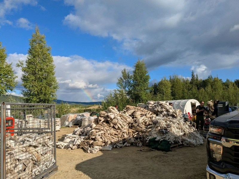
Operations: Unmanned Aerial Systems (UAS) surveillance using infrared imagery remains an effective tool for identifying areas of heat on the Aggie Creek and Himalaya Road fires. The San Juan Hotshots was inserted at the Obrien Fire to complete fuels mitigation around the Bureau of Land Management cabins in the White Mountains National Recreation Area. Excavators, followed by hand crews, are making progress extinguishing heat concealed within large berms. Road improvements were completed on Himalaya Road. Backhauling of excess equipment from Aggie Creek and Himalaya Road fires will continue throughout the week. The Type 1 Wildfire Suppression Module is scheduled to be removed from the Chatanika River corridor on Thursday.
Weather: Temperatures are expected today in the mid-upper 60s, with a light drizzle and cloud cover throughout the day. Winds will gust up to 15 mph. The cold front is expected to continue through Friday, with drier and warmer weather forecast starting Saturday.
Smoke: For smoke outlook updates go to https://outlooks.airfire.org/outlook/e16e3fa2.
Closures: No road closures reported. Check https://511.alaska.gov/map for road conditions. Olnes Pond, the Whitefish Campground and the western portion of the White Mountains NRA are closed due to fire activity.
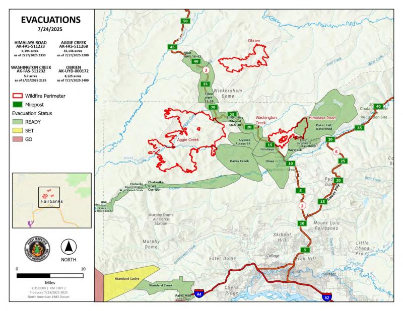
Evacuations: Level 1 “READY,” evacuations are in effect for these fires. Level 1 means “BE READY” for potential evacuation. Visit https://bit.ly/FNSBevac for current evacuation levels.
Safety: Drivers must use extreme caution on Elliott Highway. Do not stop – be alert and watch out for firefighters working in the area. A Temporary Flight Restriction is in place. Do not fly drones over the fire area. Unauthorized drone use poses serious risks to firefighter and public safety – If you fly, we can’t.
Categories: Active Wildland Fire, AK Fire Info, Alaska DNR - Division of Forestry (DOF)
