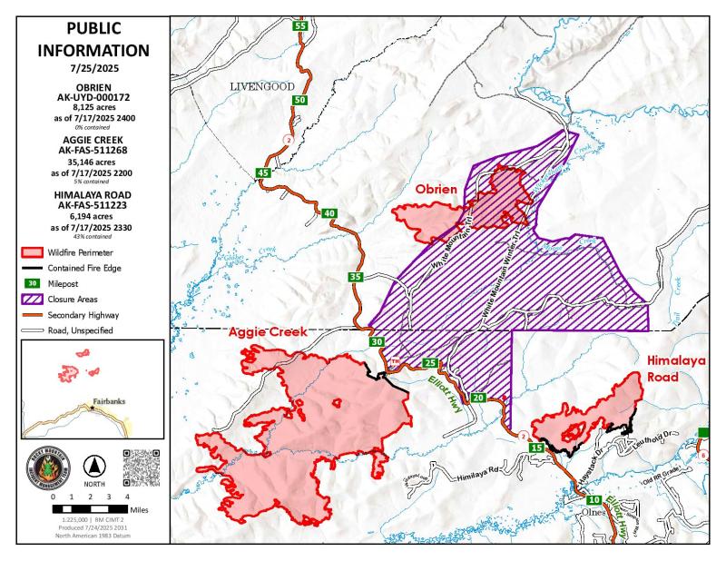
Fire activity remained minimal yesterday within the Himalaya Road Fire (#223), Aggie Creek Fire (#268), and Obrien Fire (#172) areas, primarily due to the prevailing cool and wet conditions. The evacuation status is set at Level 1 “READY” for all zones.
Numbers:
Aggie Creek Fire (#268): 35,146 acres, 5% contained
Himalaya Road Fire (#223): 6,194 acres, 43% contained
Obrien Fire (#172): 8,125 acres, 0% contained
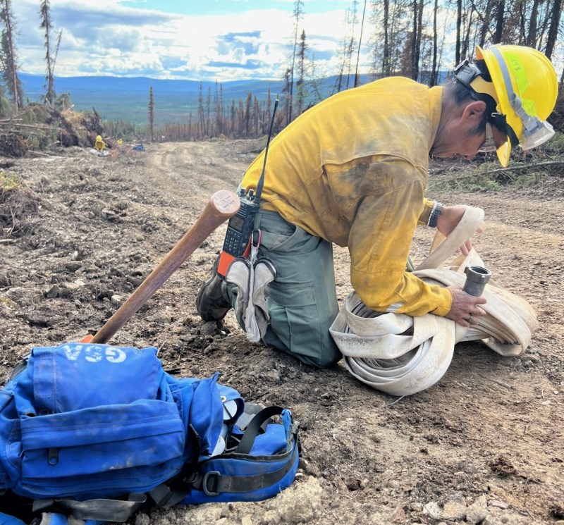
Operations: Unmanned Aerial Systems (UAS) surveillance utilizing infrared imagery continues to serve as an effective method for detecting heat signatures on the Aggie Creek and Himalaya Road Fires. The Type 1 Wildfire Suppression Module completed backhauling water delivery equipment along the Chatanika River corridor and will now be relocated to another section of the fire. Crews cooperated with heavy equipment operators to dismantle berms and debris piles, targeting and extinguishing residual hot spots. Fire suppression repair activities are underway, aiming to restore the disturbed forested area to a natural appearance. The San Juan Hotshots completed fuels reduction around the Bureau of Land Management recreational cabins. Essentially, defensible space was expanded by increasing the vegetation clearance around the cabins. The overall objective of this operation was to remove enough fuels so that – whether with this fire or the next one – those structures can stand alone. The goal is to enable fire to burn around them without requiring significant personnel to be inserted for protection. The structure group successfully finalized the structure protection plan as assigned.
Weather: Today’s forecast indicates partly sunny skies accompanied by scattered rain showers throughout the region. Light winds are expected, with a high temperature of 63 degrees Fahrenheit and a minimum relative humidity of 52%. However, there is a chance of a thunderstorm tomorrow afternoon around 3:00 p.m.
Smoke: For smoke outlook updates go to https://outlooks.airfire.org/outlook/e16e3fa2.
Closures: No road closures reported. Check https://511.alaska.gov/map for road conditions. Olnes Pond, the Whitefish Campground and the western portion of the White Mountains NRA are closed due to fire activity.
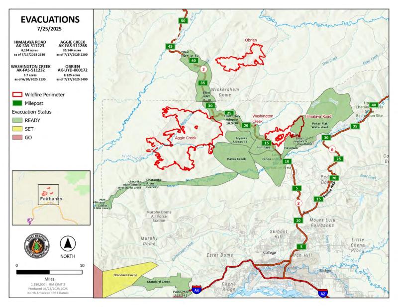
Evacuations: Level 1 “READY,” evacuations are in effect for these fires. Level 1 means “BE READY” for potential evacuation. Visit https://bit.ly/FNSBevac for current evacuation levels.
Safety: Drivers must use extreme caution on Elliott Highway. Do not stop – be alert and watch out for firefighters working in the area. A Temporary Flight Restriction is in place. Do not fly drones over the fire area. Unauthorized drone use poses serious risks to firefighter and public safety – If you fly, we can’t.
Categories: Active Wildland Fire, AK Fire Info, Alaska DNR - Division of Forestry (DOF)
