Saturday, July 26 will be the Rocky Mountain CIMT2’s final workday. At that time, command will transition to a Type 3 Incident Management Team tomorrow, Sunday, July 27 at 8:00 a.m. Please note, a new information phone line is listed as 907-356-5511. Fire activity remained minimal yesterday within the Himalaya Road Fire (#223), Aggie Creek Fire (#268), and Obrien Fire (#172) areas, primarily due to the prevailing cloudy and wet conditions. The evacuation status is Level 1 “READY”.
Numbers:
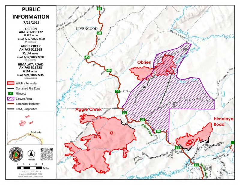
Aggie Creek Fire (#268): 35,146 acres, 5% contained
Himalaya Road Fire (#223): 6,194 acres, 43% contained
Obrien Fire (#172): 8,125 acres, 0% contained
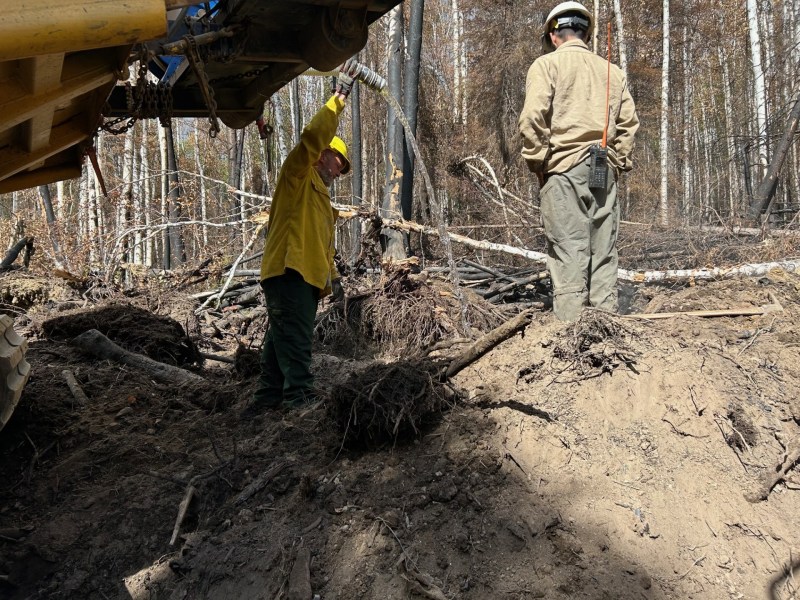
Operations: Unmanned Aerial Systems (UAS) surveillance utilizing infrared imagery found limited heat in the interior of Himalaya Road Fire. Backhaul of water delivery systems is complete on Himilaya Loop Road on the Aggie Creek Fire. Crews will continue backhauling additional equipment no longer in use. Additionally, teams continue patrolling and mopping up residual hot spots remaining in berm piles to ensure full containment and safety. Obrien Fire is unstaffed and responsibility for its management will be transferred to the Bureau of Land Management as of 8:00 a.m. tomorrow. A slight increase in fire behavior is possible under warming and drying conditions through the weekend.
Weather: Mostly sunny on Saturday and Sunday with temperatures in the 70s. Monday brings a return of southwest winds, expected to produce cloudy conditions and chances for rain.
Smoke: For smoke outlook updates go to https://outlooks.airfire.org/outlook/e16e3fa2.
Closures: No road closures reported. Check https://511.alaska.gov/map for road conditions. Olnes Pond, the Whitefish Campground and the western portion of the White Mountains NRA are closed due to fire activity.

Evacuations: Level 1 “READY,” evacuations are in effect for these fires. Level 1 means “BE READY” for potential evacuation. Visit https://bit.ly/FNSBevac for current evacuation levels.
Safety: Drivers must use extreme caution on Elliott Highway. Do not stop – be alert and watch out for firefighters working in the area. A Temporary Flight Restriction is in place. Do not fly drones over the fire area. Unauthorized drone use poses serious risks to firefighter and public safety – If you fly, we can’t.
Categories: Active Wildland Fire, AK Fire Info, Alaska DNR - Division of Forestry (DOF)
