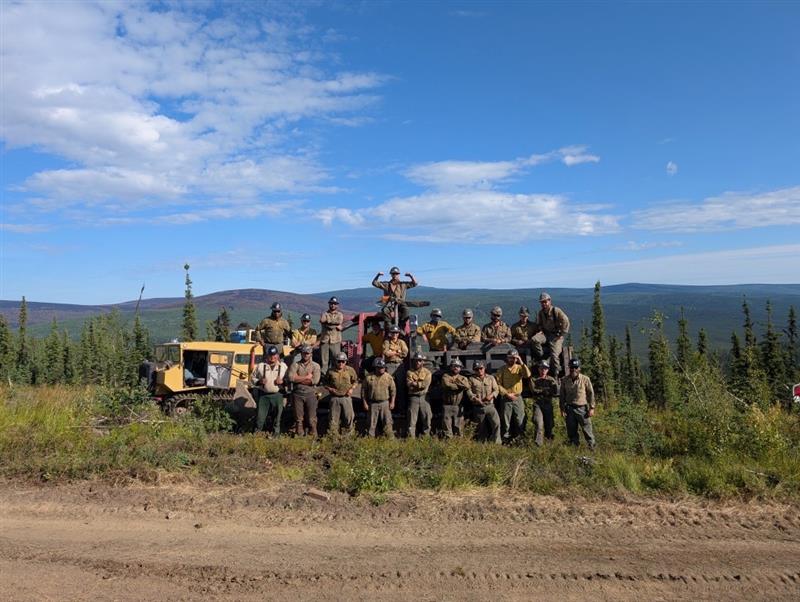
Fire personnel posing with the Nodwell Crew machinery with the burn scar for Aggie Creek in the distance. July 26, 2025.

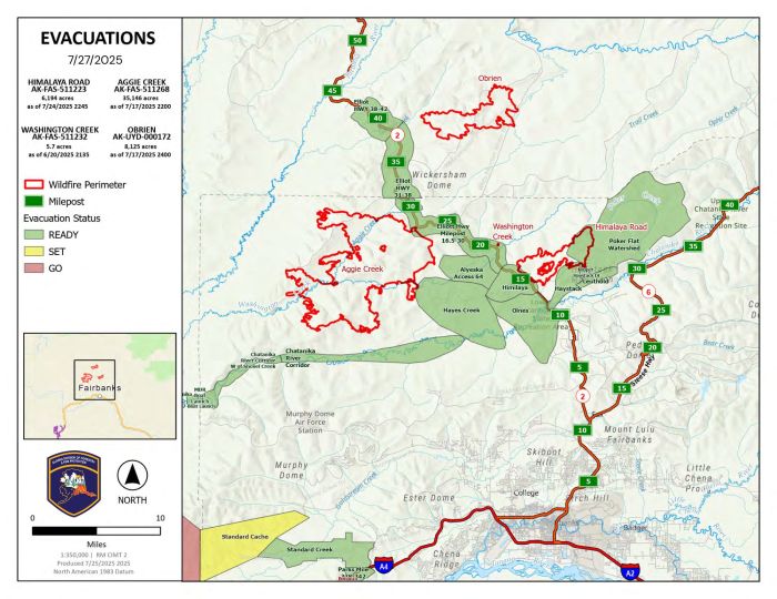
Area Map for Himalaya Road, Aggie Creek, and Obrien Fires for July 27, 2025. View printable PDF
An Ad Hoc Type 3 Incident Management Team has taken command of the group of fires as of this morning. Cooler, wetter, and cloudy conditions over the past day have helped to minimize fire activity in the areas of the Himalaya Road Fire (#223) and Aggie Creek Fire (#243), but fire managers are working diligently to ensure they are prepared for hotter and drier weather during the upcoming drying trend. The evacuation status in the area remains at Level 1 “READY”.
Numbers:
Aggie Creek Fire (#268): 35,837, 5% contained
Himalaya Road Fire (#223): 6,057 acres, 43% contained
Operations: Unmanned Aerial Systems (UAS) utilizing infrared found multiple areas within the interior of the fire producing limited heat and small amounts of smoke in the interior of Aggie Creek Fire. Crews will continue to patrol the perimeter of the fire. Firefighters across the Himalaya Road Fire continue to pull apart dozer berms to repair areas impacted by heavy equipment. Crews will continue to backhaul additional equipment that is no longer in use. A slight increase in fire behavior, which can produce visible smoke, is possible with the warm weather conditions experienced throughout the weekend, and fire managers will continue to monitor fire behavior.
Weather: Sunny conditions are expected for most of today with temperatures in the 70s. Tomorrow is likely to bring a return of winds from the southwest, with a likelihood that Monday will be cloudy with a chance of rain over the fire.
Smoke: For smoke outlook updates, go to https://outlooks.airfire.org/outlook/e16e3fa2.
Closures: Check https://511.alaska.gov/map for road conditions. Olnes Pond and the Whitefish Campground remain closed to the public for use by the fire crews.
Evacuations: Level 1 “READY,” evacuations are still in effect. Level 1 indicates that a fire is present in the area and to prepare for potential evacuation. Visit https://bit.ly/FNSBevac for current evacuation levels.
Safety: Drivers must use caution on Elliott Highway. A Temporary Flight Restriction is in place. Do not fly drones over the fire area. Unauthorized drone use poses serious risks to firefighter and public safety – If you fly, we can’t.
Phone Number: 907-921-7881
Website: https://akfireinfo.com/ Email: 2025.himalayaroad@firenet.gov
Categories: Active Wildland Fire, AK Fire Info
